
So Lo Pun Abandoned Village Hike: Hong Kong's Most "Haunted" Trail
Contents
- Essential Information
- Hike Highlights
- Google Route Map and GPX
- How to Get There
- Quick Route Summary
- Starting Point: Wu Kau Tang Village
- The Trail to Kau Tam Tso
- 2 Weird Bridges and another Fork to the Right
- Sheung and Ha Miu Tin Abandoned Villages
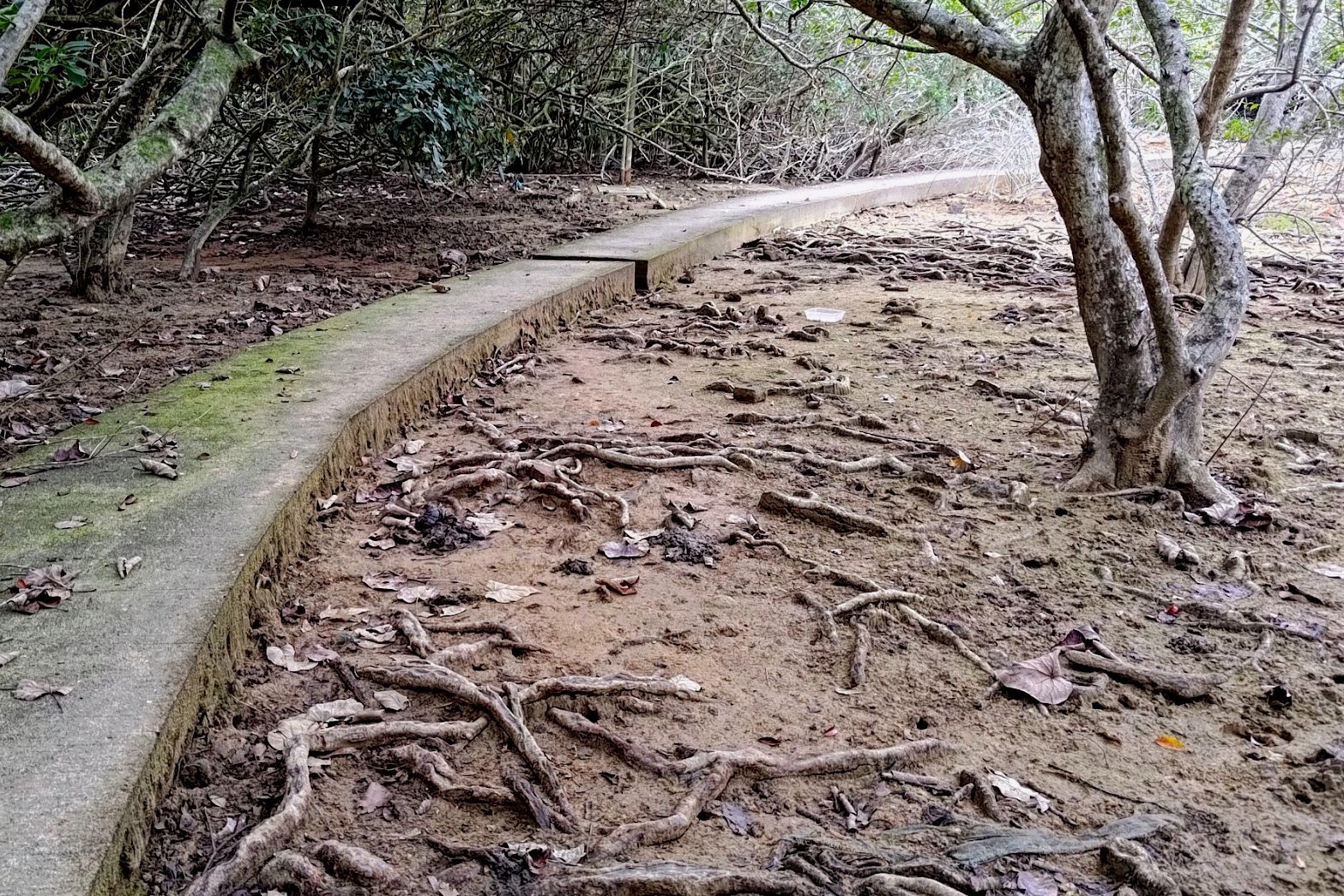
- Stream Crossings and Mangroves
- More Mangrove Scenery
- Coastal Mangrove Scenery
- Sam A Tsuen
- Sam A Tsuen to Lai Chi Wo
- Lai Chi Wo Village Scenery
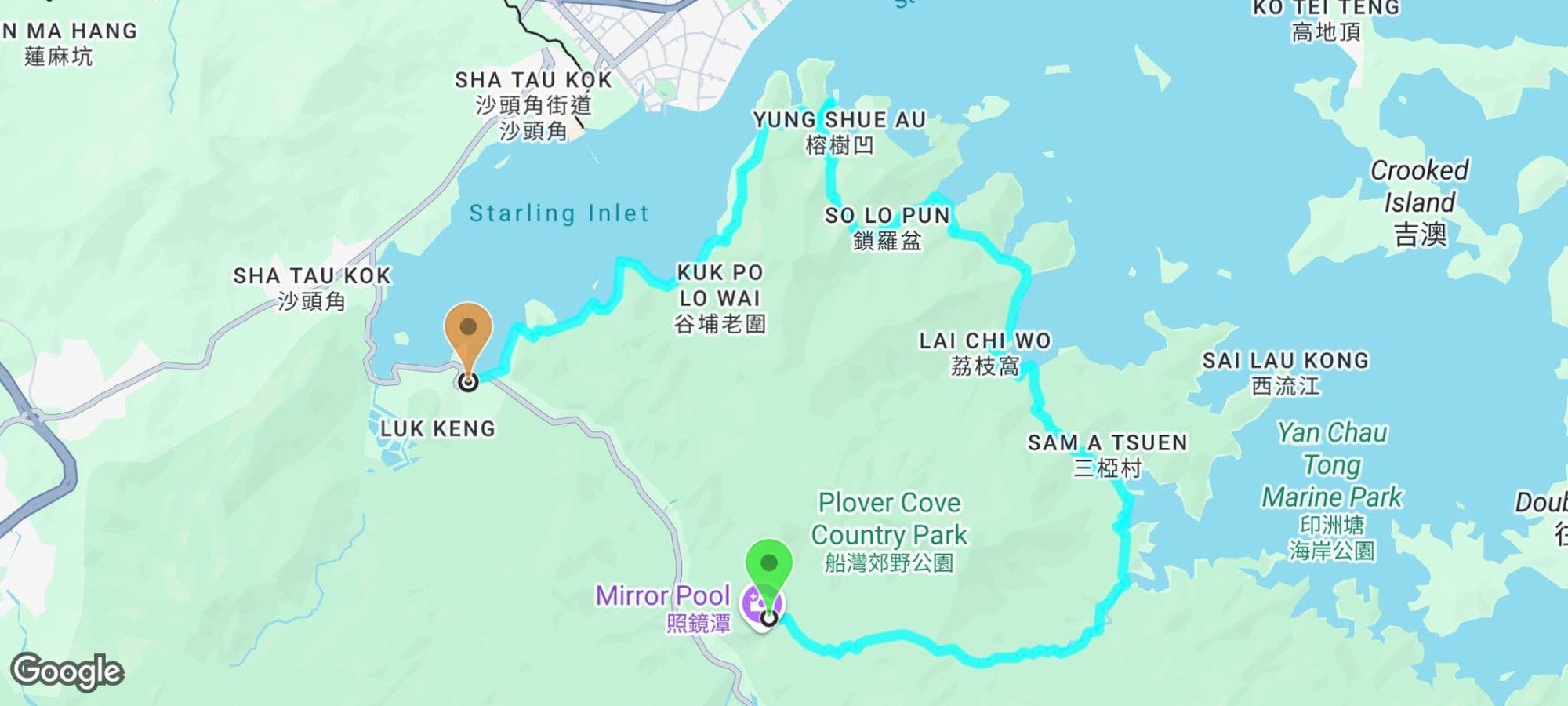
- Getting to So Lo Pun
- So Lo Pun
- Getting to Yung Shue Au
- Yung Shue Au
- Getting to Kuk Po
- Starling Inlet Coastline
- Getting to the Bus Stop
- Getting Back to the City
Essential So Lo Pun Hike Details
- District: New Territories
- Duration: 4.5-5 hours
- Distance: 18km
- Highest Elevation: 160ish meters
- Difficulty: 3.5/5
- Facilities: Drinks, food and toilets available at multiple points throughout the hike
Why Hike So Lo Pun?
*You will lose phone signal on this hike, so screenshot any relevant sections of the guide or download the GPX map file in the 'Google Route Map' section below.
Summary of So Lo Pun's History
So Lo Pun, located in the northeastern New Territories of Hong Kong, is one of the oldest and most rural abandoned villages in the region. It was originally named So Nou Pun, meaning "basin surrounded by mountains," but was mistakenly recorded as So Lo Pun by the British in 1898, which translates to "locked compass" in Cantonese. The village was established by the Wong family, who migrated from Mainland China around 872 AD, and it was part of the Hing Chun Alliance, a group of seven Hakka villages.
Historical Significance and Decline
So Lo Pun was once a thriving fishing and farming community, with about 60 to 70 families residing there during its peak. However, due to transportation difficulties and limited economic opportunities, most villagers relocated to urban areas or emigrated abroad between the 1960s and 1970s. By the early 1980s, the village was largely abandoned.
Haunting Legends
The village's reputation as haunted stems from several local urban legends. One of the most popular tales is that hikers' compasses stop working when they enter the village, which led to its name "So Lo Pun" or "locked compass". My phone's camera froze up several times in the area, which was highly unusual. Not saying the area is haunted, but that sure was weird!
Another legend claims that a group of villagers died in a boat accident while traveling to a wedding, leading to the village's sudden abandonment. Additionally, there are stories of visitors experiencing paranormal events, including seeing ghosts and suffering from heart attacks.
The Journey There
Today, So Lo Pun remains a fascinating, albeit eerie, destination for hikers and those interested in Hong Kong's rural history. The route is about 18km in total from start to finish. You will pass by several traditional Hakka villages along the way including Ha Miu Tin, Sam A Tsuen, Lai Chi Wo, So Lo Pun, Yung Shue Au, Kuk Po and Fung Hang.
Most of the hike is flat with the occasional uphill section. As long as you are comfortable walking long distances, you don't need to be in tremendous shape to complete this hike. Just expect to be tired by the end since it takes about 5 hours to complete at a gentle pace.
Google Route Map and GPX
*Click the box icon in the top right of the map below to load the blue route directly into your own Google Maps. You can then see your location relative to the trail in real time!
How to Get to the So Lo Pun Hike Start Point

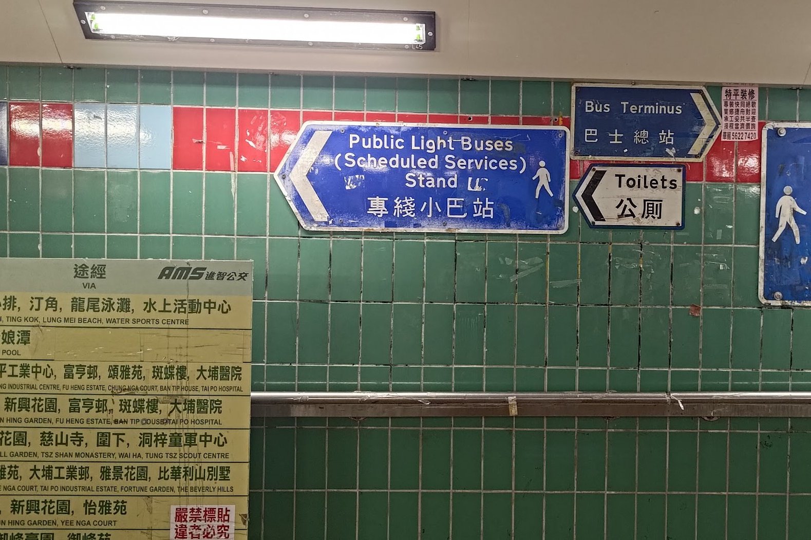
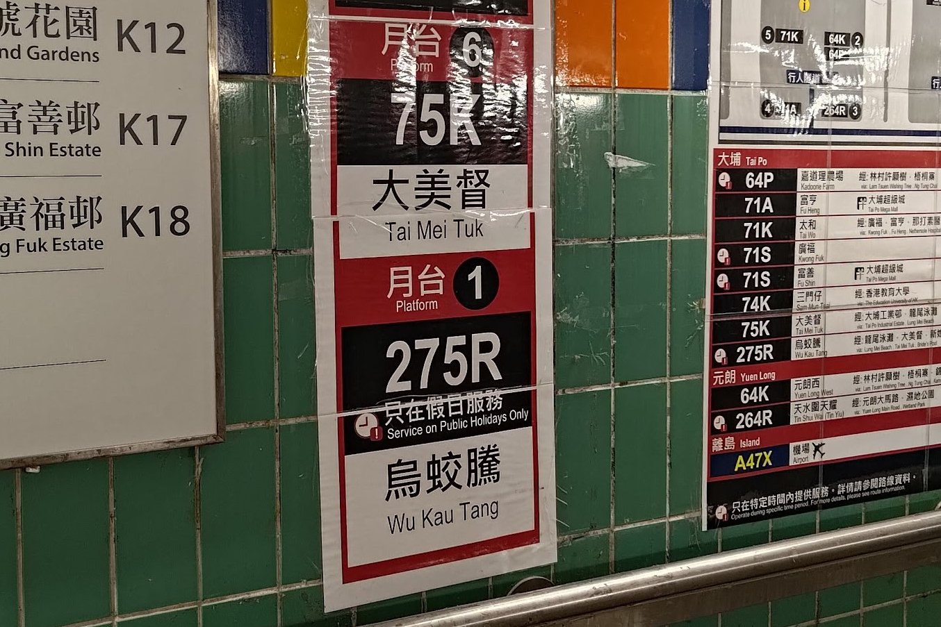
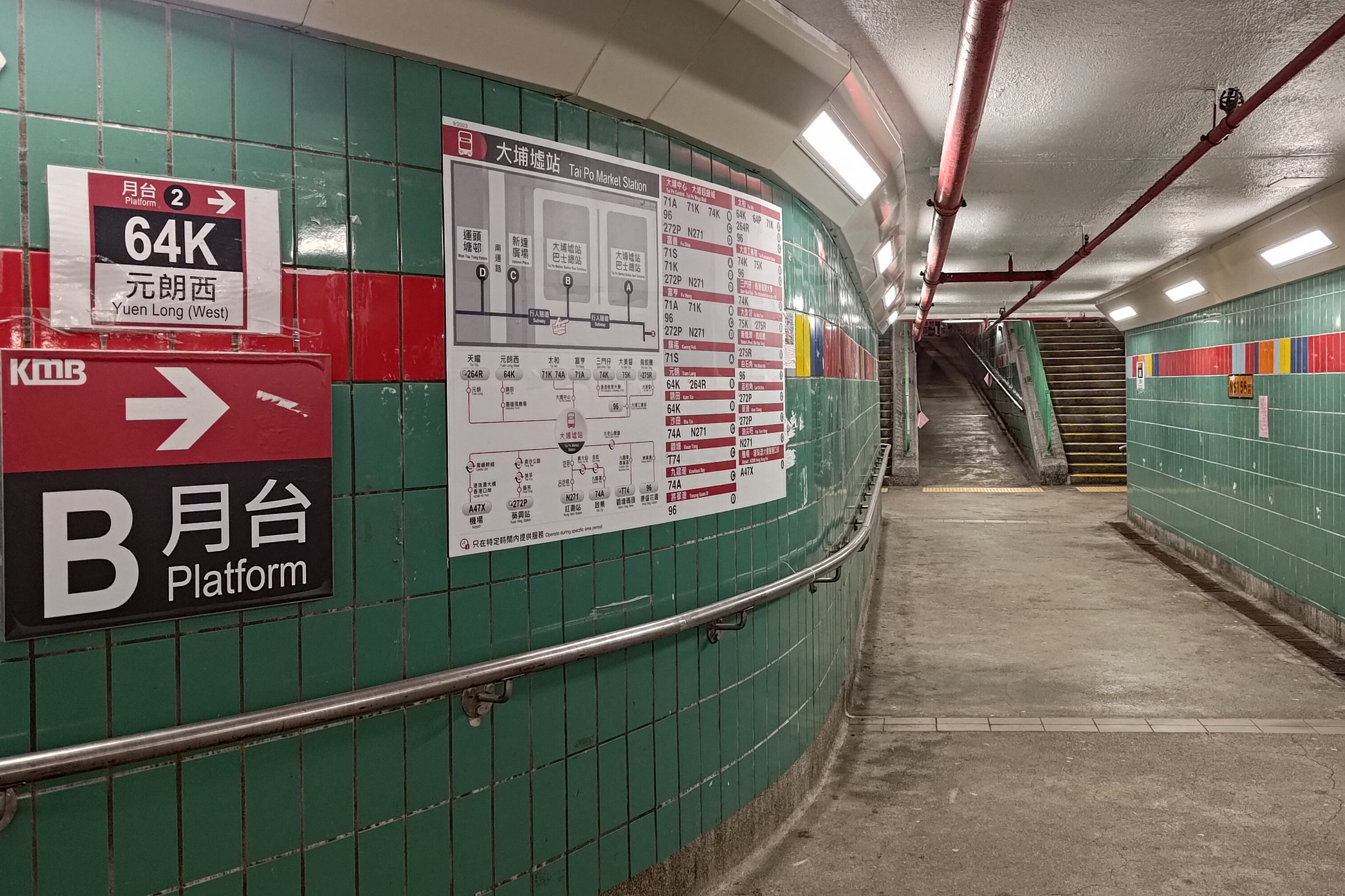

To get to the So Lo Pun hike start point, take the MTR to Tai Po Market station and then hop on any of the two following buses:
Leave Tai Po Market Station at Exit A3 and follow the 275R laminated signs.
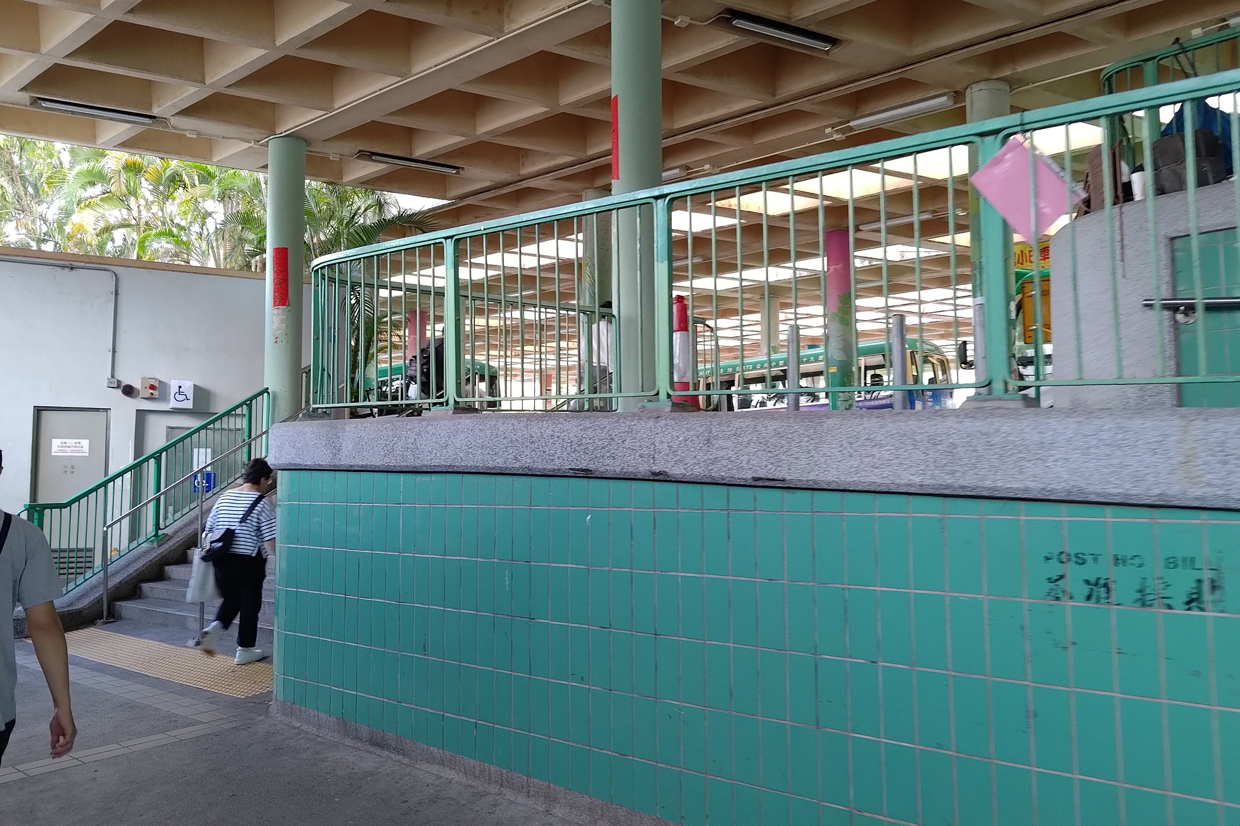
You can take the 275R bus on Sundays or public holidays to the last stop, which is Wu Kau Tang Bus Terminus (hike start point).
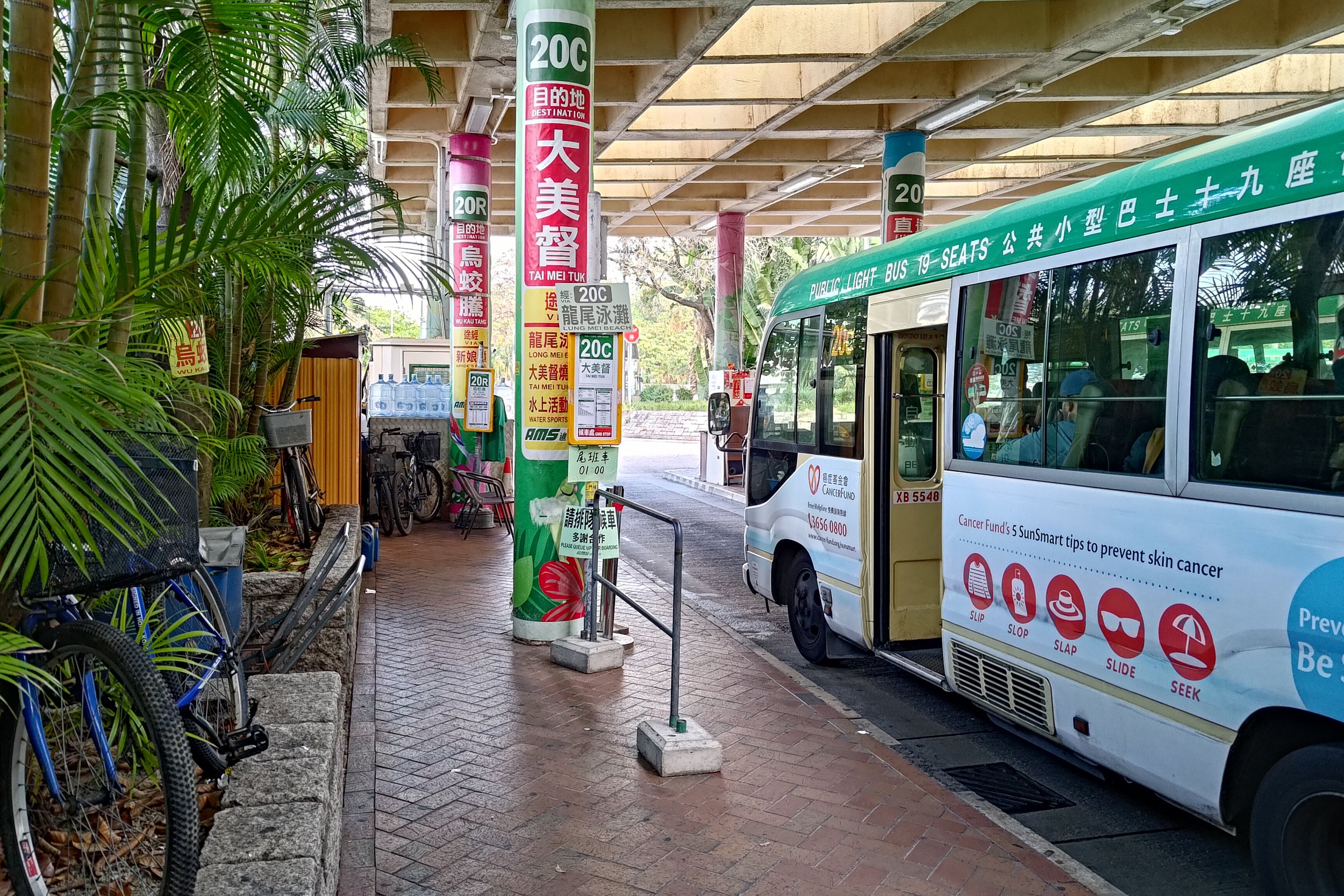
- 20R Green Minibus
Leave Tai Po Market Station at Exit A3 and turn left following the blue 'Public Light Buses' sign. The 20R bus will be immediately to your left at the minibus station.
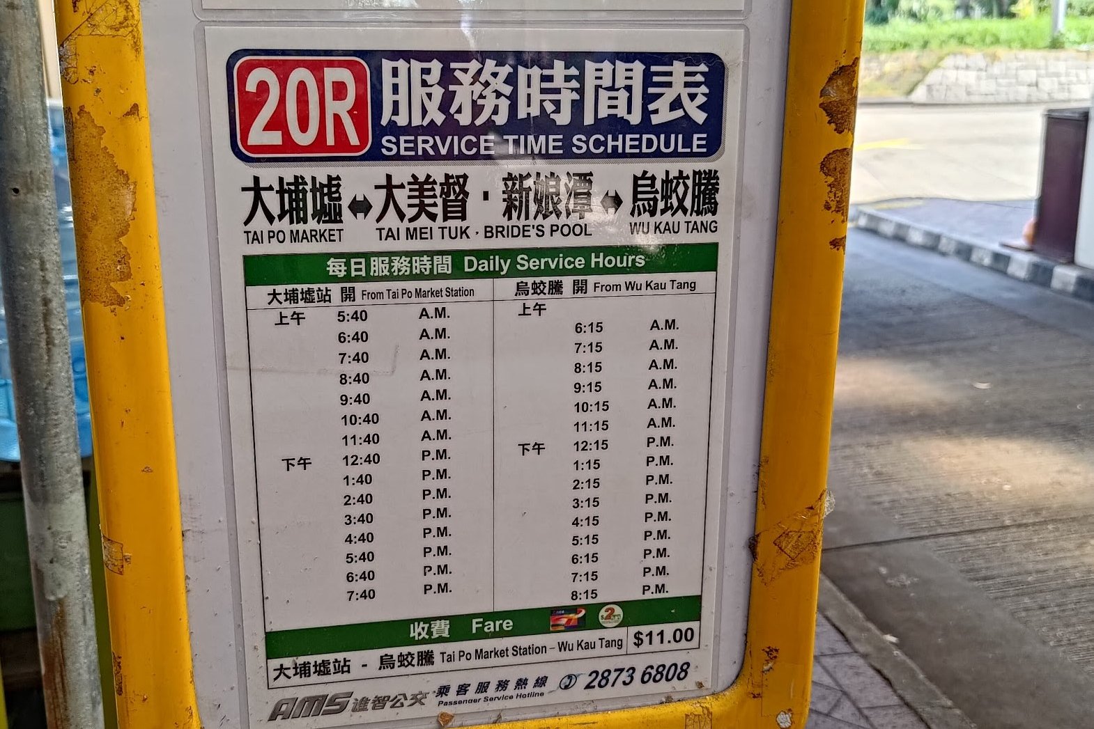
The 20R minibus runs only once per hour on weekdays every 40th minute of the hour (06:40, 07:40 etc), but is more frequent on weekends. Get off at the second-last stop - at the intersection of Chi Sum and Wu Kau Tang Road. Walk up Wu Kau Tang Road to Wu Kau Tang Bus Terminus (hike start point).
If you end up at the last stop, walk back in the direction you came from on the bus for a couple of minutes before going left on Wu Kau Tang Road.
You'll see the start point at the end of Wu Kau Tang Road.
Quick So Lo Pun Hike Route Summary
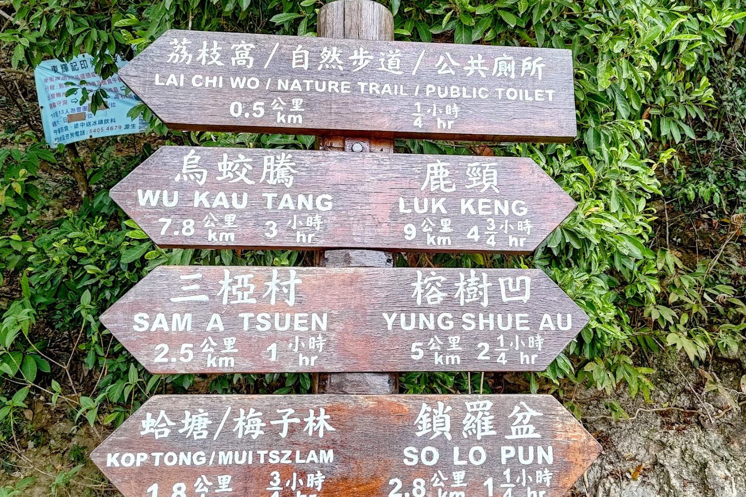
- Follow the 'Wu Kau Tang Tsuen' sign behind the Wu Kau Tang Bus Terminus shelter
- Follow the 'Sam A Tsuen' sign and cut through the bottom of Wu Kau Tang Village
- Turn right at the 'Kau Tam Tso' sign and follow the trail for 10 mins
- At the fork in the road follow the 'Sam A Tsuen' sign up the sloping path
- 5-10 mins later, follow the path straight and avoid the stairs (near the red emergency post)
- 25 minutes later, follow the 'Sam A Tsuen Via Sam a Chung' sign
- Miu Sam Stream intersects with the trail all the way to the Sam A Chung stone marker and the mangroves after it
- Follow the trail inland and heed the 'Sam A Tsuen' stone marker
- Enjoy a 30-minute coastal walk before reaching the next 'Sam A Tsuen' sign
- At the Sam A Tsuen grassland, follow the sign toward 'Lai Chi Wo'
- When you begin to ascend a few minutes later, there's another 'Lai Chi Wo' sign to follow
- 20 minutes later, go past the 'Welcome to Lai Chi Wo' sign (don't take the stairs)
- Arrive at Lai Chi Wo about 15 minutes later (can escape here via ferry)
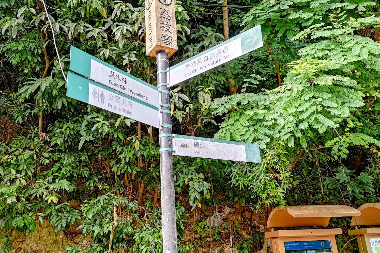
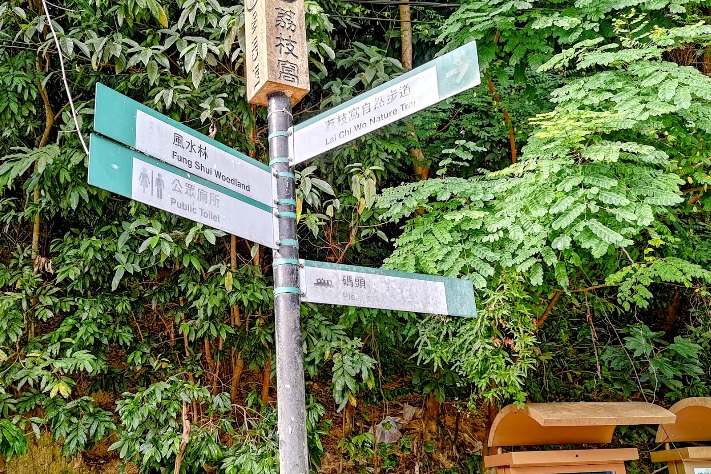
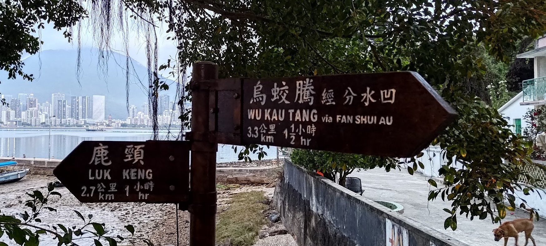
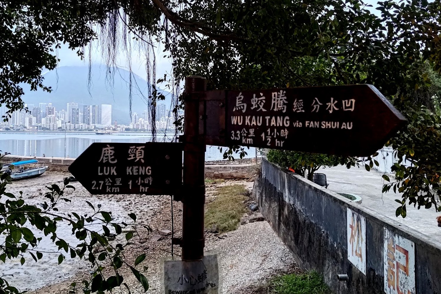
- Follow the green sign to the pier (you can explore Lai Chi Wo first and then come back)
- Head through the little archway by the water and follow the brown sign pointing to So Lo Pun
- You will enter a spooky forest trail that inclines upward. More signs point the way to So Lo Pun
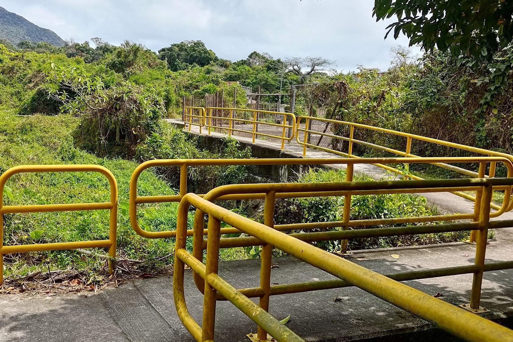
- After descending, cross the yellow-railing pathway and take a left (a sign points you in the correct direction)
- You will soon arrive at So Lo Pun. After exploring, continue along the trail and look out for a set of brown signs on your right
- Follow the brown sign to Yung Shue Au. It involves another incline through a spooky forested area before you head back downward and arrive at Yung Shue Au Village
- After exploring, follow the brown Luk Keng sign for another incline before following a flat path by the coast that overlooks Starling Inlet
- You will eventually descend into Kuk Po by its pier. Connect to the trail and you'll see a set of signs. Follow the one pointing to Luk Keng
- Follow the coastal trail for 20-25 minutes past the Fung Hang Pier and village
- Take the stairs up at the next 'Luk Keng' sign
- Continue along the coast for a few minutes until you arrive at Kai Kuk Shue Ha village
- Follow the village's road until you reach Bride's Pool Road
- The 56K minibus stop is a few minutes away to your right
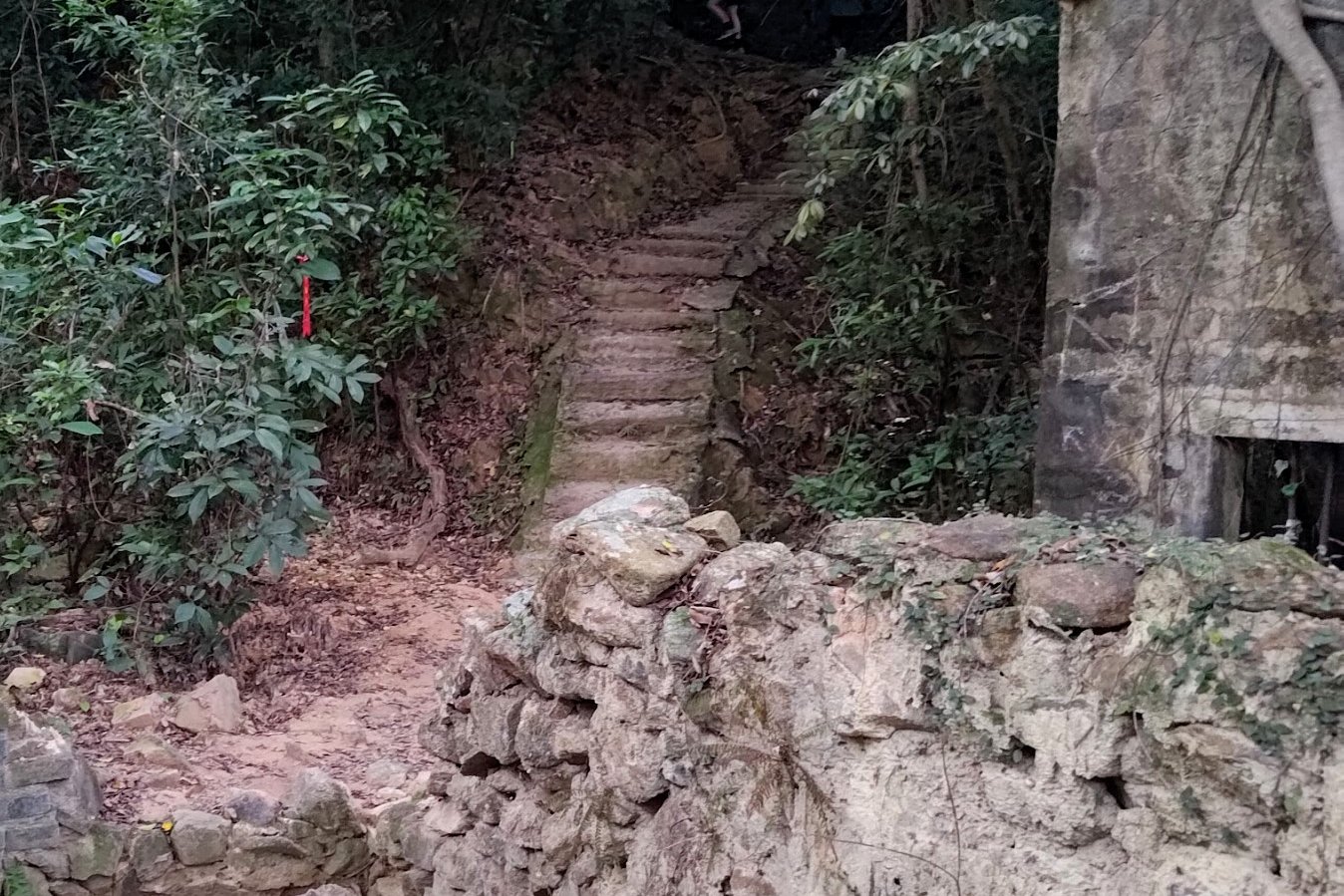
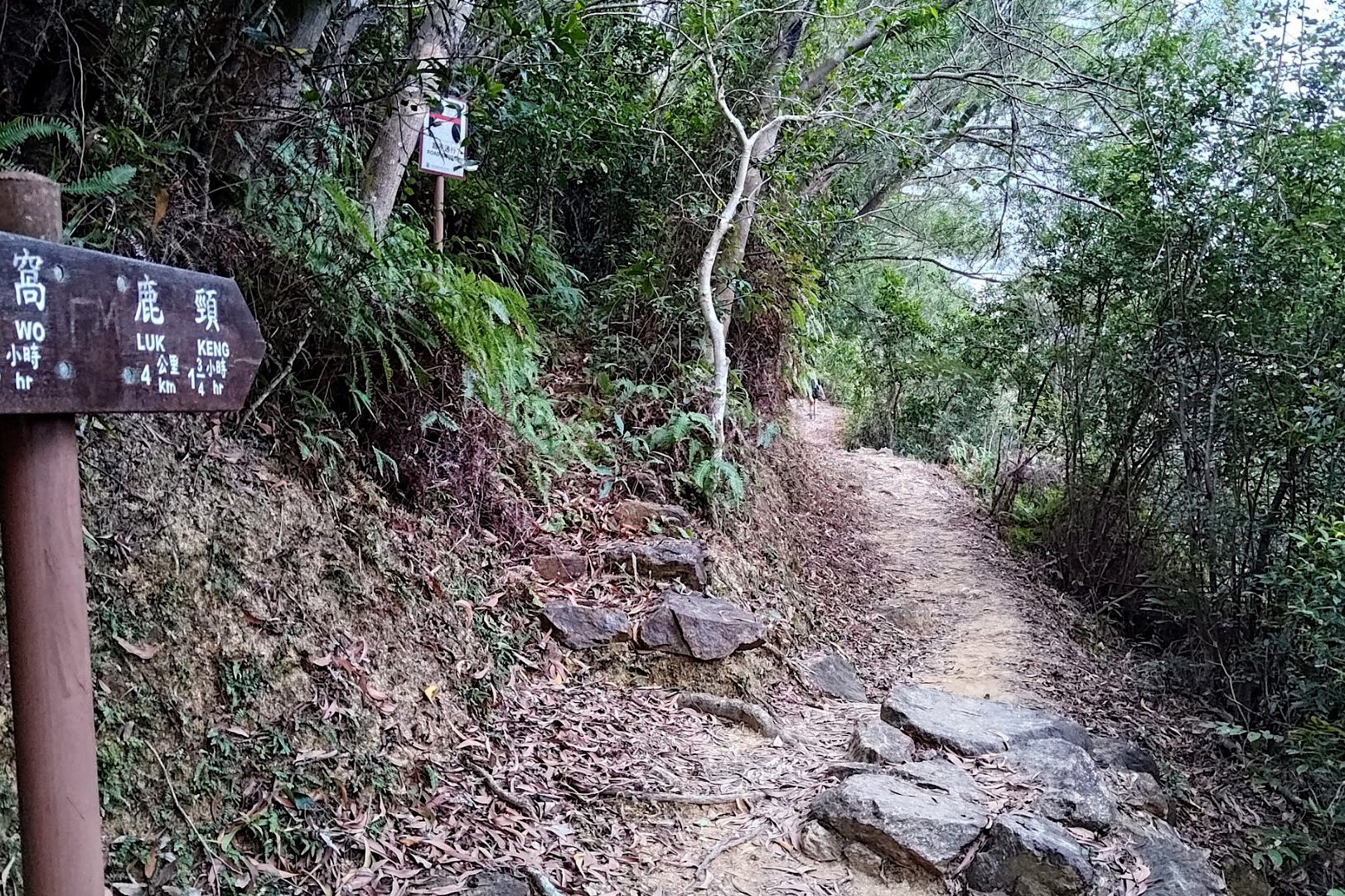
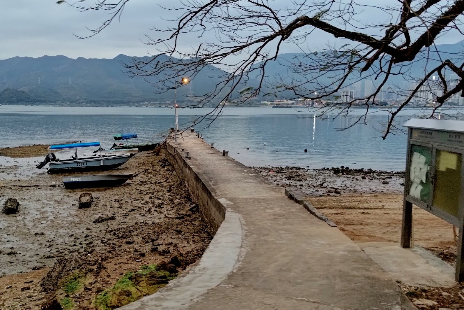
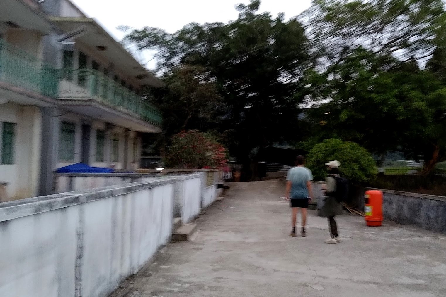
Wu Kau Tang Village

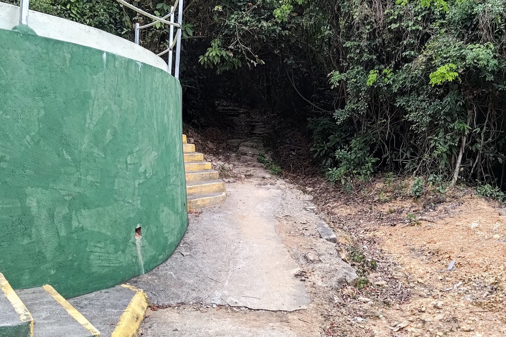
After getting off at the Wu Kau Tang ( 烏蛟騰) Bus Terminus, follow the 'Wu Kau Tang Tsuen' sign in front of the 'Double Haven Country Trail' marker and descend the green-railing slope.
Follow the brown 'Sam A Chung' sign and take the path that goes across the little stream.
You'll emerge a few minutes later at Wu Kau Tang Village, which was founded in the 1660s or 1670s.
You'll see the main village to your left as you take the right fork around an impressive lone, walled house.
Wu Kau Tang is known for its butterflies (apparently, there are 137 species of butterflies that can be observed here), so take your time to admire the beauty of your surroundings.
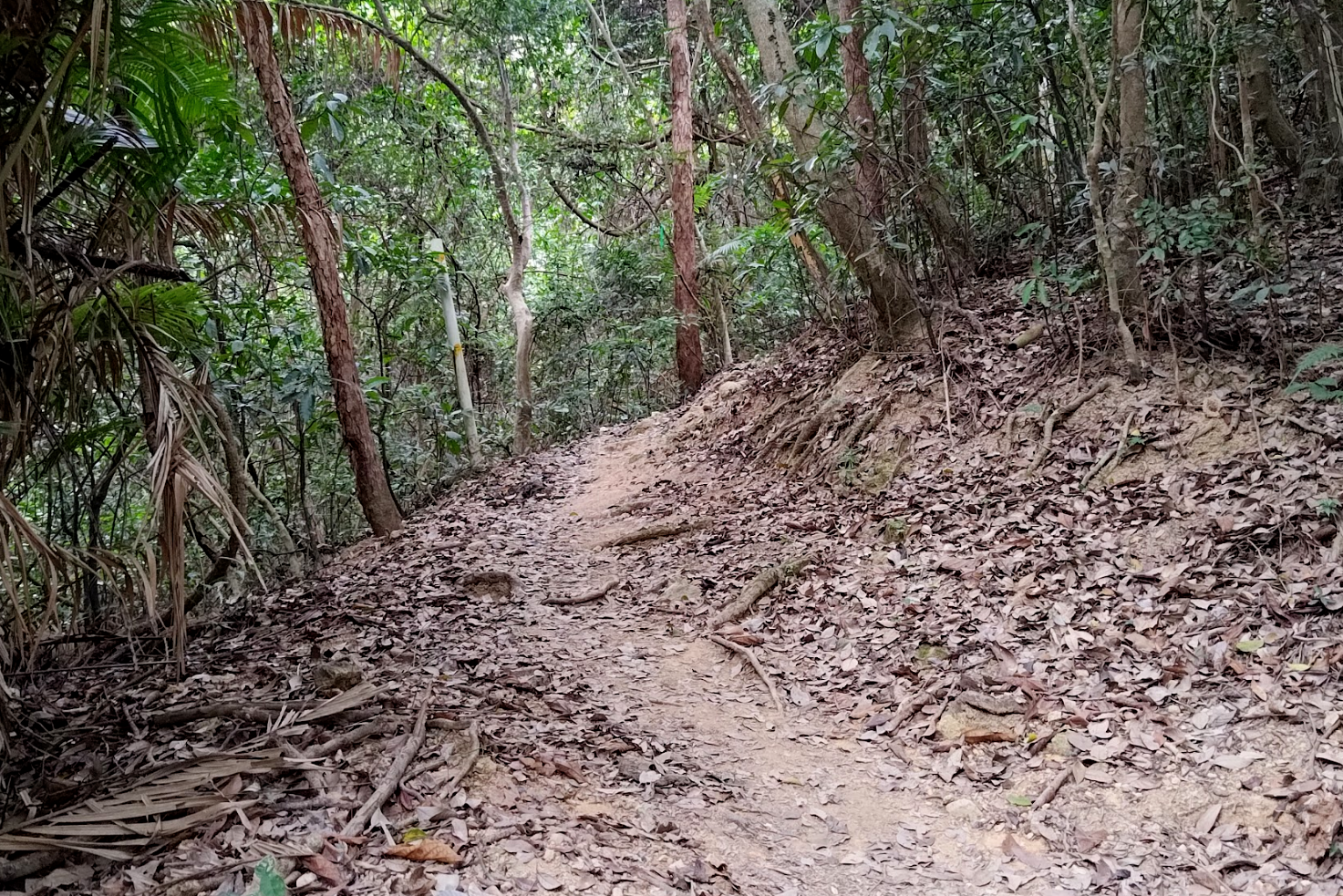
Kau Tam Tso Sign and Fork


After going past the walled house, you'll see a sign pointing you towards 'Kau Tam Tso'. Follow the sign and walk past a beautiful stream with cool fish in it, a large chunk of green grassland with maple trees in it and even some abandoned village homes.
At the fork in the road about 10 minutes later, follow the sign pointing to 'Sam A Tsuen' and take the path that slopes upward.
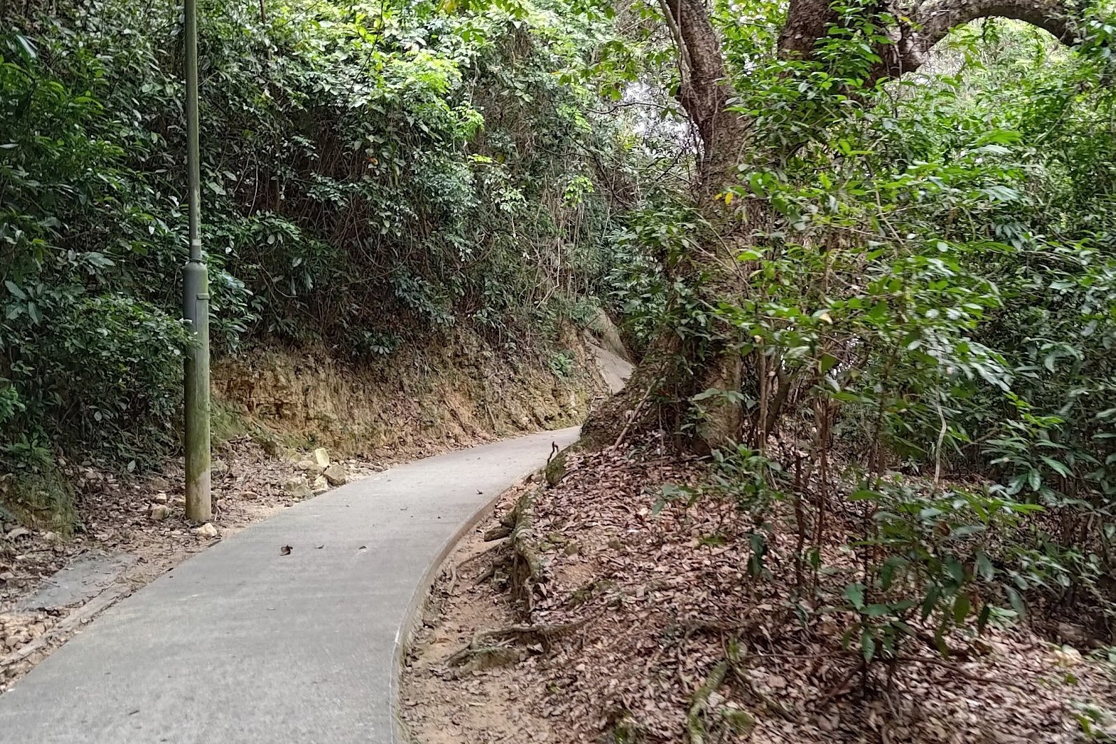
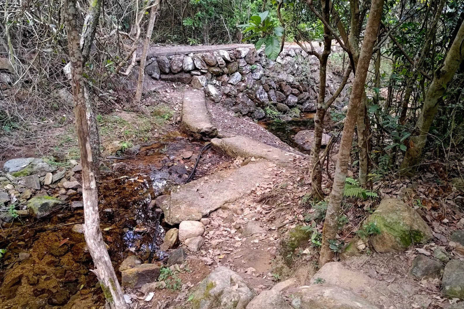
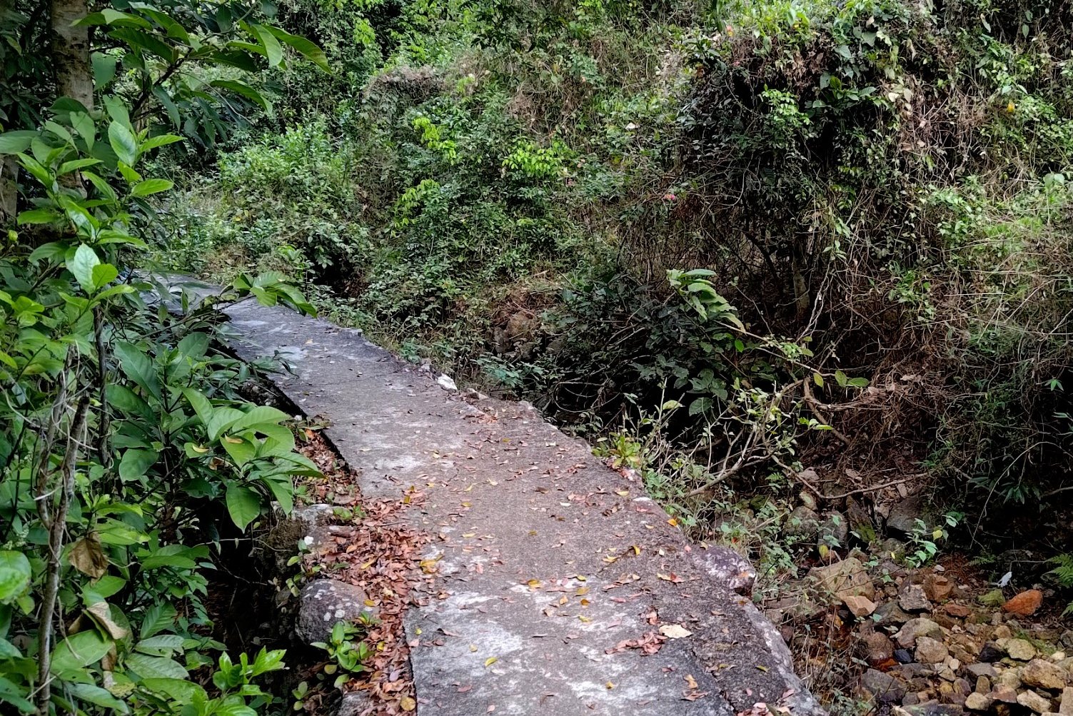
2 Weird Bridges and another Fork to the Right


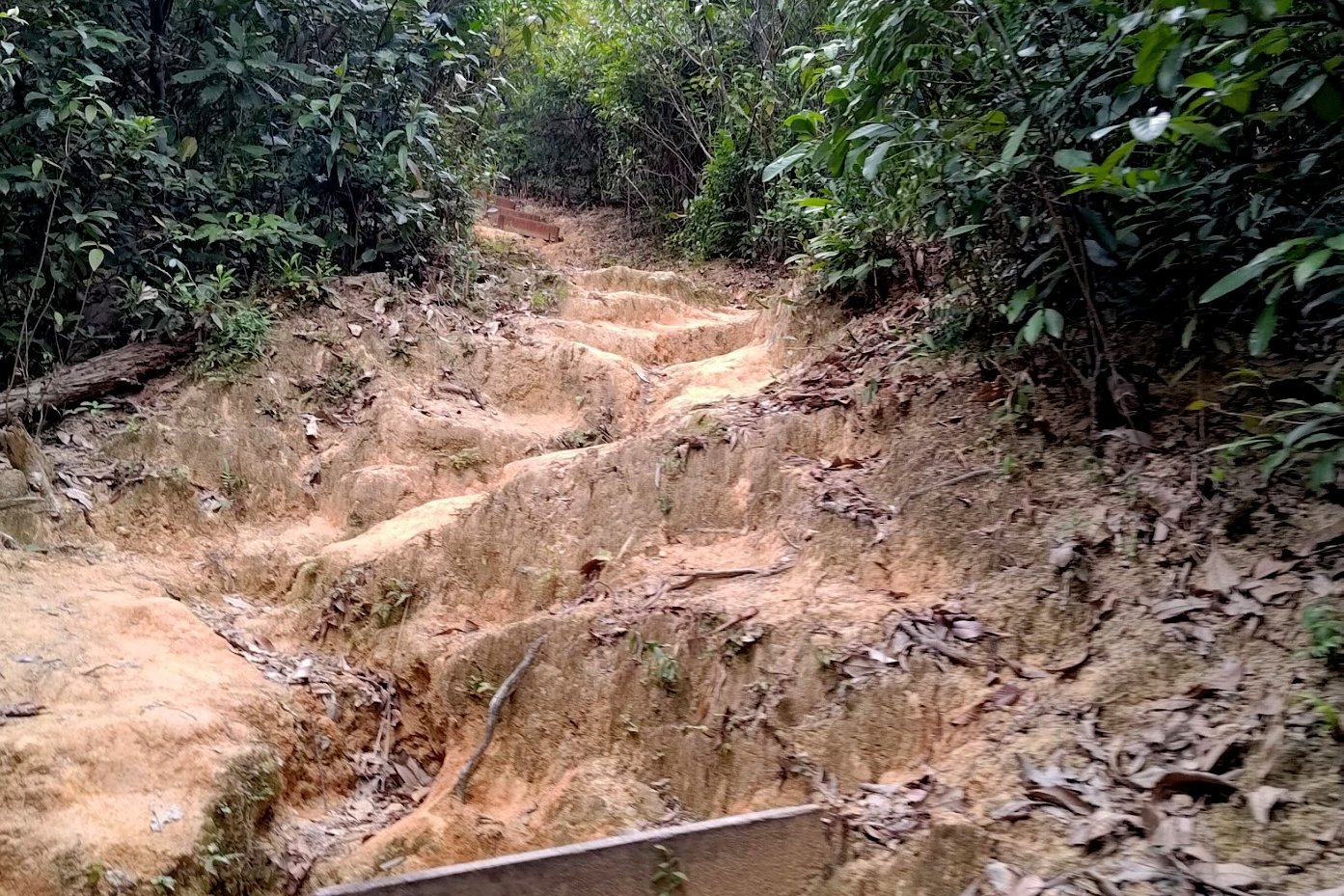
Keep following the trail for 10 minutes, going past a couple of strange bridges - one really small and almost inconsequential and the other super large and overdone.
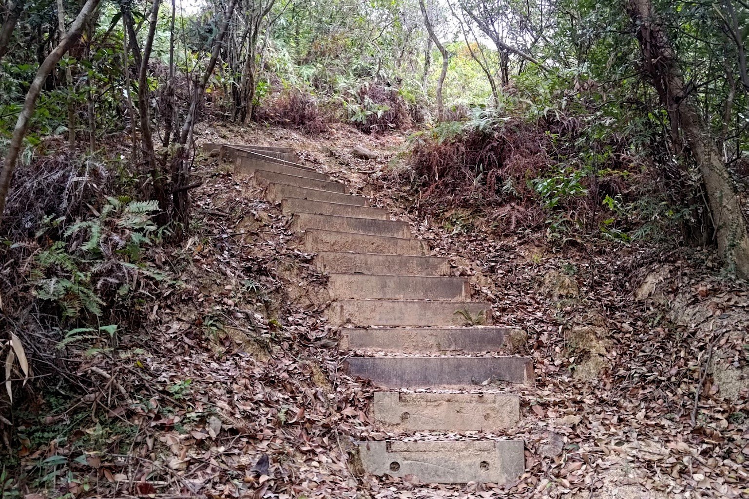
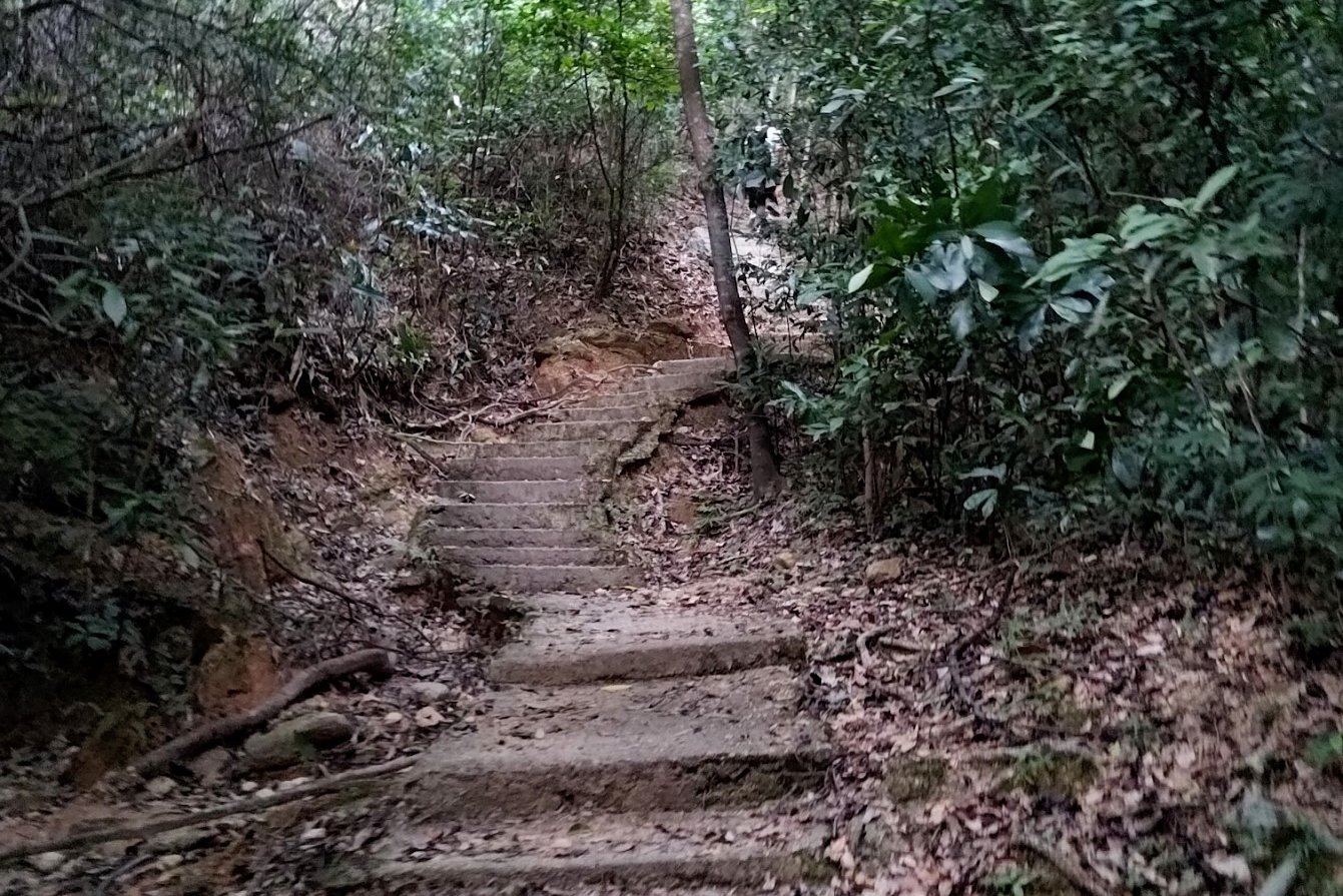
You'll emerge from the trees soon after and see a set of stairs heading upward to the left and a flat path on the right. Take the flat path and avoid the stairs heading upward.
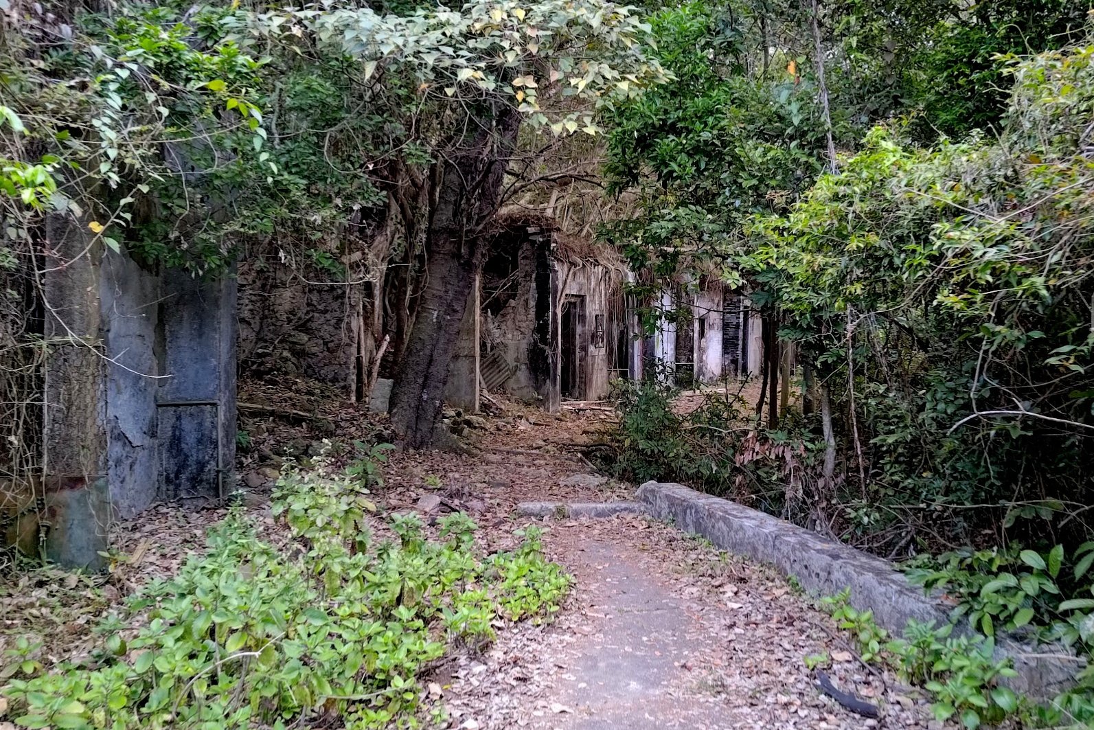
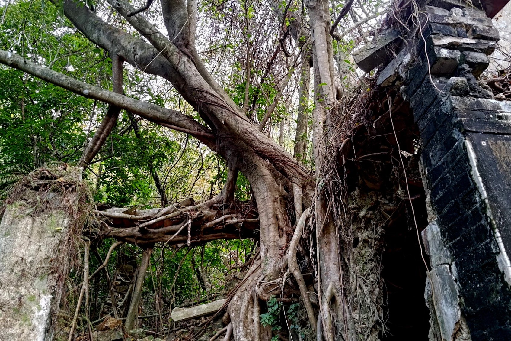
Sheung and Ha Miu Tin Abandoned Villages


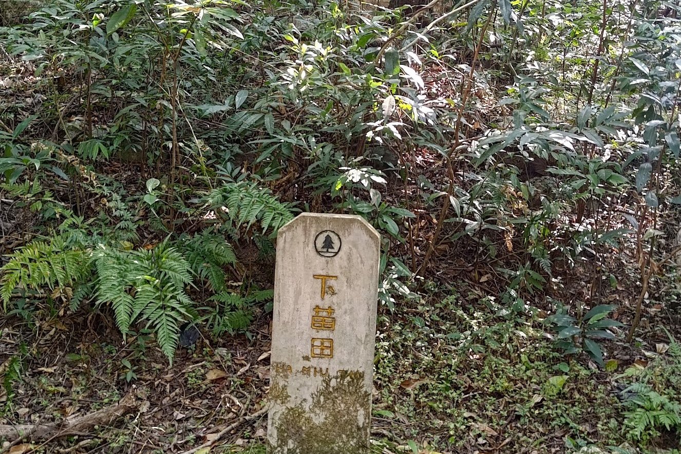

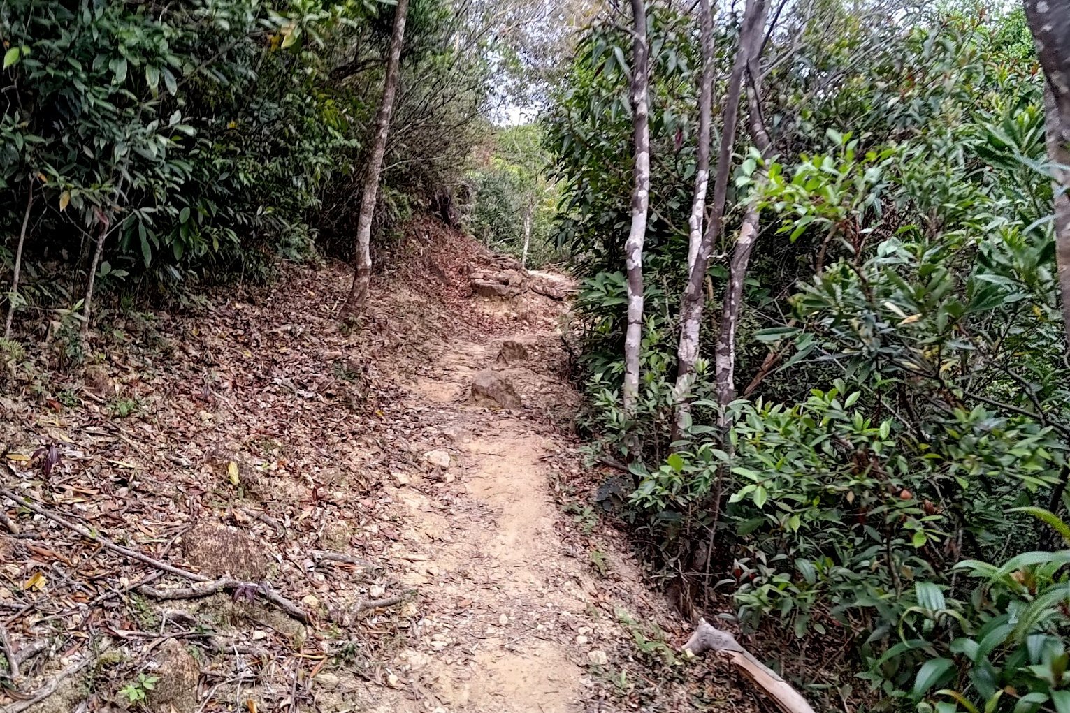
The next 25 minutes has you walking through a wonderful forested section of the trail that takes you past the remnants of Sheung and Ha Miu Tin Villages, which were once home to the Tsang and Mo Hakka family clans.
A little stone marker, almost like a small grave stone, marks the site where each of the villages used to stand. While Sheung Miu Tin is almost completely gone, a little path leads to the remnants of Ha Miu Tin Village, which is incredible!
You'll eventually cross a stream via some stepping stones after the abandoned villages and arrive at a set of signs.
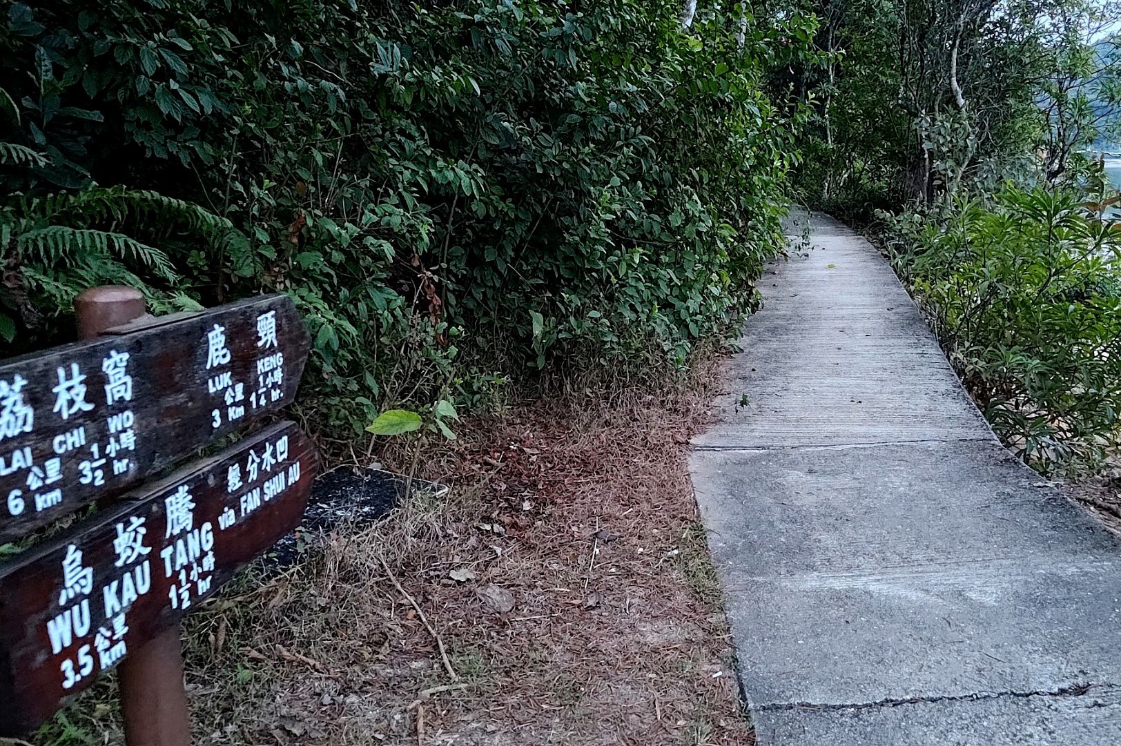
Follow the 'Sam A Tsuen Via Sam A Chung' Sign to the Mangroves


Follow the 'Sam A Tsuen Via Sam A Chung' sign for the next section of the hike. If you follow the sign to Tai Tung, you will be en route to Hong Kong's Pink Beach and the Devil's Fist hike (Hong Kong's toughest hike).
The next 30 minutes of the trail is intersected often by Miu Sam Stream, which means more stepping stones as you continue toward the wetlands and coast. Each time the stream crosses the trail, the scenery just seems to get even more beautiful.
The terrain will also take on a sort of pinkish-red hue part way through. This is a natural coloration caused by the presence of siltstone, which is a type of sedimentary rock that was compressed over a hundred million years ago.
After crossing the weird bridge, you'll arrive at the the first mangrove views of the hike.

30 Minutes of Gorgeous Mangrove Scenery


You'll soon see the Sam A Chung stone marker that indicated where the village once used to be.
Just behind it, the terrain turns a vibrant mauve/pink color as you cross another little stream crossing and head inland for a bit.
Follow the stone 'Sam A Tsuen' sign before getting even more amazing mangrove scenery.
You'll go across perhaps the most spectacular stream crossing a little while later before reemerging at the coast.
Follow the Coast until the 'Sam A Tsuen' Sign


This is one of the most spectacular and scenic sections of the entire hike. You'll be walking right beside the coast - literally so close that you can touch the water.
A combination of pink rocks, shimmering waters and lush mangroves makes this one of the most unique landscapes you can find in Hong Kong. The presence of cute mud skippers only makes things all the more magical.
Toward the end of the coastal section, you'll see a sign pointing you to 'Sam A Tsuen'. Follow it back inland.
Enter Sam A Tsuen and begin the Journey to Lai Chi Wo


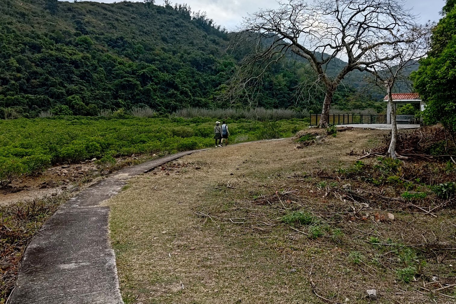
Entering Sam A Tsuen via the roped walkway, one can't help but find it remarkable how beautiful and isolated this place is. In its heyday in the 1950s and 1960s, the village had over 200 inhabitants.
Today, it's mostly empty since all the villagers have opted to pursue lives in the city. On weekends, descendants of the original Tsang Hakka Clan, who first set up the village, will return to sell food and drinks to visitors.
Follow the concrete path and go in the direction of the brown sign pointing to 'Lai Chi Wo' at the crossroads.
A few minutes later, you'll see another split in the road. Go in the direction of the next Lai Chi Wo sign (past the phone booth) or go left if you want to check out the village. Return back to the trail after the village if you decide to explore or stock up on supplies.
Or, you can go towards Green Villa (there's a sign for it) where you can find a restaurant and some stairs behind it to connect back to the path.
The Path to Lai Chi Wo


A few minutes after the last sign pointing to Lai Chi Wo, you'll begin to ascend and see another 'Lai Chi Wo' sign. Follow that sign and you'll soon begin to see some of the abandoned houses of Sam A Tsuen. You can really begin to see the scale of how big the village once was versus how tiny it is now.
20 minutes later, you'll come across a 'Welcome to Lai Chi Wo' sign. Stick to the coastal path here unless you want to climb up the stairs to the observation point before returning back down.
A little while later, there'll be another wooden sign pointing you in the direction of Lai Chi Wo.
Make sure not to miss the wooden walkway that curves out onto the mangroves and offers a really unique view of the natural landscape.
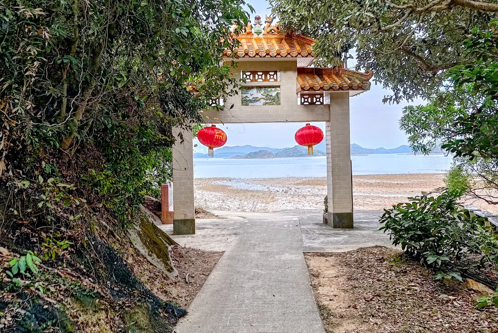
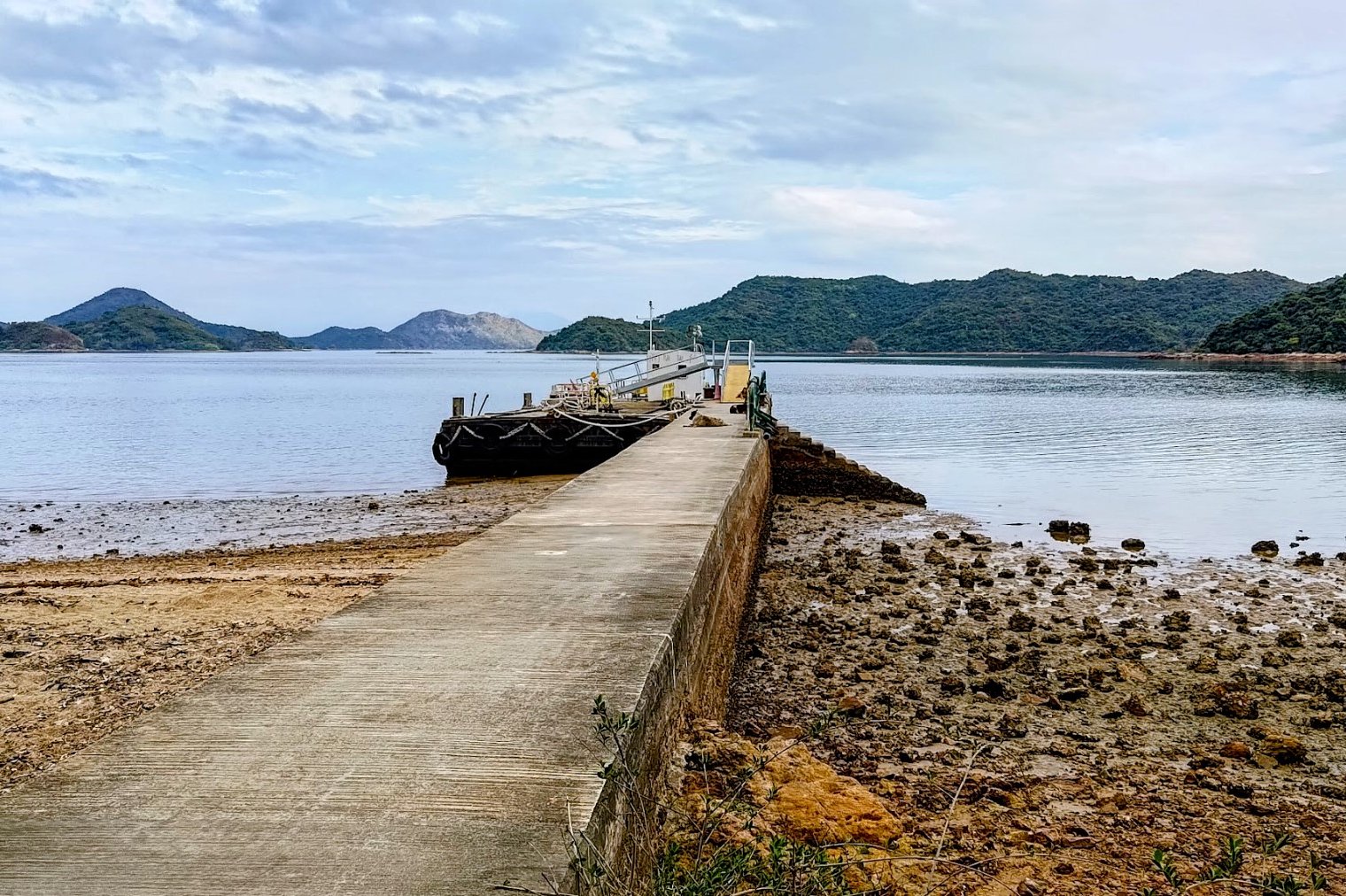
You'll arrive at Lai Chi Wo about 15 minutes later. It's worth exploring Lai Chi Wo for sure. But if you're pressed for time, you can skip it and follow the sign right to the pier.
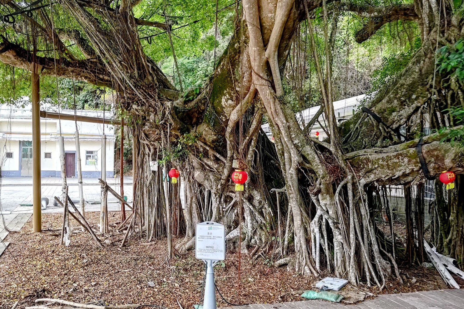
Lai Chi Wo Village Scenery


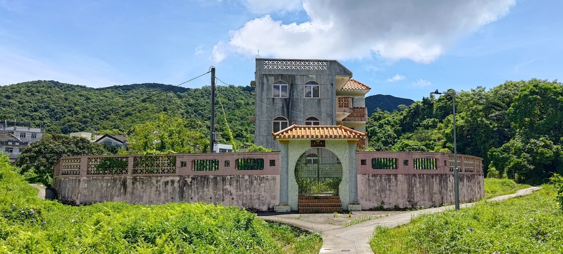
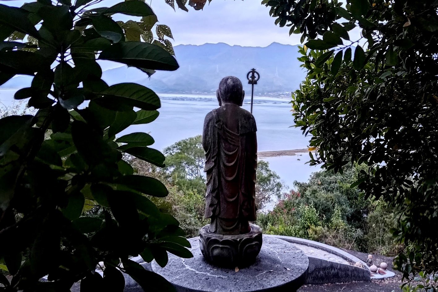
Upon arriving at Lai Chi Wo, the first thing you'll likely notice is the wall that surrounds the village. It's been sympathetically restored and hasn't been turned into something gaudy and for show. Indeed, one of the things I appreciated most about Lai Chi Wo is that you can still feel the village's age when you wander around its streets and houses.
Built over 300 years ago, Lai Chi Wo is one of Hong Kong's best examples of an ancient Hakka Village. In the past, this was the center of an alliance of 7 Hakka villages in the area which included: So Lo Pun, Mui Tsz Lam, Kap Tong, Siu Tan, Ngau Shi Wu and Sam A Tsuen (which we just visited).
These days, most of the village's inhabitants have opted to live a more convenient life in the city or abroad.
Still, Lai Chi Wo continues to flourish as it's been recognized by UNESCO for the sustainable rural revitalisation project that's being undertaken there.
For a comprehensive list of things to see in Lai Chi Wo, click here.
If you want to visit Lai Chi Wo without the hiking, or want to end your hike here, check out the ferry schedule. It only operates reliably on Saturday, Sunday and public holidays with one ferry at 3:30pm.
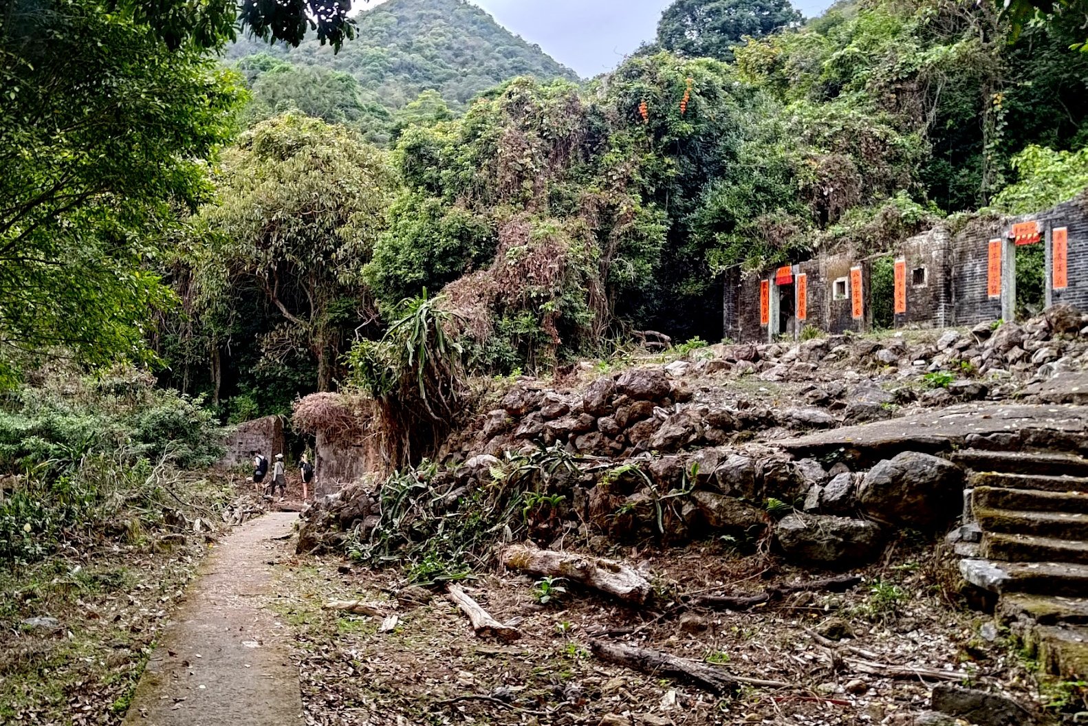
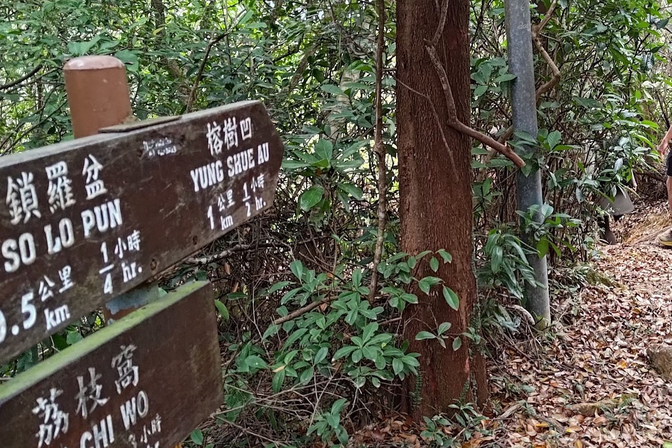
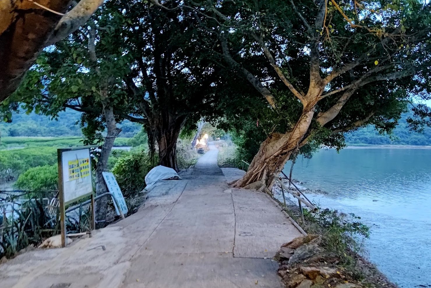
Getting to So Lo Pun
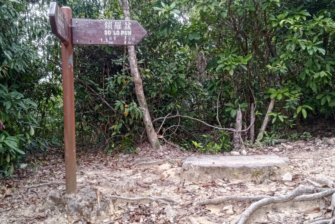
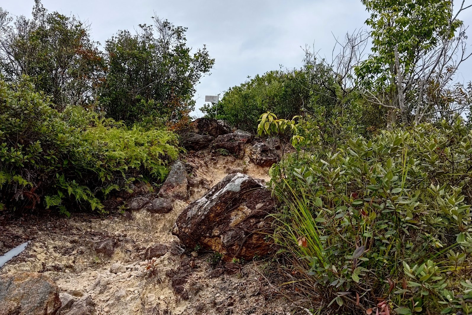
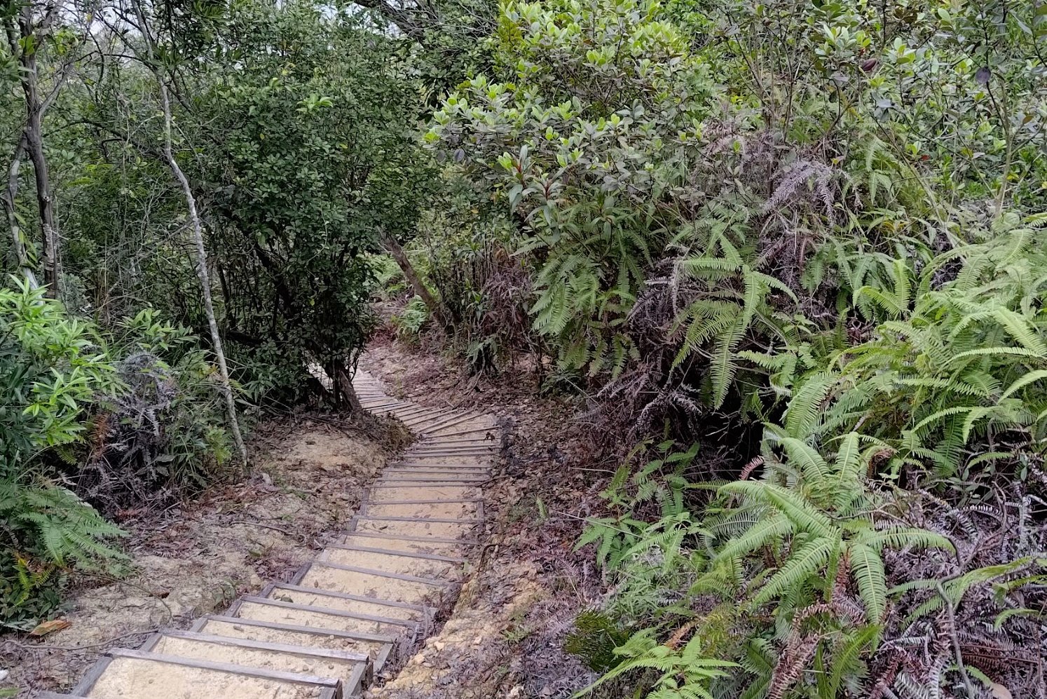
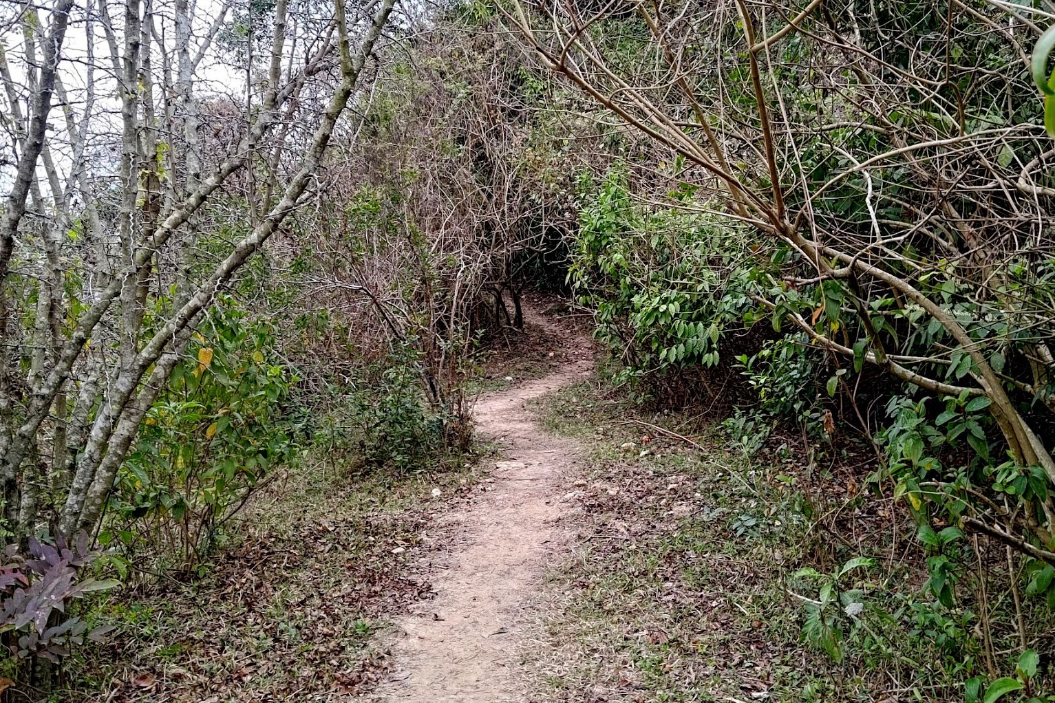
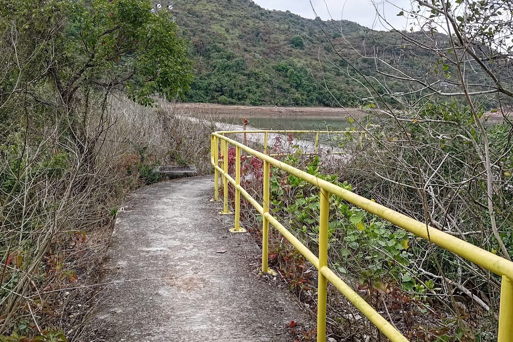
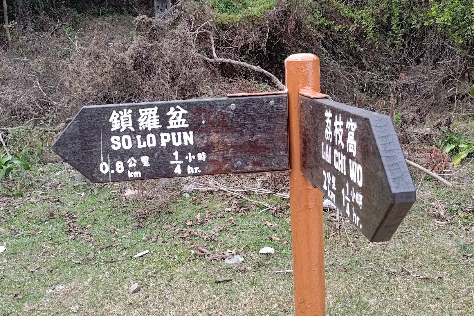
This entire section took about 40 minutes from Lai Chi Wo. It's pretty much impossible to get lost since there is ample signage along the way to point you in the correct direction.
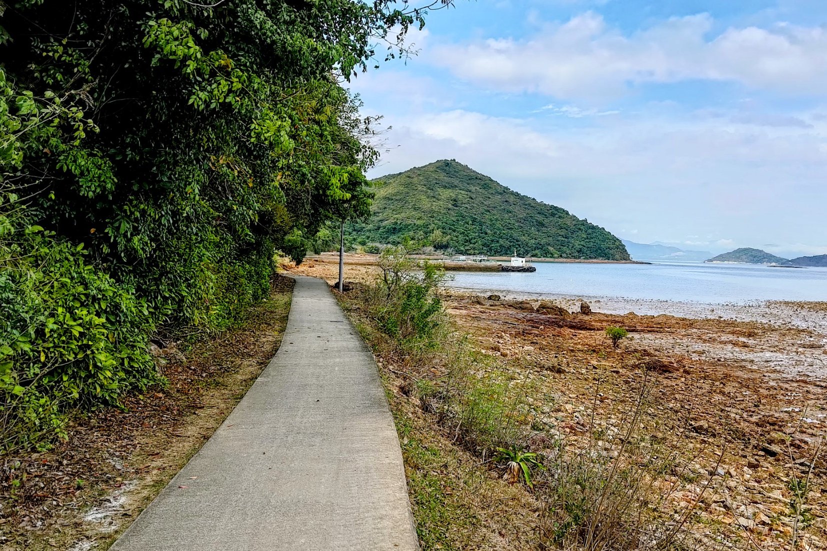
Follow the coastal path after Lai Chi Wo and keep in mind that there are ferries on weekends (at 3:30pm) if you are tired and want to escape. The ferry schedule can be found here.
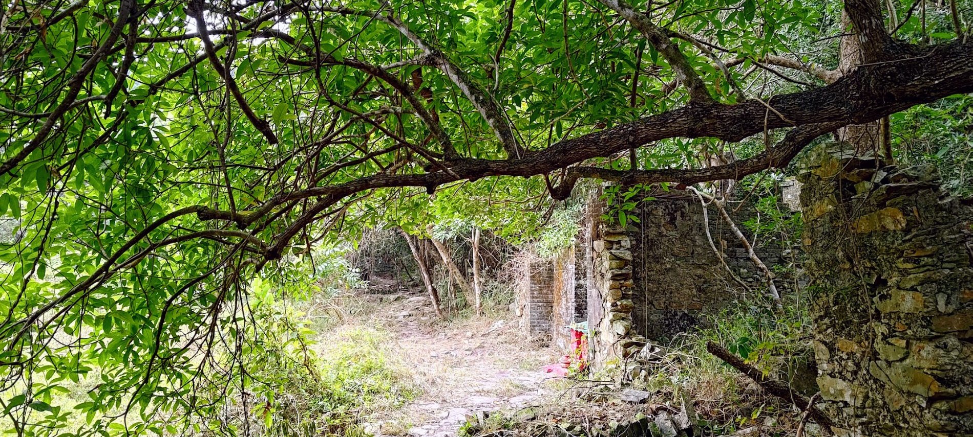
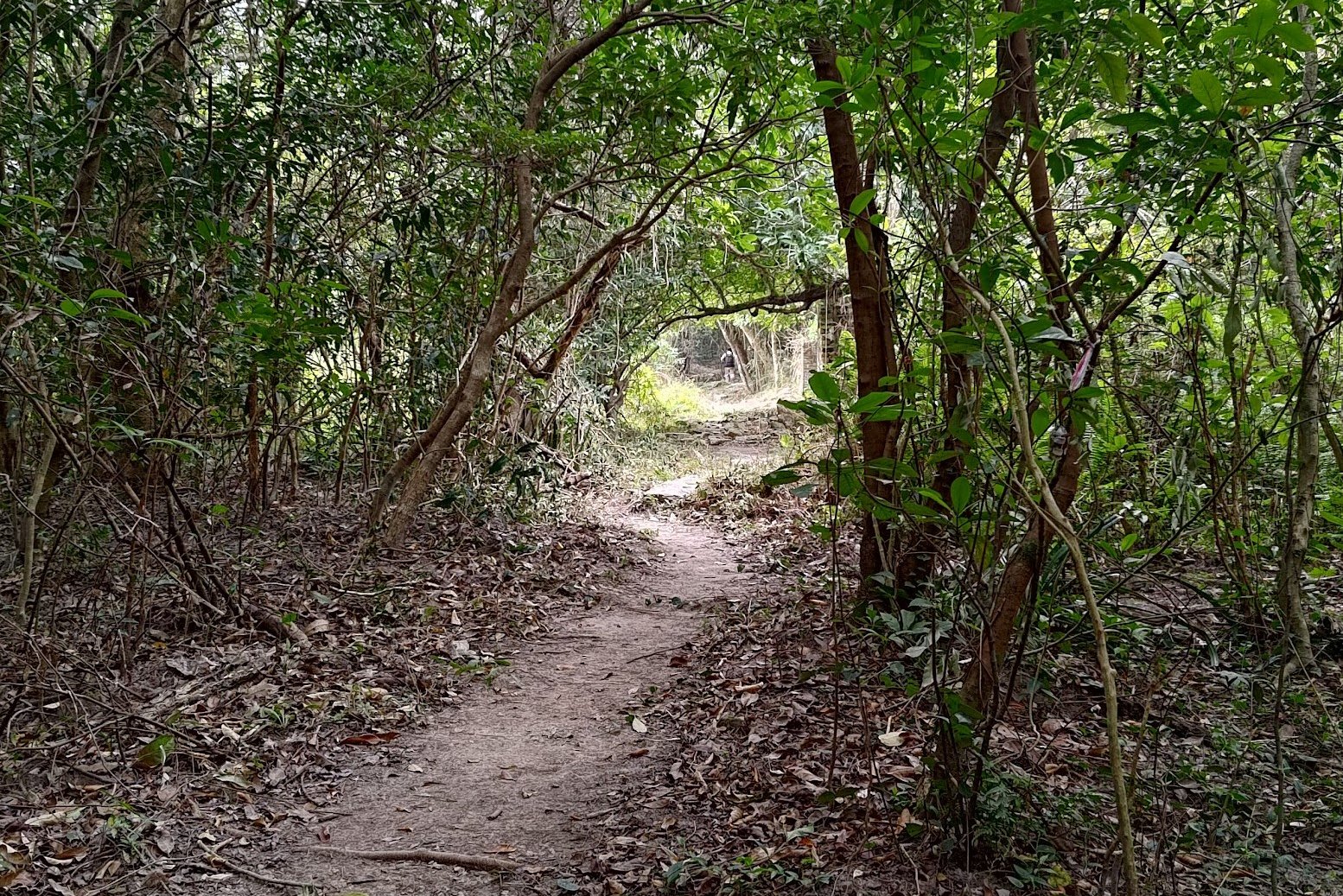
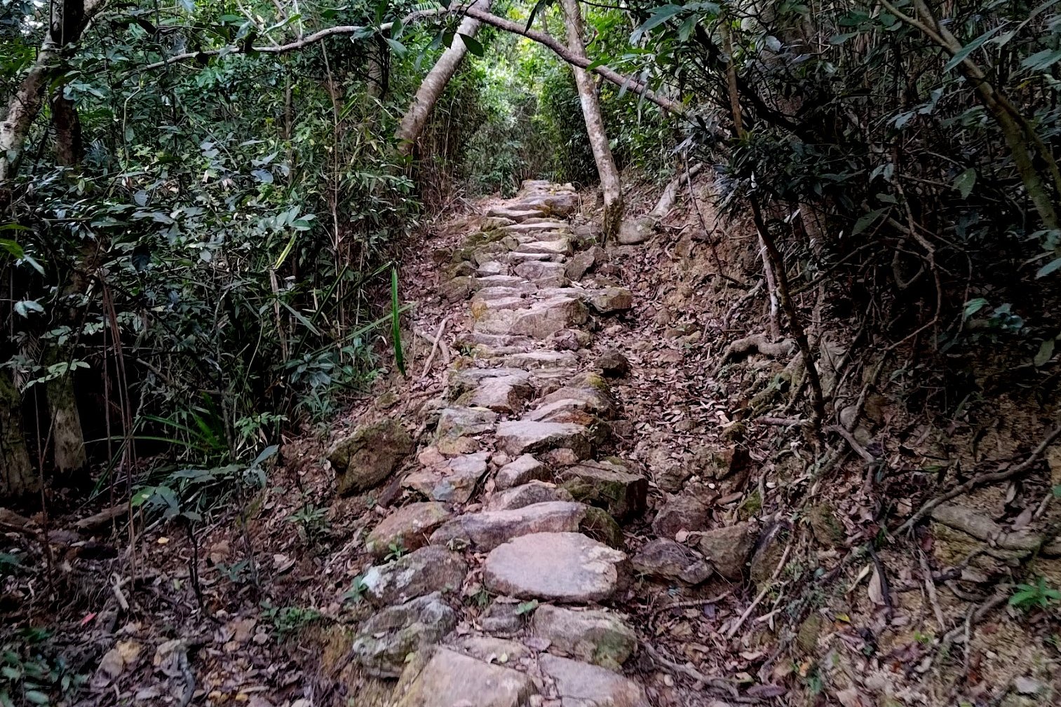
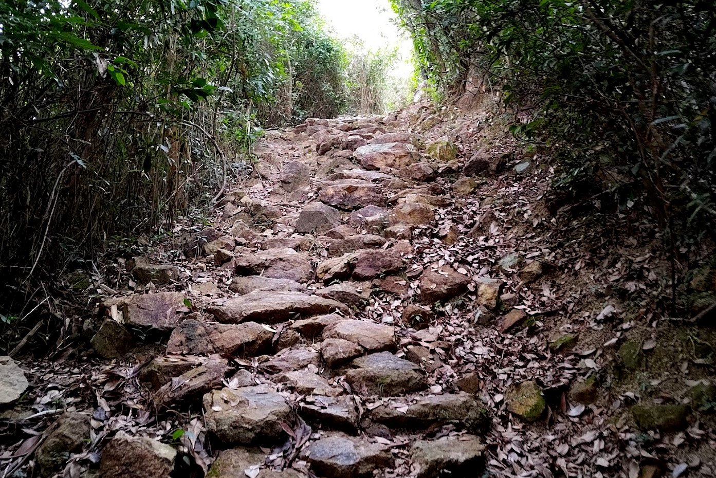
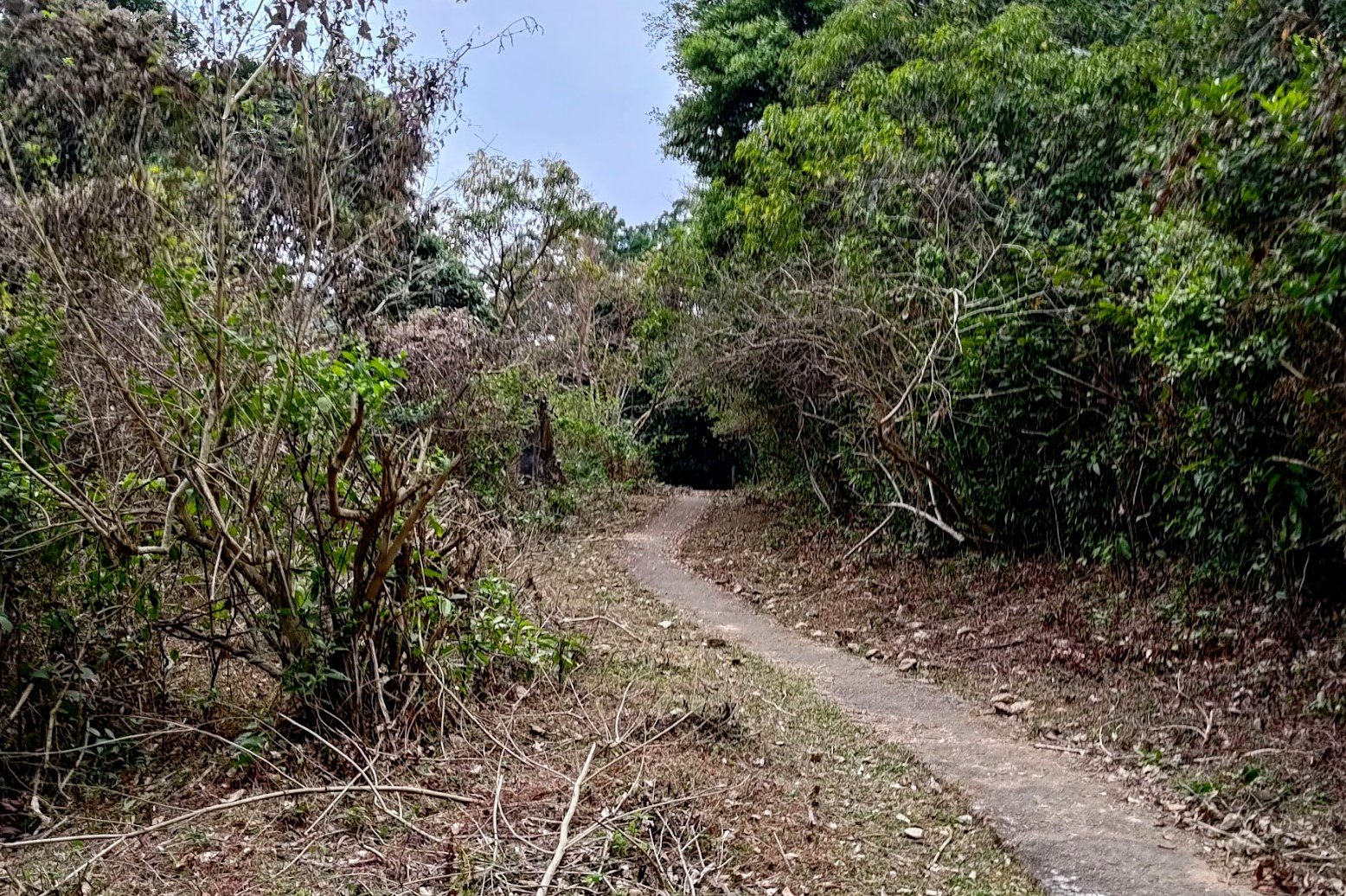
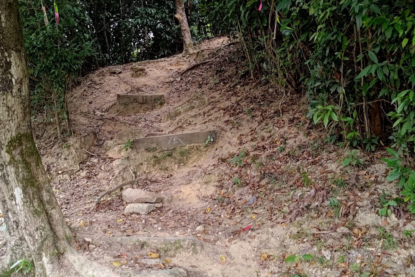
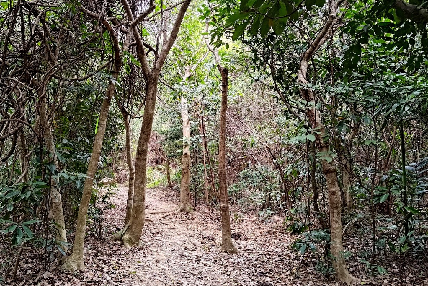
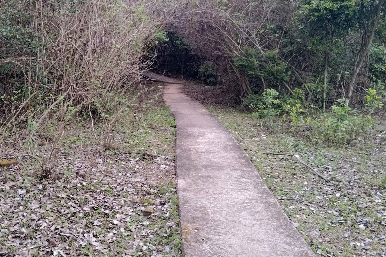
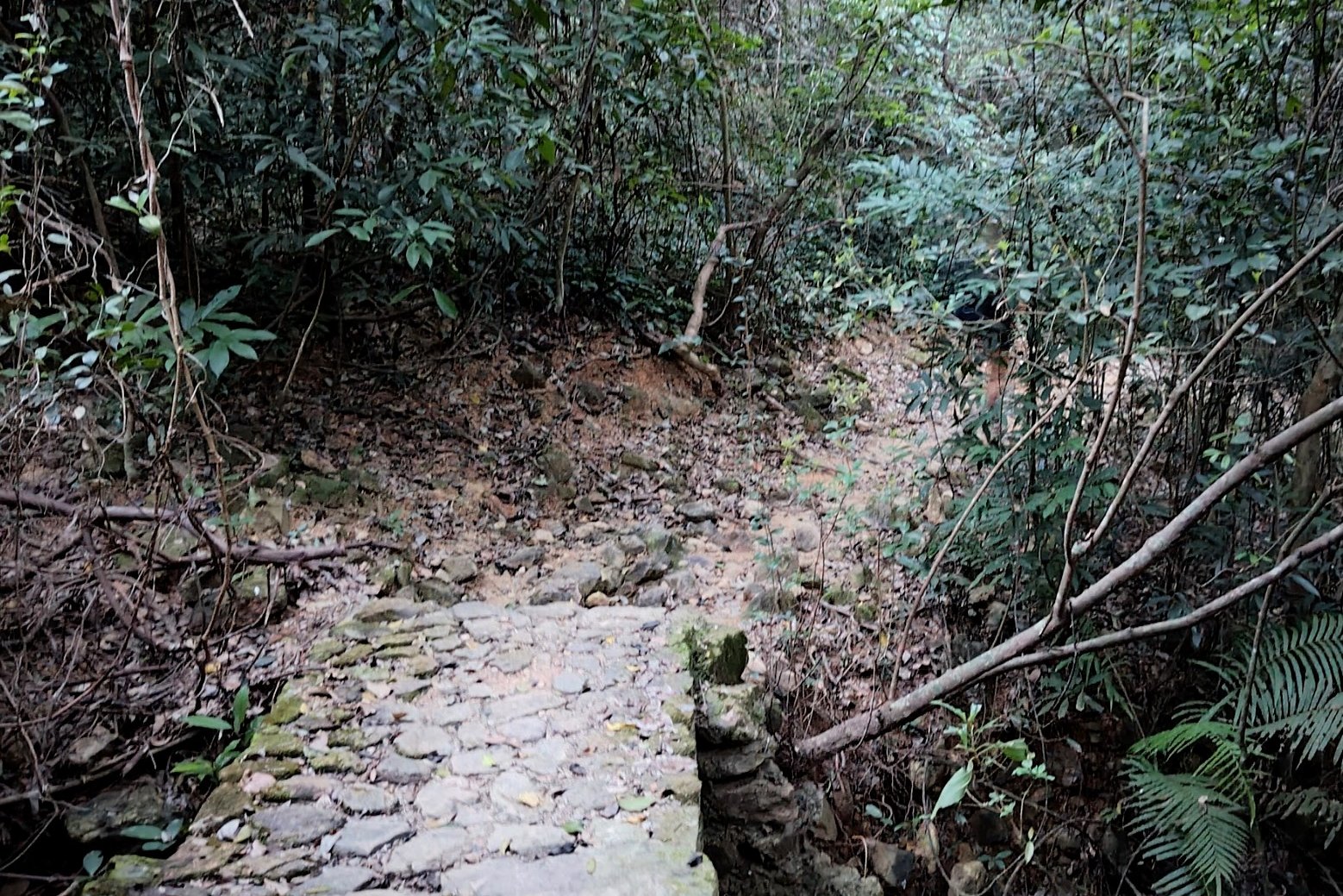
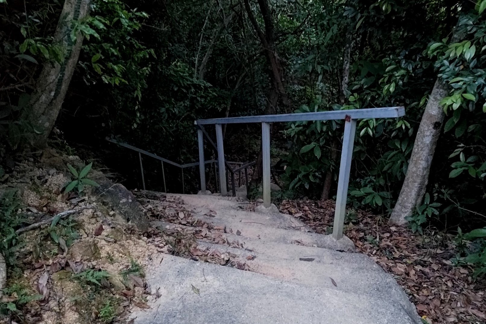
If you're continuing, you'll enter a forested section after meandering around the coast for a bit. This is the toughest uphill of the hike, so be prepared for a bit of a climb.
After your ascent, you'll take a staircase all the way back down to the coast, cross a bridge and then follow the trail towards So Lo Pun.
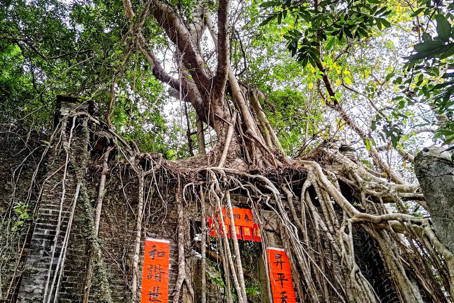
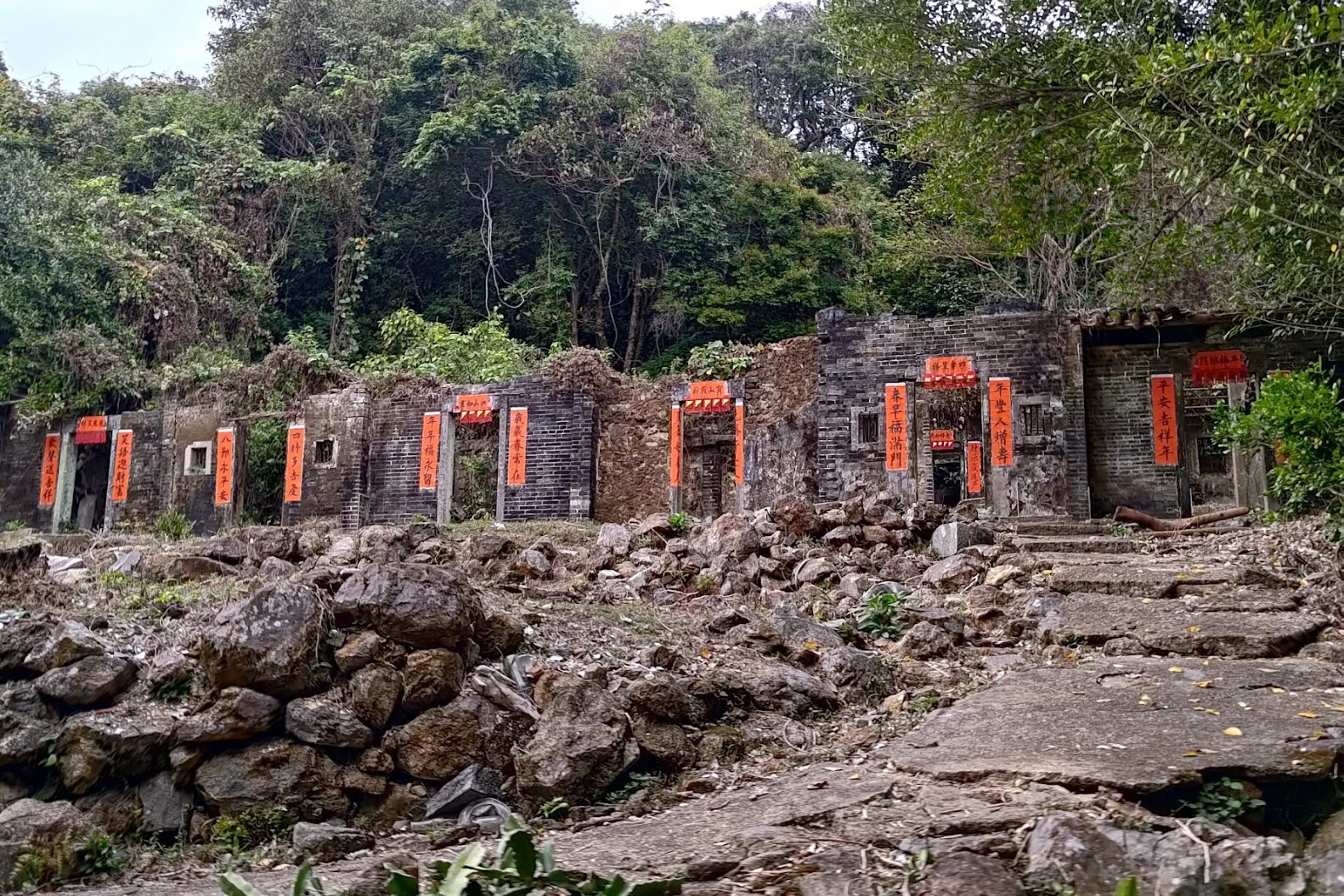
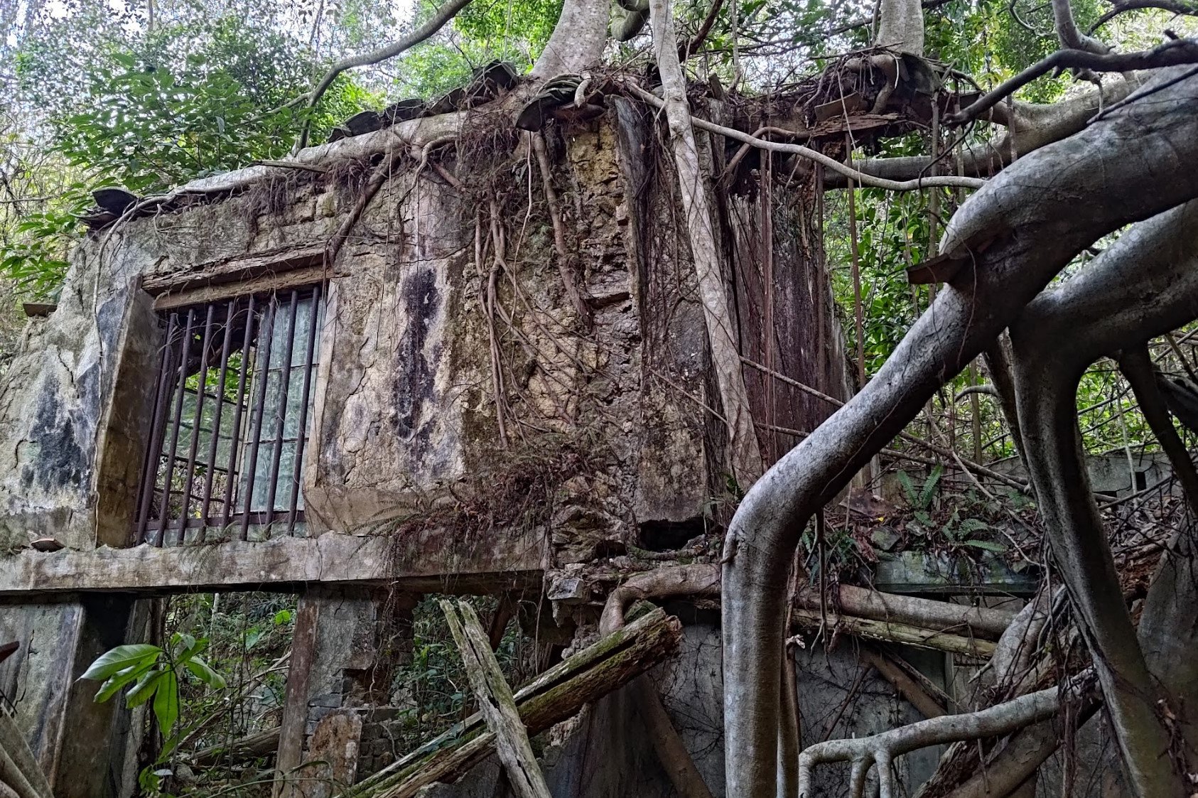
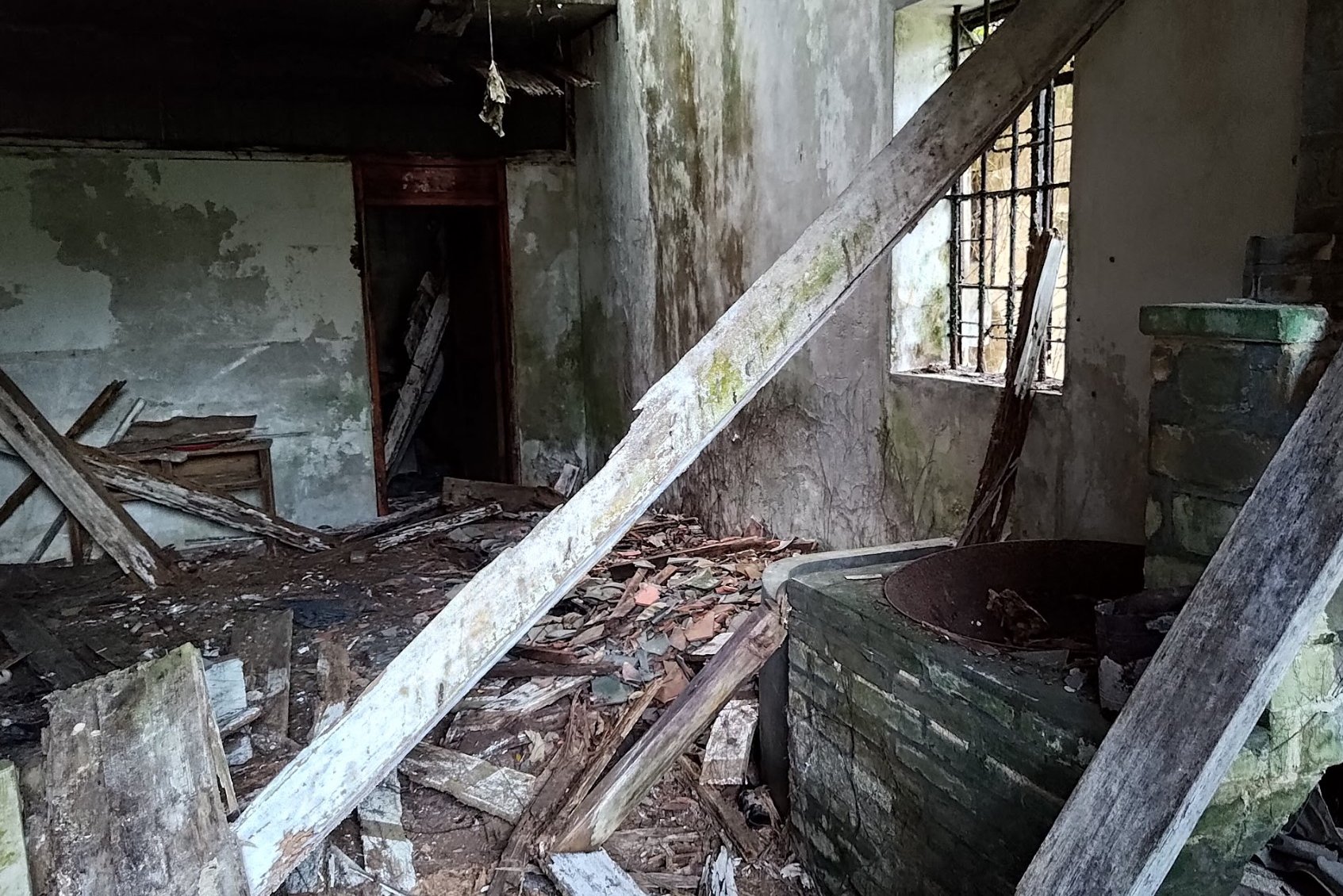
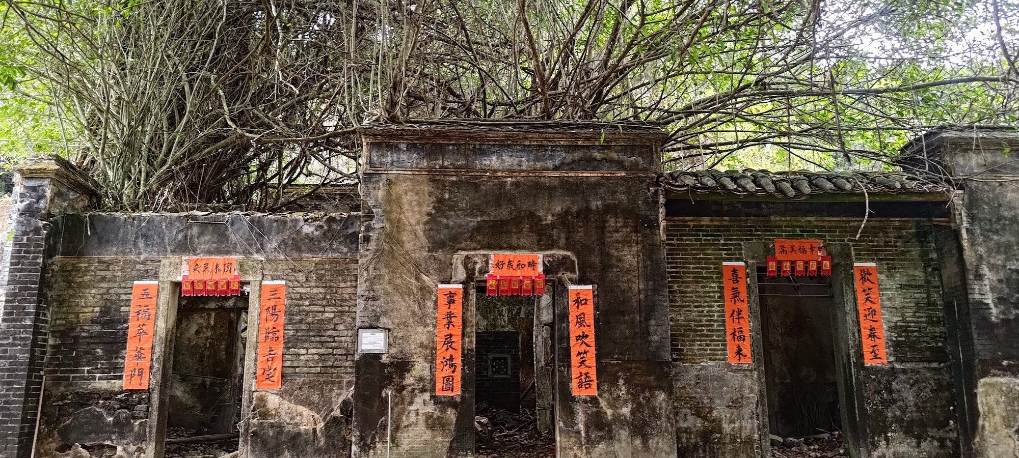
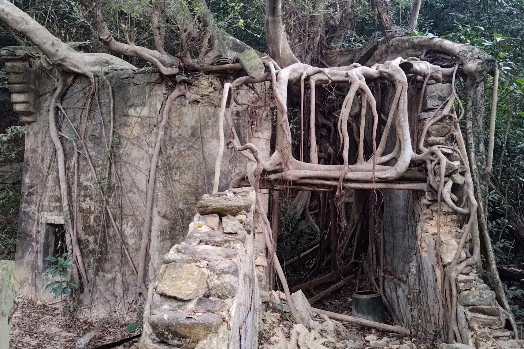
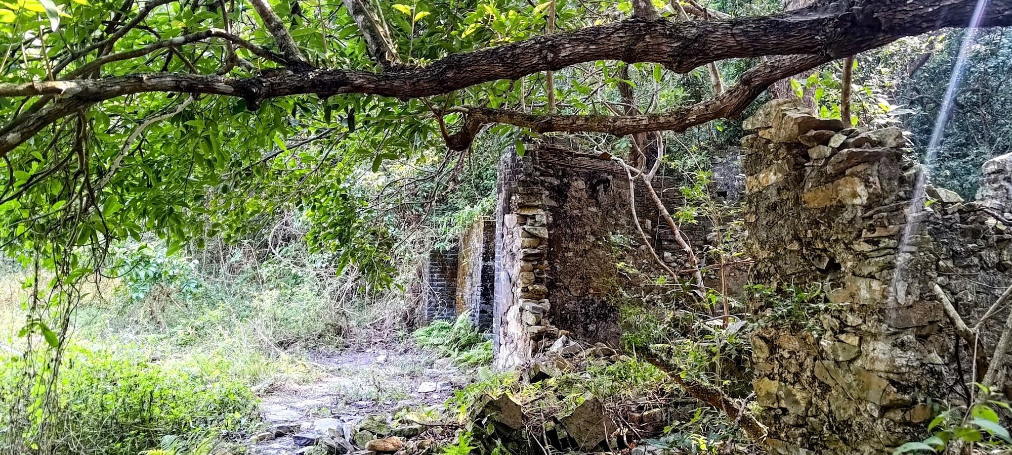
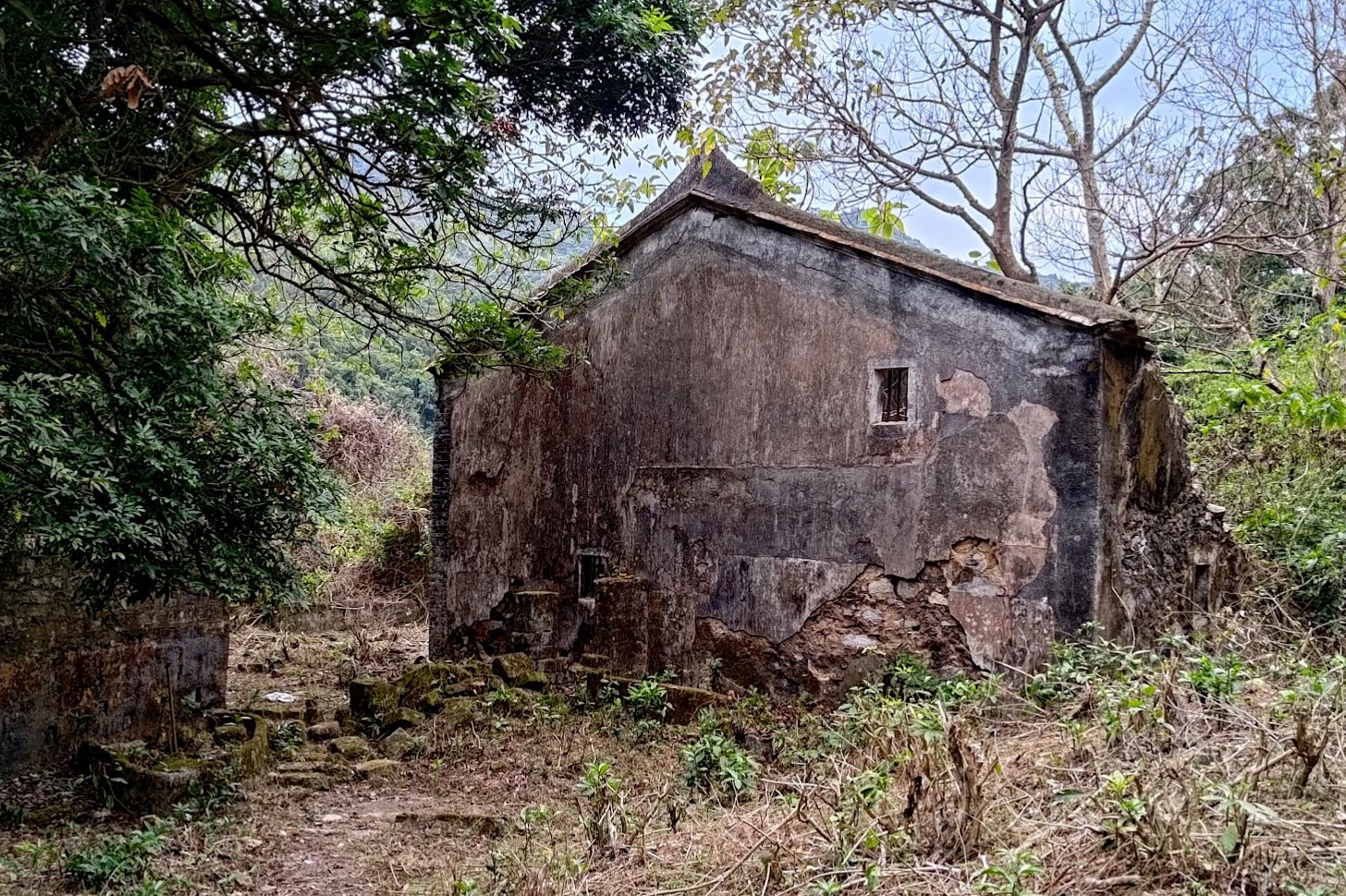
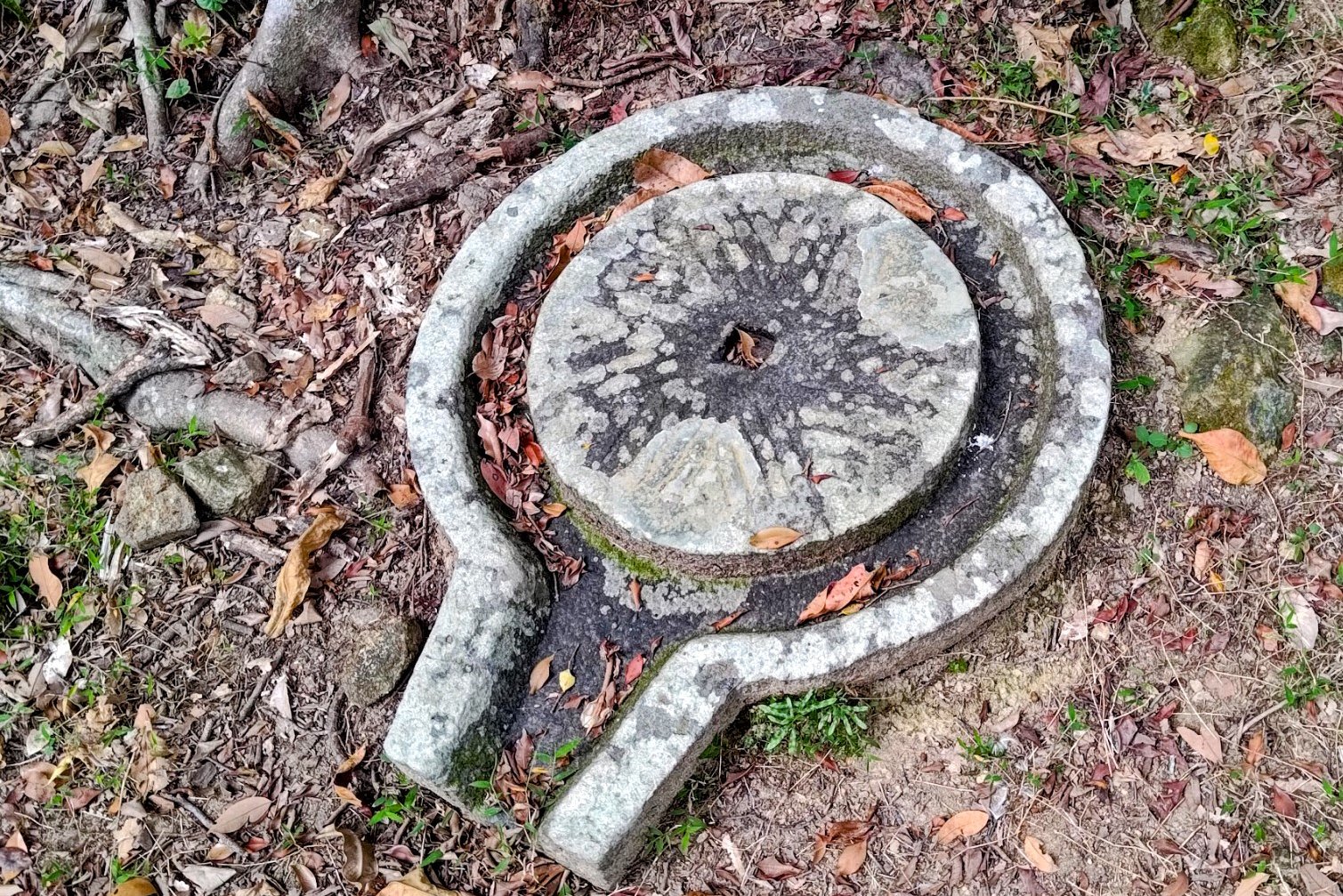
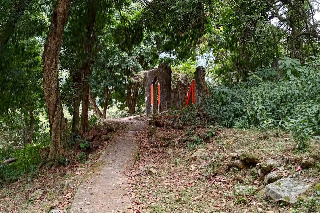
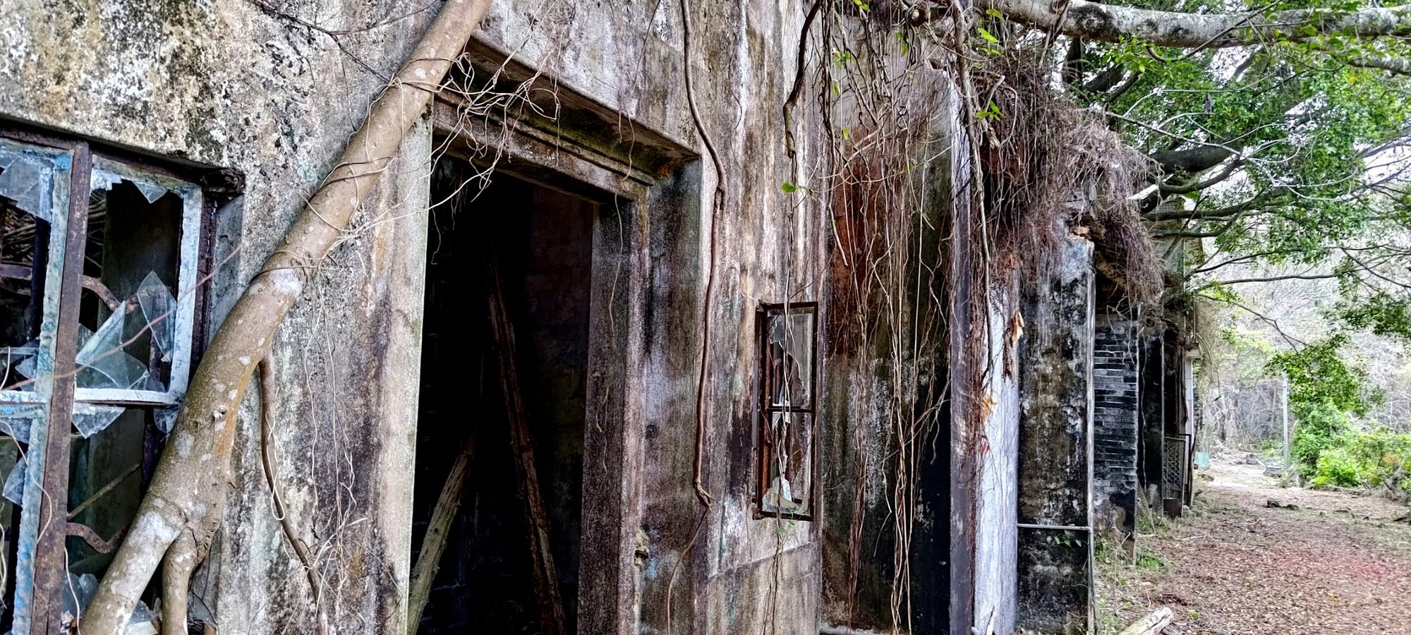
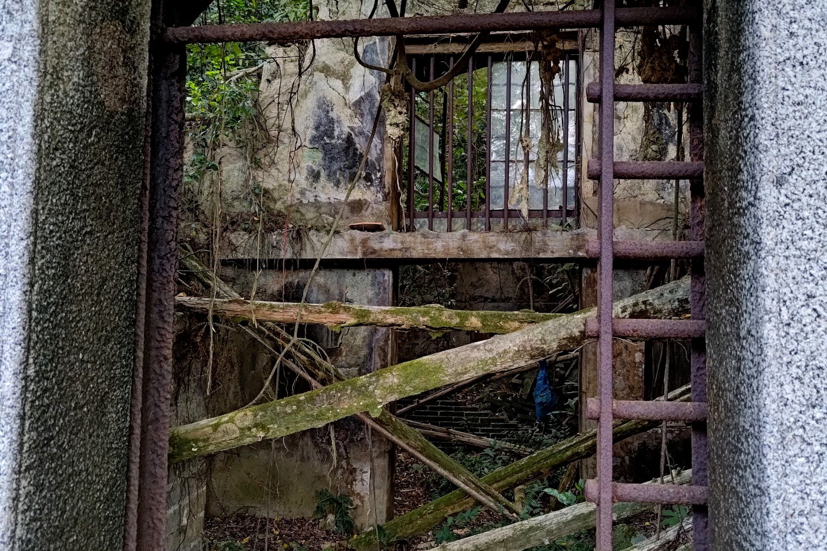
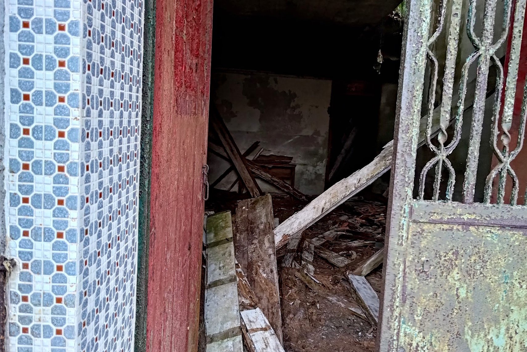
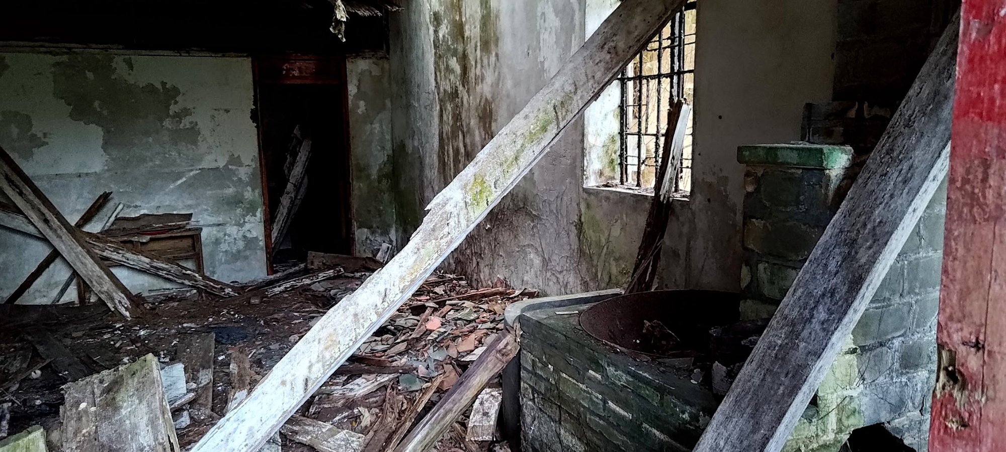
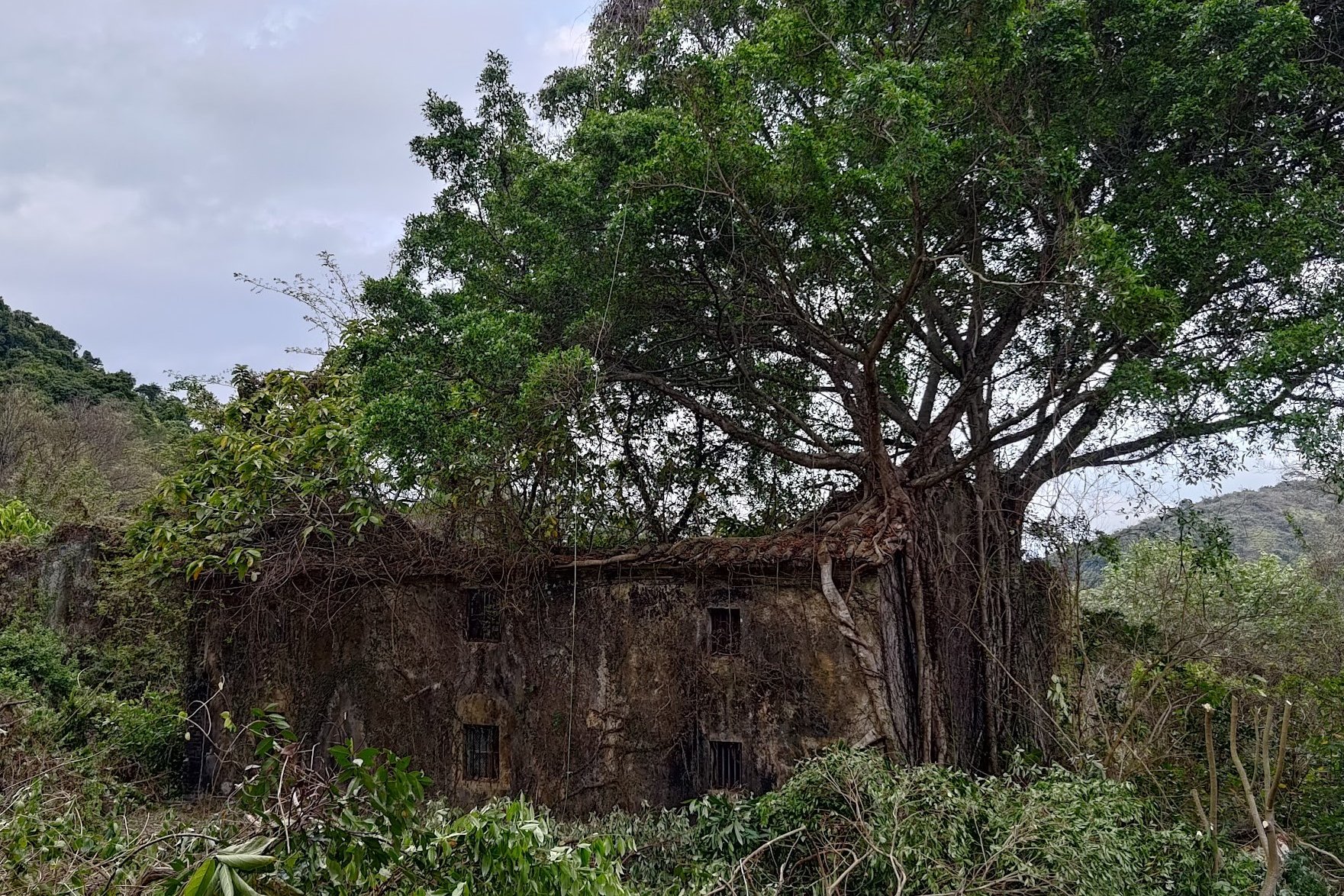
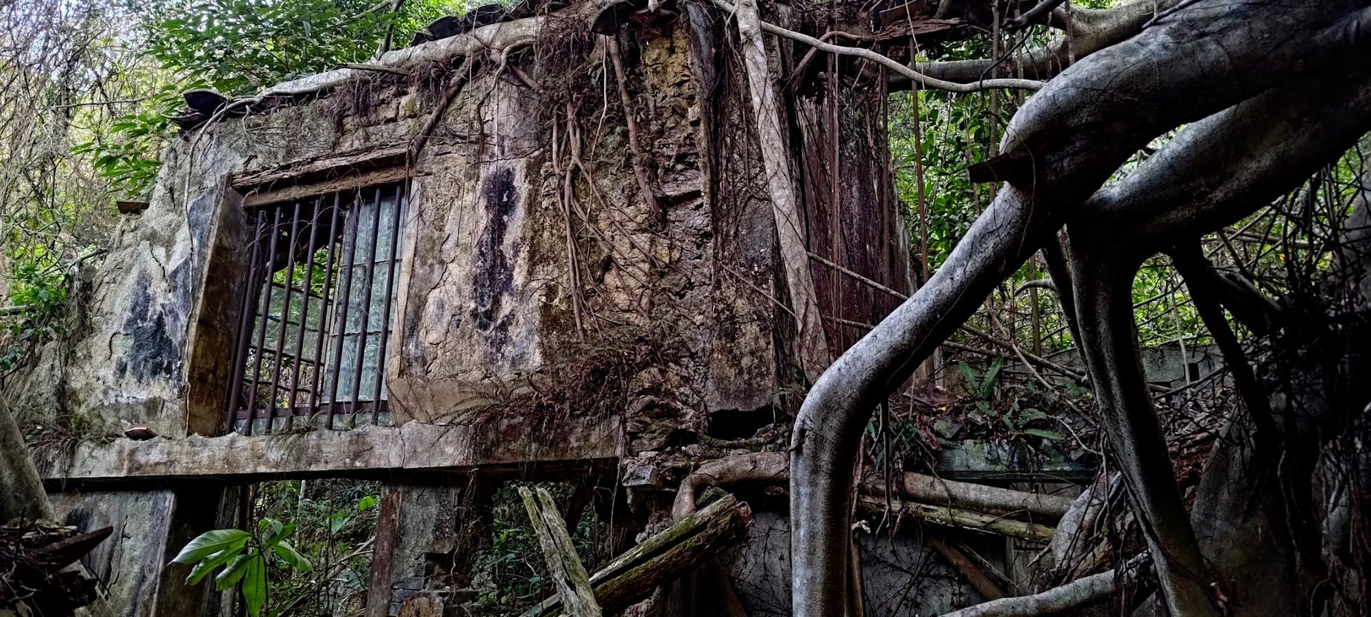
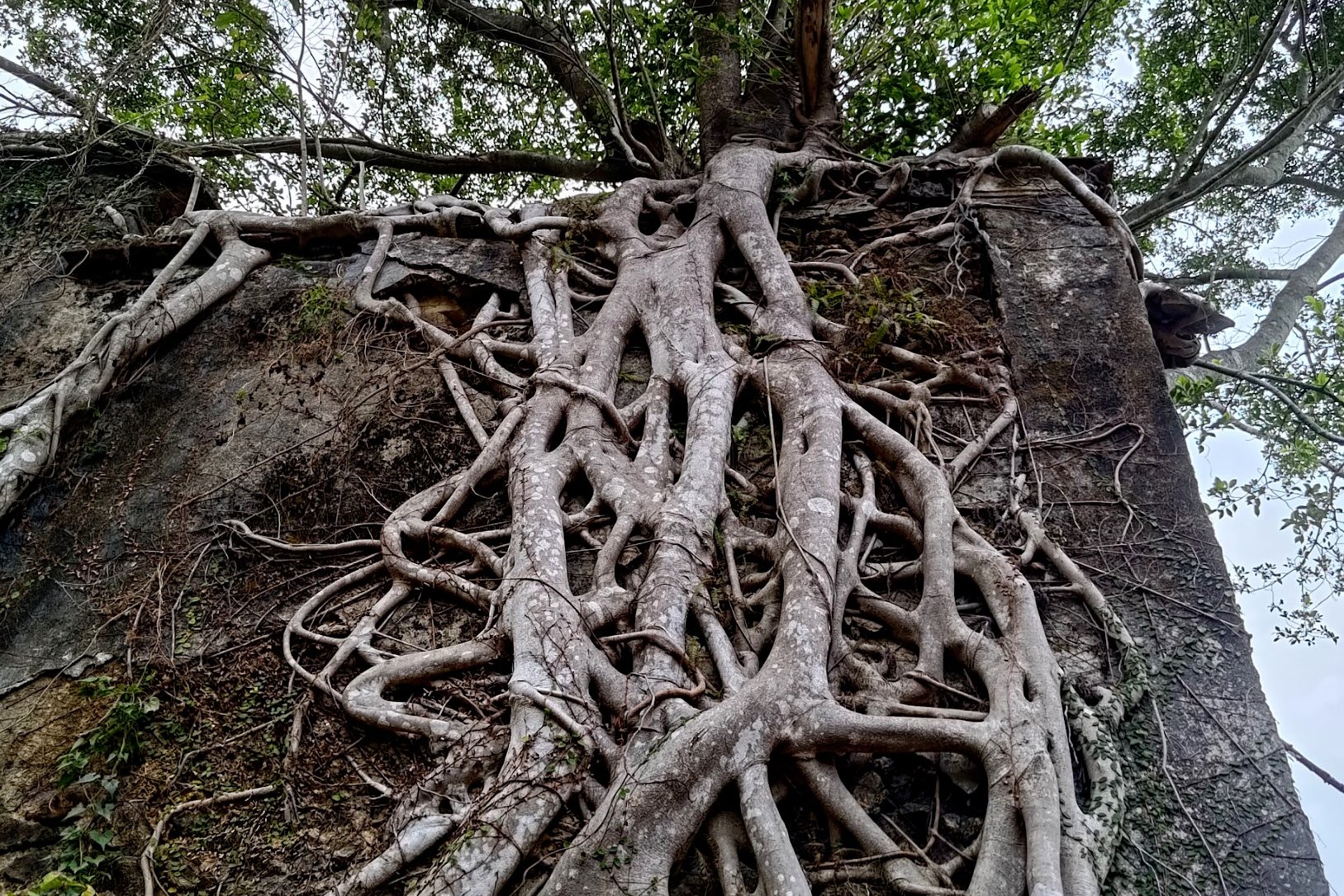
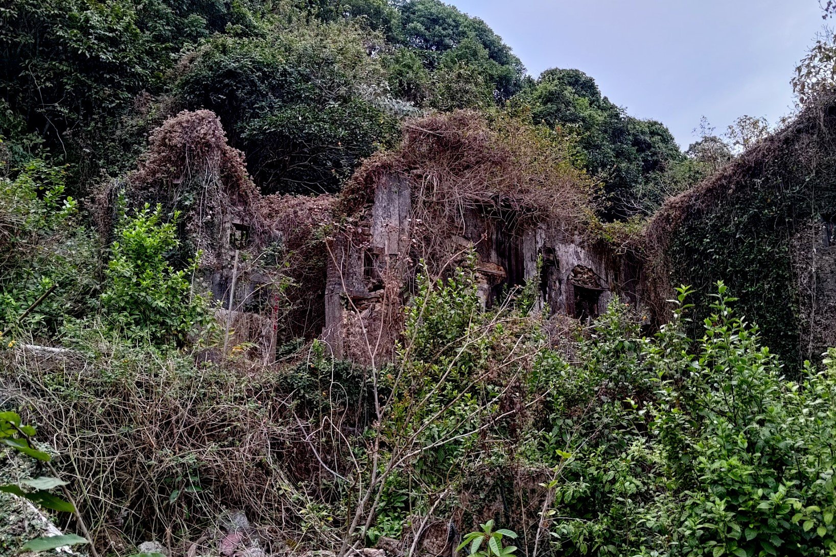
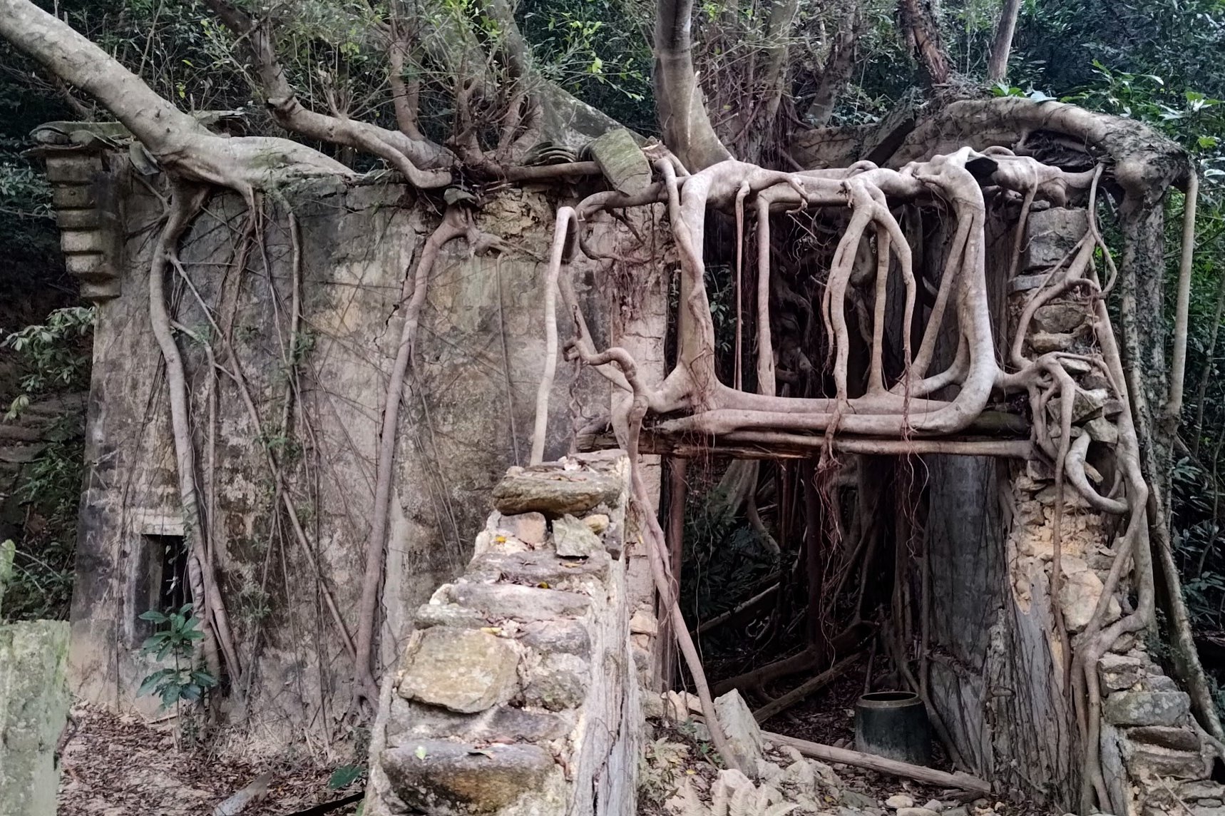
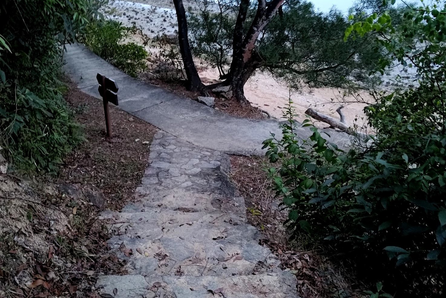
So Lo Pun
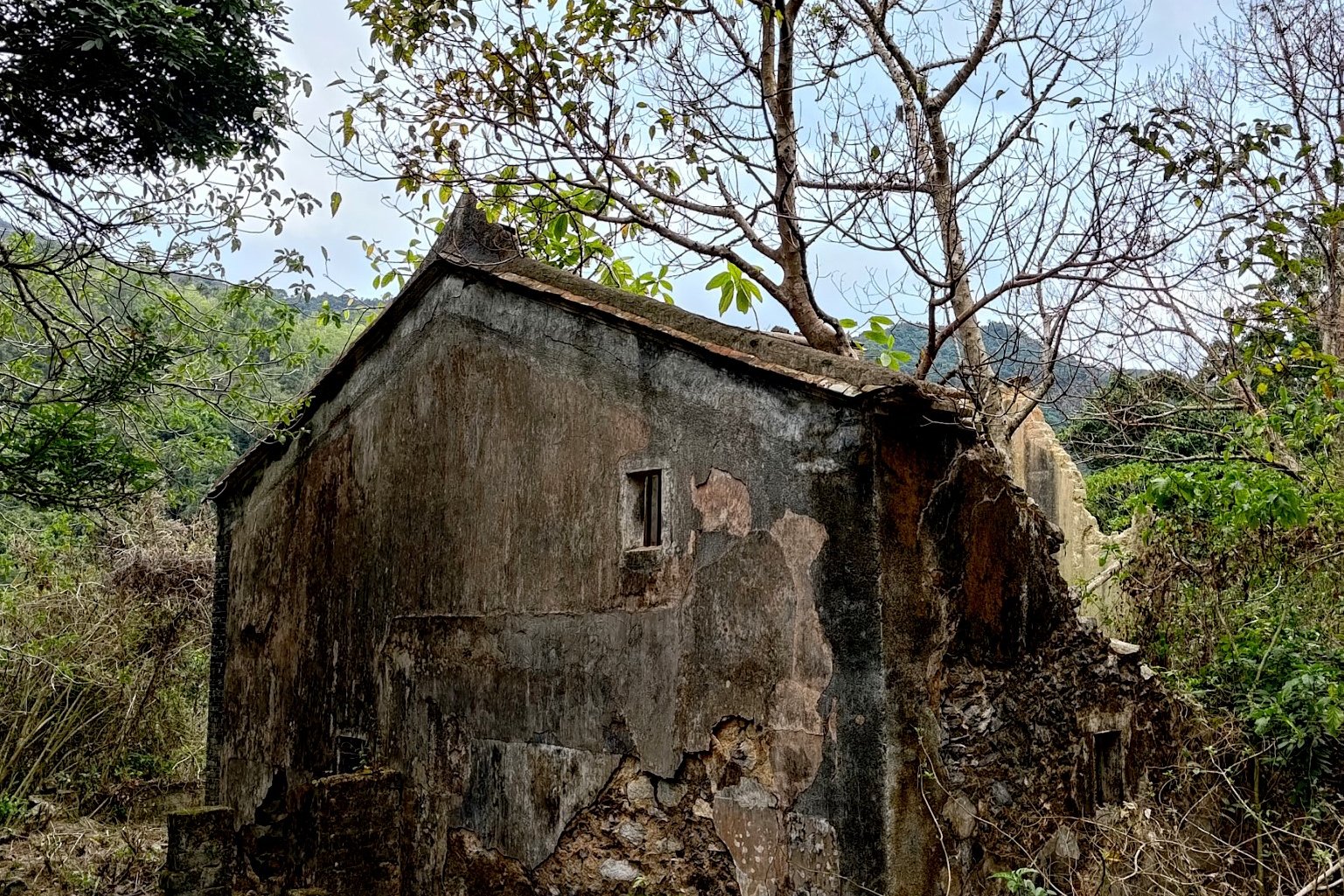
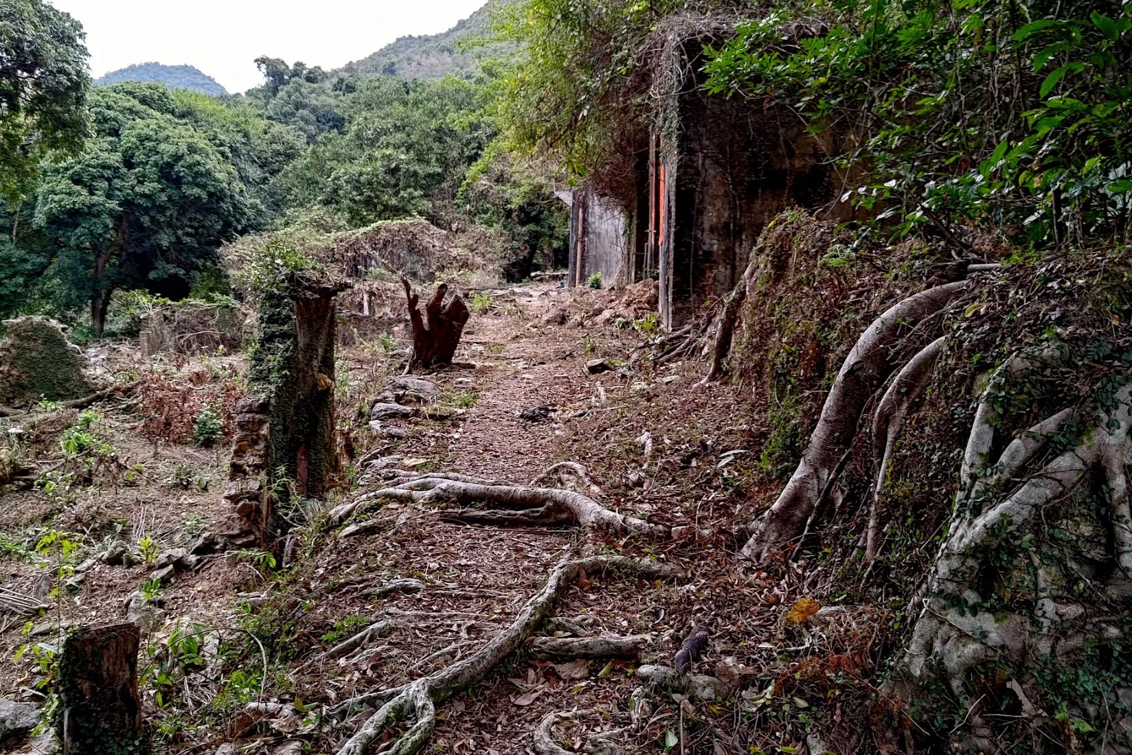
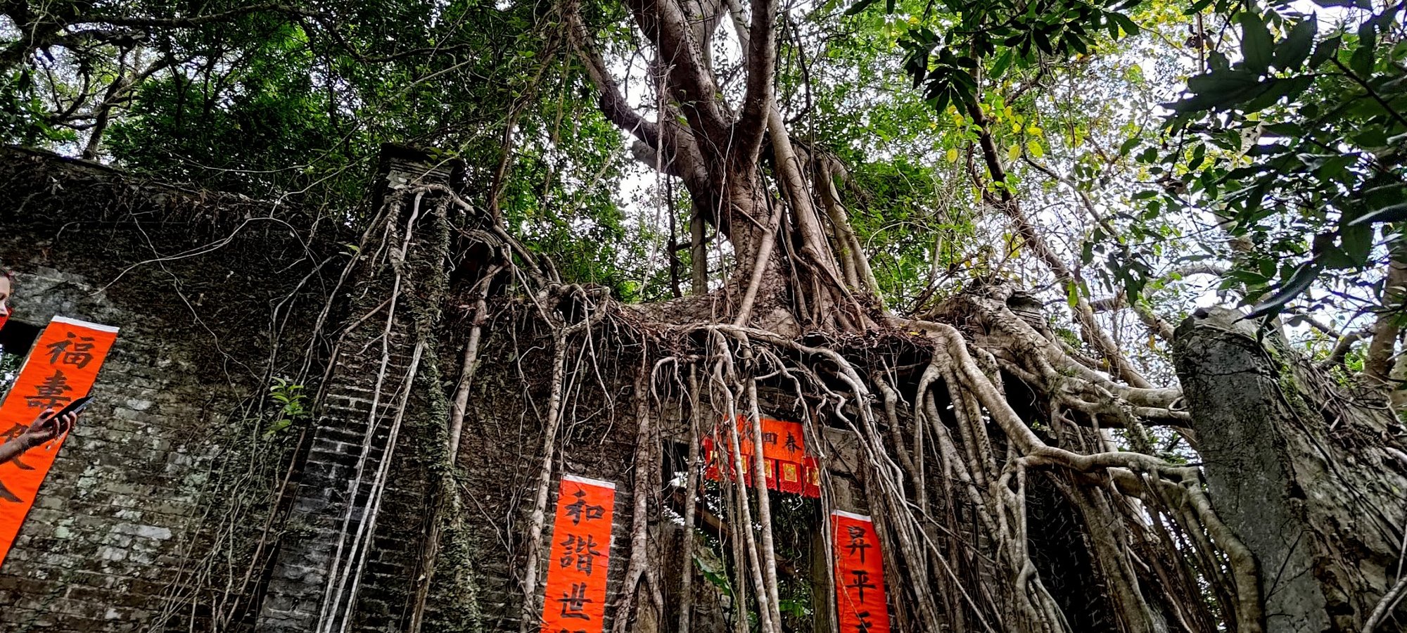
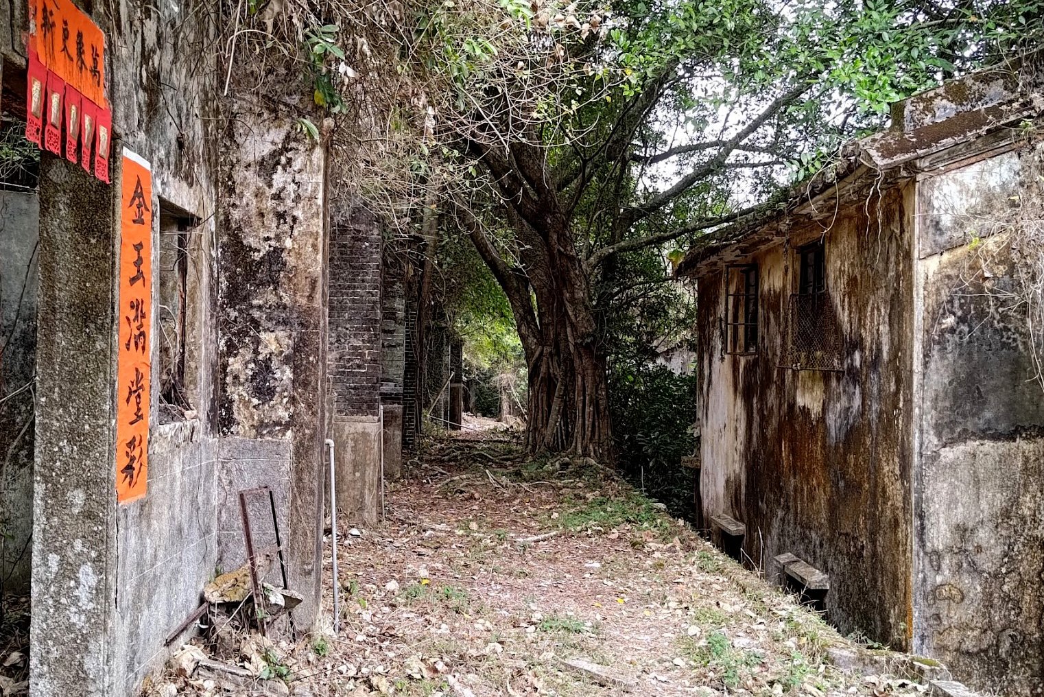
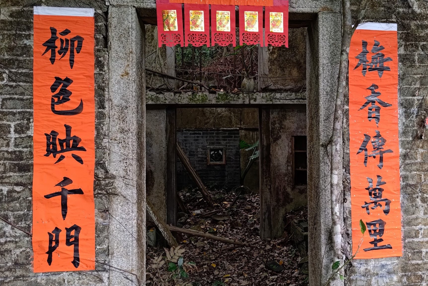
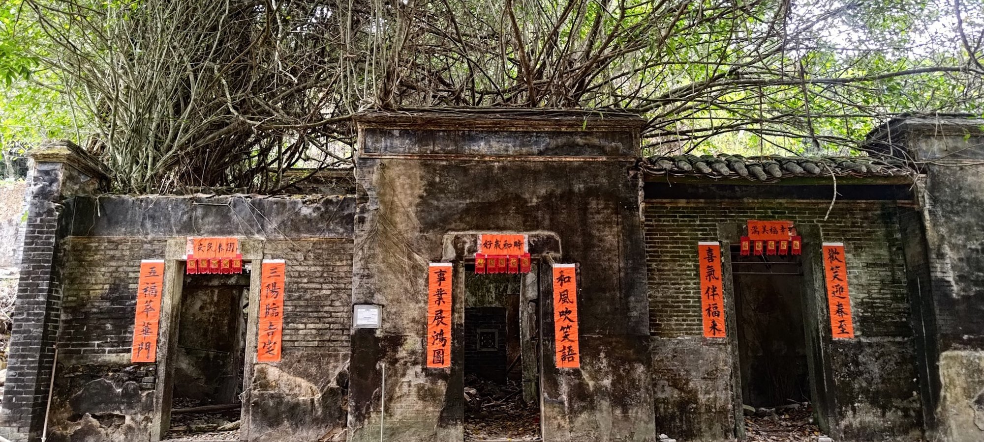
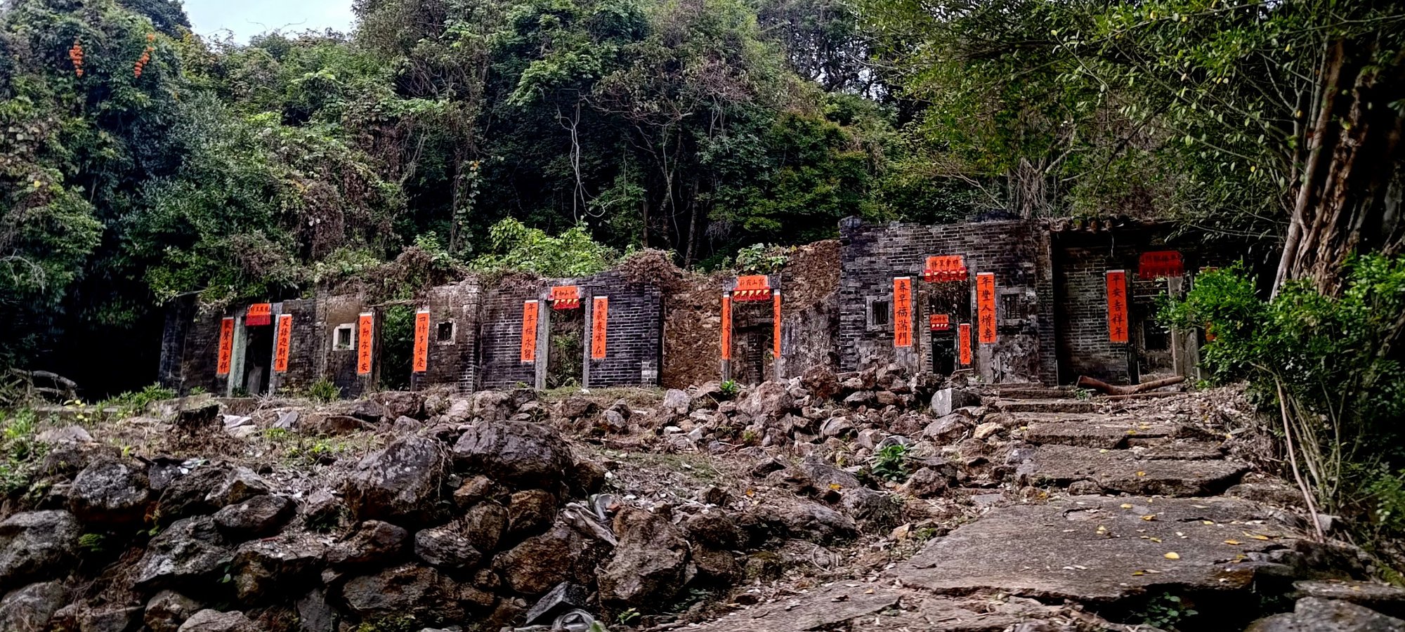

So Lo Pun was indeed quite creepy to visit. I found that my phone's camera feature froze up a few times and refused to work without a restart. I chalk this down to my phone being a bit old, but you can decide if it was something more supernatural at play.
The village was founded in 872AD by the Wong Family. So Lo Pun was part of an alliance of seven other villages in the area, who used to trade with one another. However, as society modernized, most residents left for a more convenient city life. By the 1980s, it was pretty much completely abandoned.
Urban legends tell of compasses stopping in the area, of a large portion of villagers dying on a bot trip to a wedding banquet and of paranormal encounters when hiking in the dark. Personally, I wouldn't really recommend coming here super late unless you're in a group and are seasoned with nighttime hiking.
Once you're done exploring, return to the base of the village and continue forth.
Getting to Yung Shue Au

This portion of the hike took about 25 minutes.
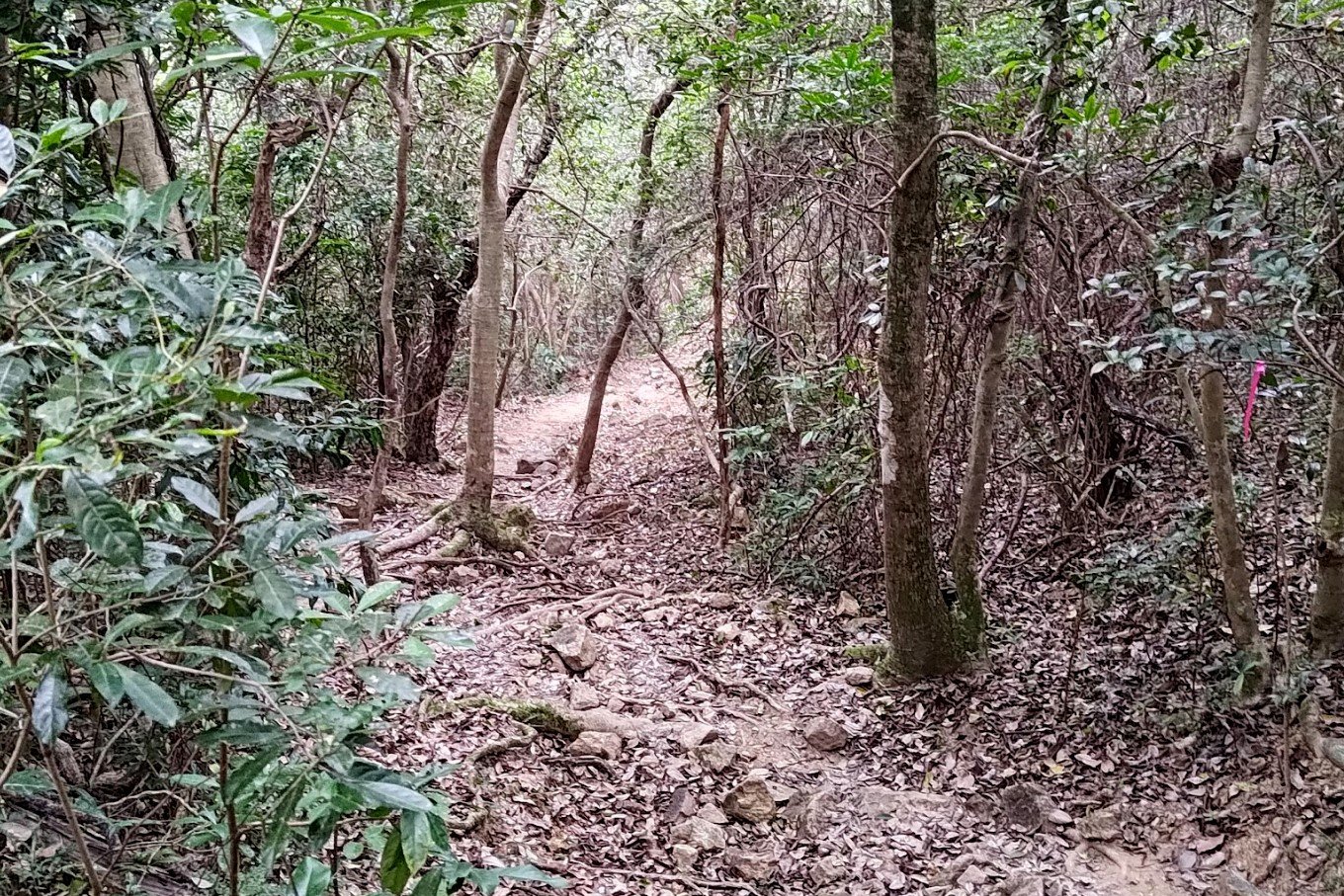
As long as you don't miss the sign pointing to Yung Shue Au just after leaving So Lo Pun, you'll be fine. That being said, you've got a bit more climbing to do, so expect to do a bit of cardio before descending and arriving at Yung Shue Au.
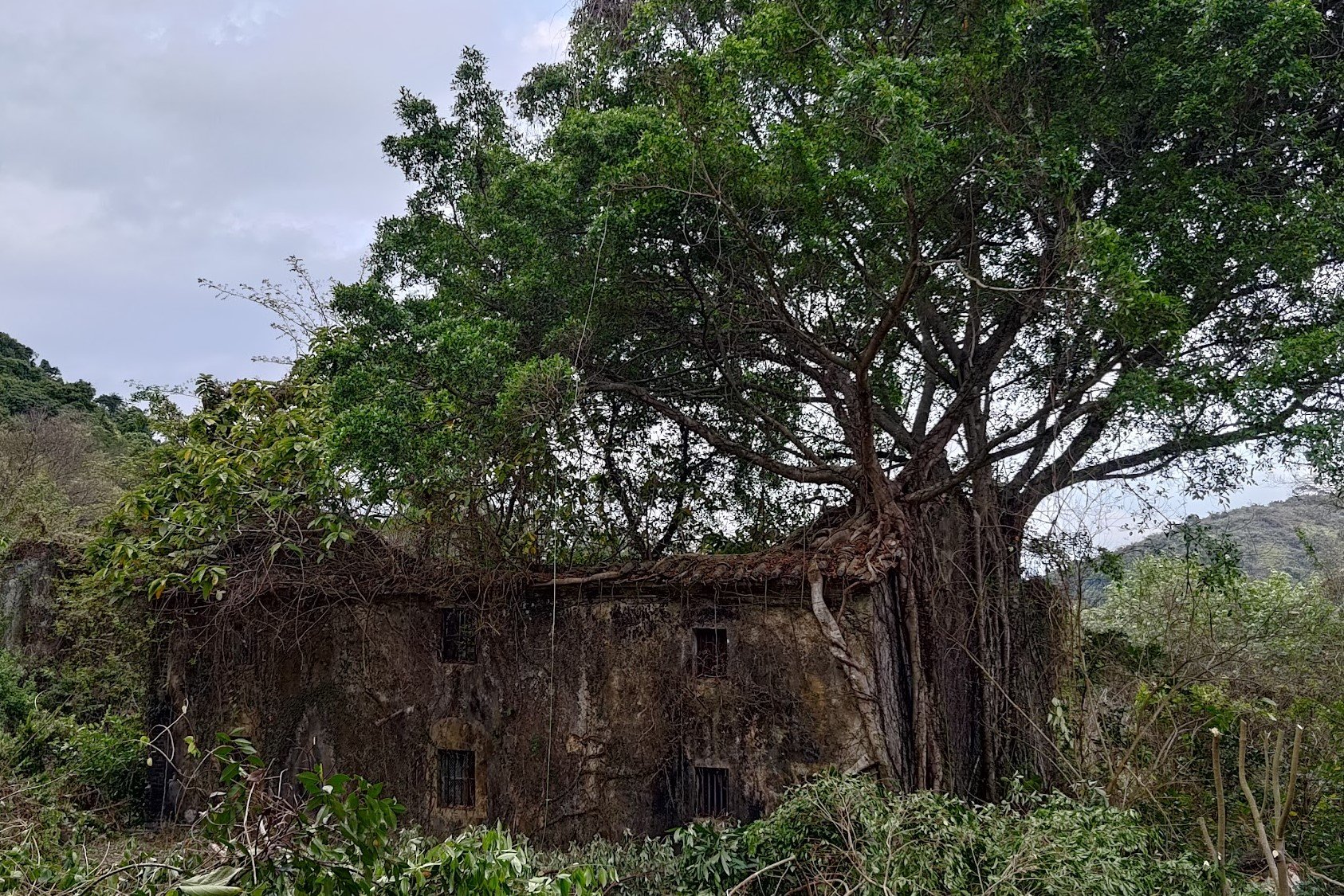
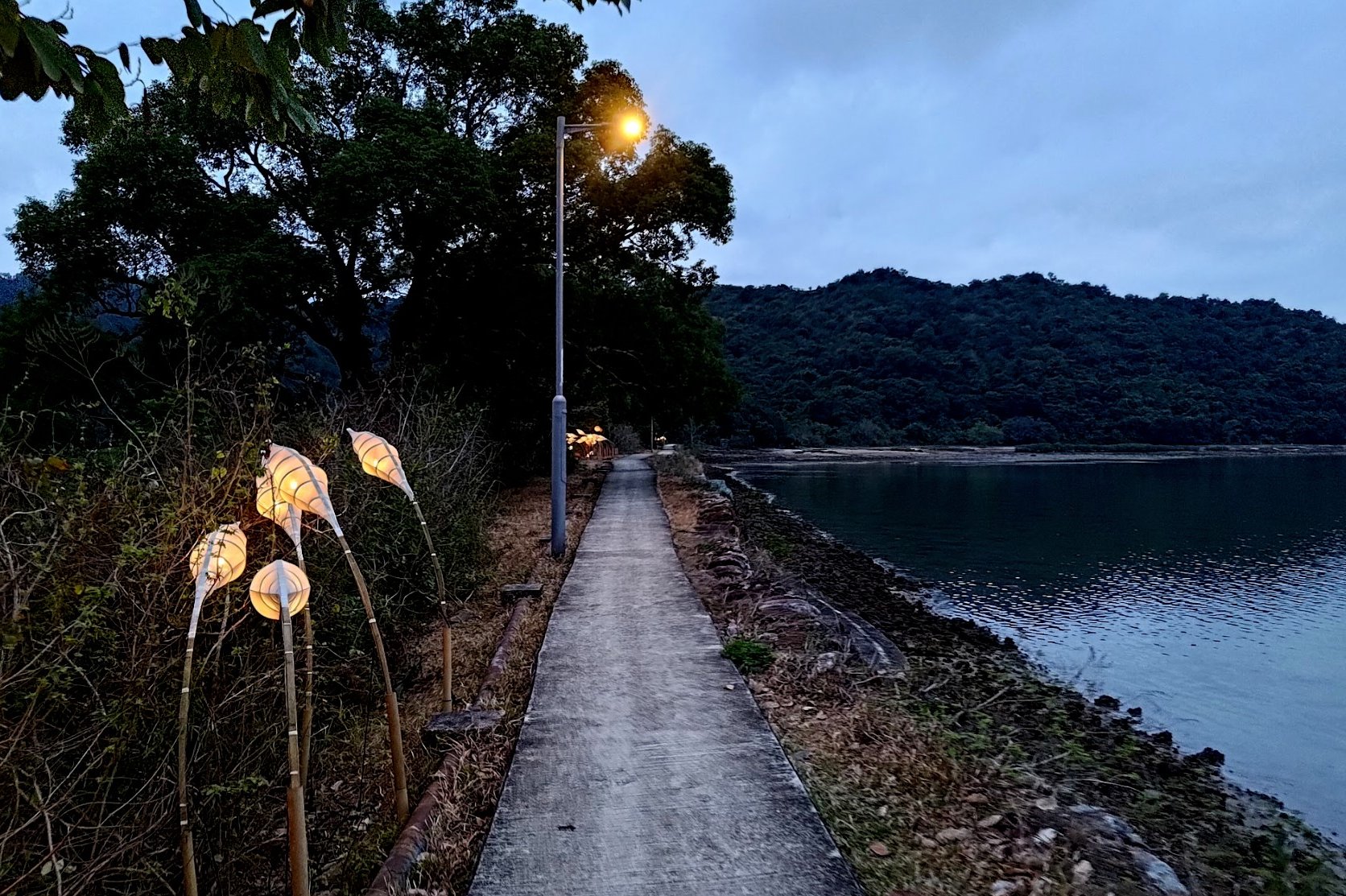
Yung Shue Au


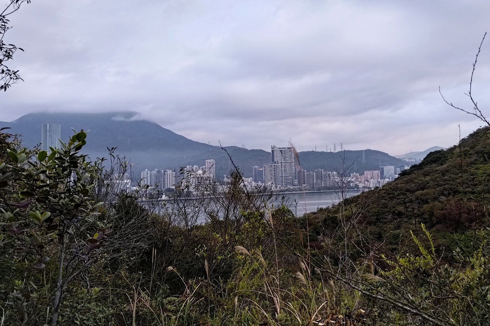
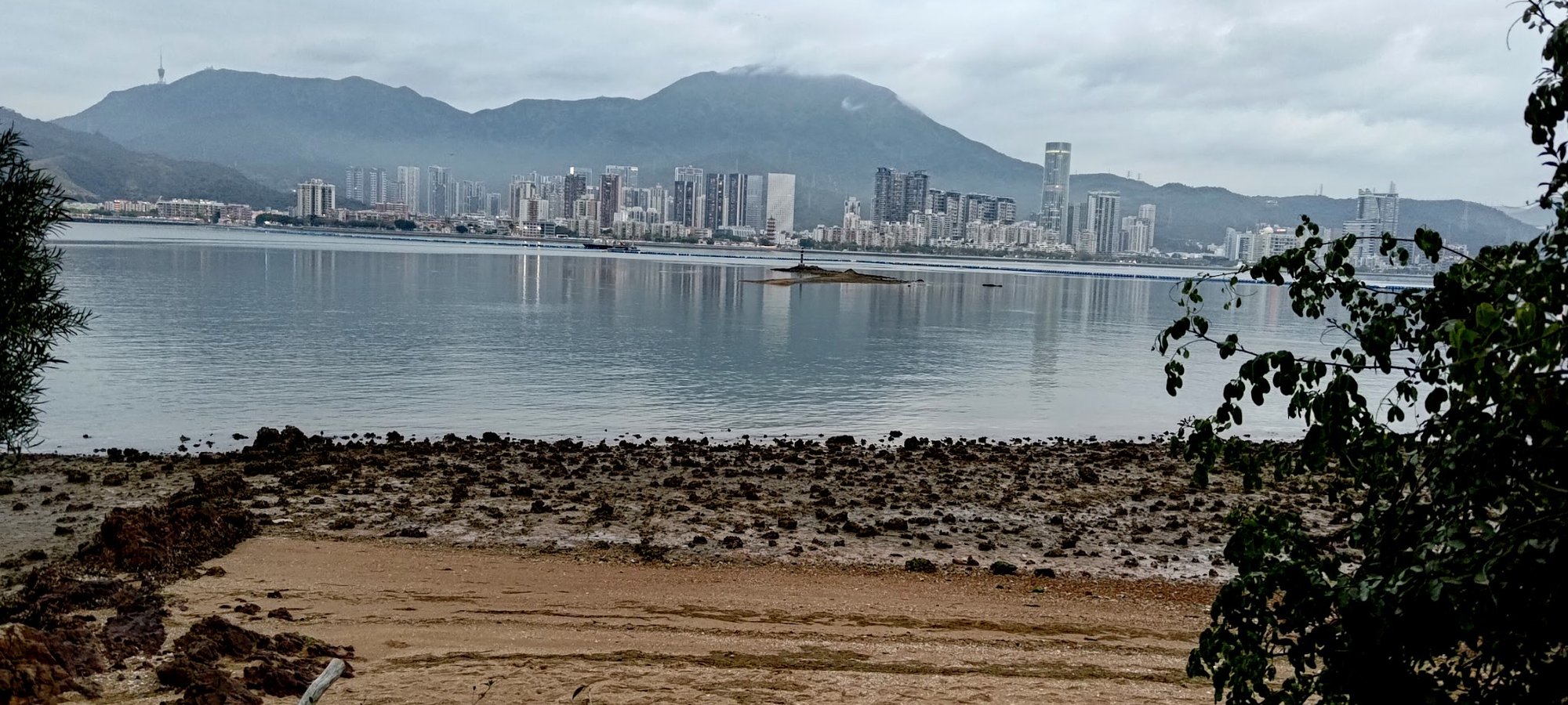
Yung Shue Au has a history of over 350 years. It was a self-sustaining coastal village that eventually followed the same fate as So Lo Pun. Inhabitants chose to leave for the conveniences of modern city life and the village was left to become abandoned.
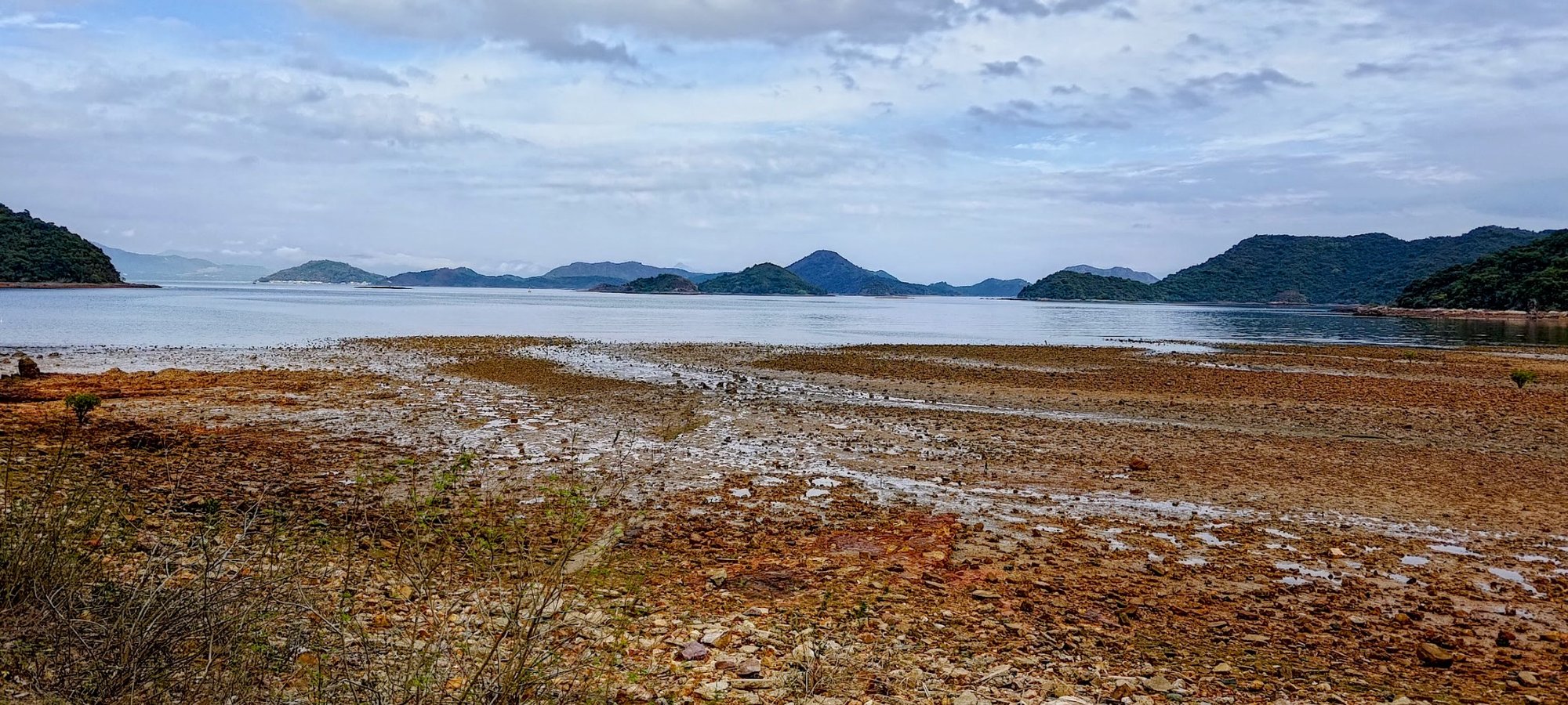
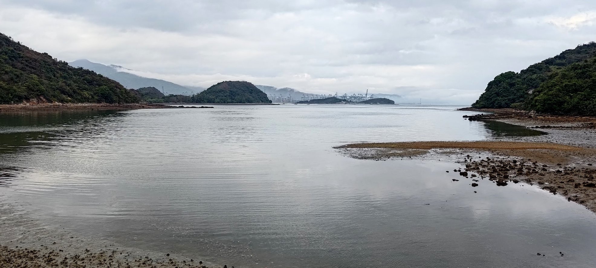
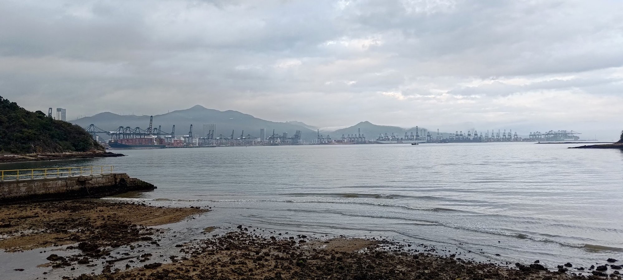
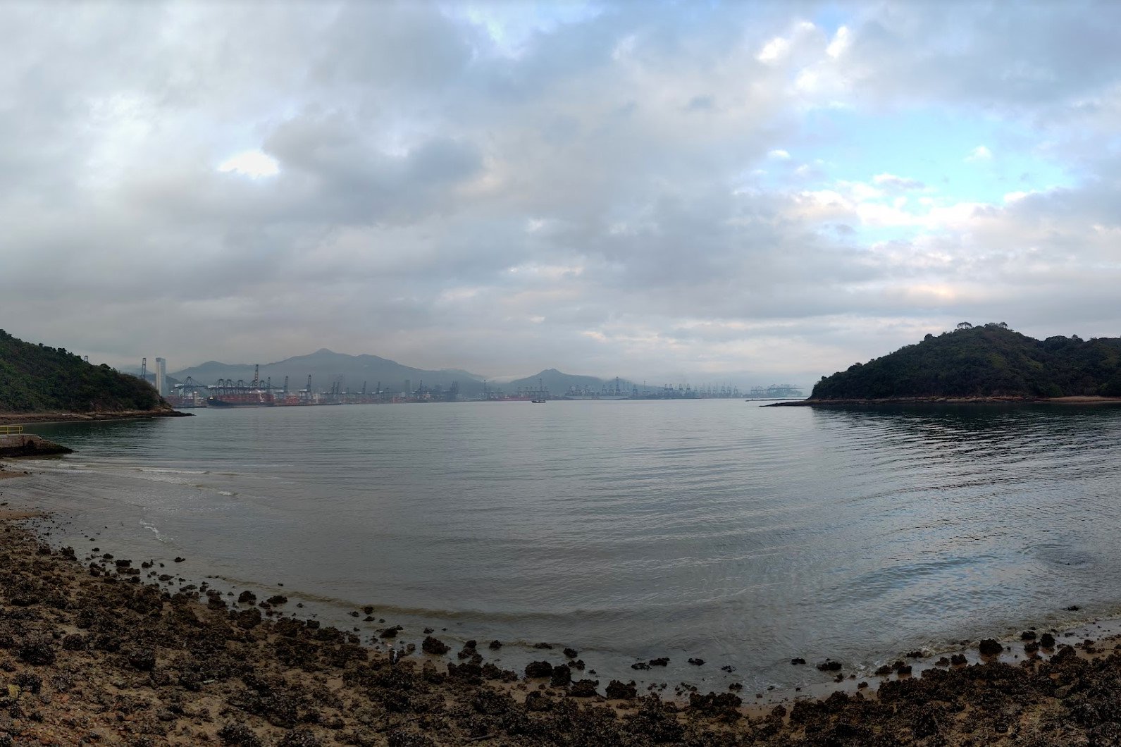
In the 1980s, the British military set up an outpost in Yung Shue Au that was used to protect against illegal immigrants who would swim over to Hong Kong from mainland China via Starling Inlet, which you can see in the pictures above.
Anyway, when you're done exploring the village, make sure to follow the sign pointing to Luk Keng.
Getting to Kuk Po


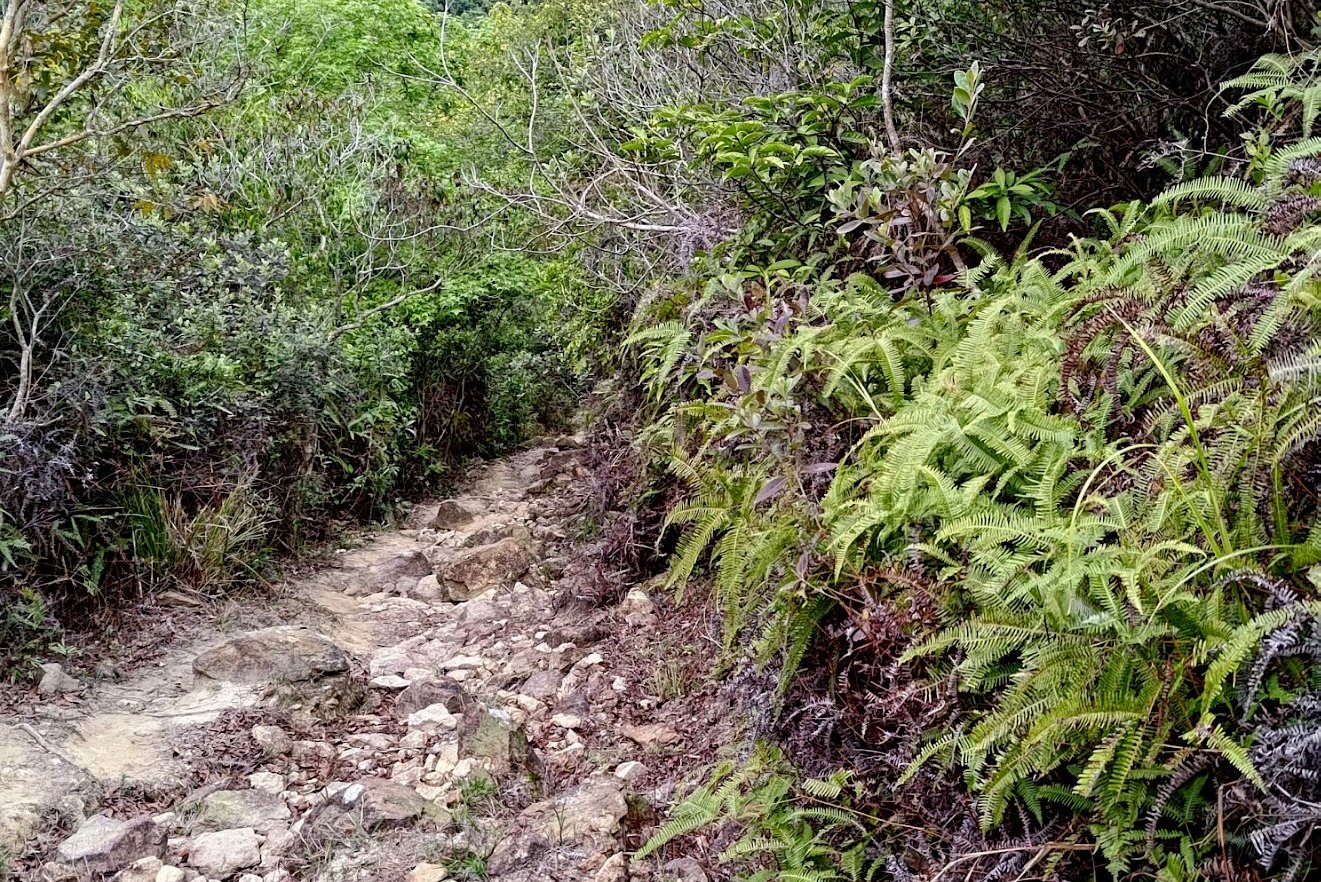
Getting to Kuk Po from Yung Shue Au takes roughly 30 minutes. Apart from an initial incline, most of the way was flat.
You'll want to follow all the signs along the way that point to Luk Keng since that comes after Kuk Po. Enjoy views of Shenzhen across Starling Inlet while you complete this section.
At the end, you'll want to follow the sign to Luk Keng and go past the beach and pier. When you arrive at Kuk Po Village, you can buy drinks and food if you need it.
When you're ready to continue, look for the next Luk Keng sign and follow it.
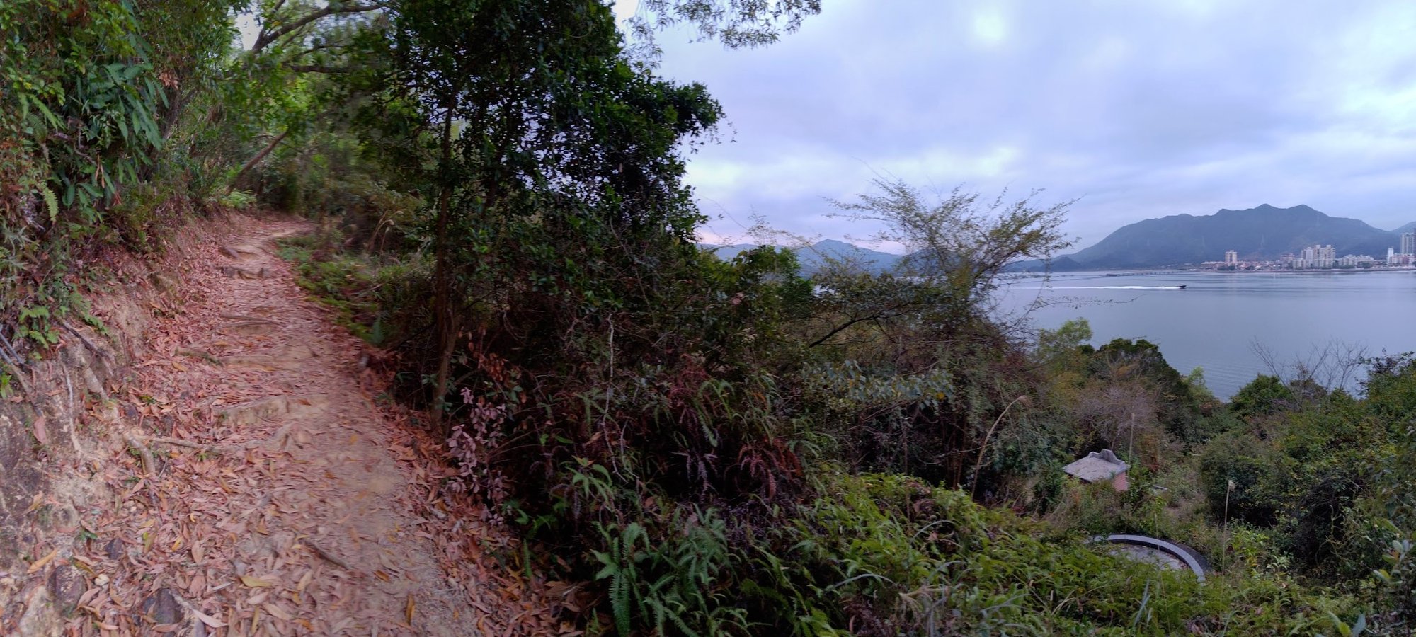
Follow the Coastline for 40 Minutes


The final concrete coastal trail takes you across beaches, mangroves and even grassland as you progress closer to the end of the hike.
You'll have Shenzhen on your right just a stone's throw away across Starling Inlet.
You'll come across Fung Hang Village about 20 minutes into this section. Go past it, continuing along the coastal path.
About 2 minutes later, you'll see a sign pointing you toward 'Luk Keng'.
Follow the sign as it takes you inland and up a set of stairs and then makes you descend to Kai Kuk Shue Ha village.
Getting to the Bus Stop


After descending, you'll soon arrive at Kai Kuk Shue Ha village, which is marked by a golden lion chilling on the gate of a village house.
Walk past the gate and at the fork ahead, follow the sign left to go around the village and arrive at a road.
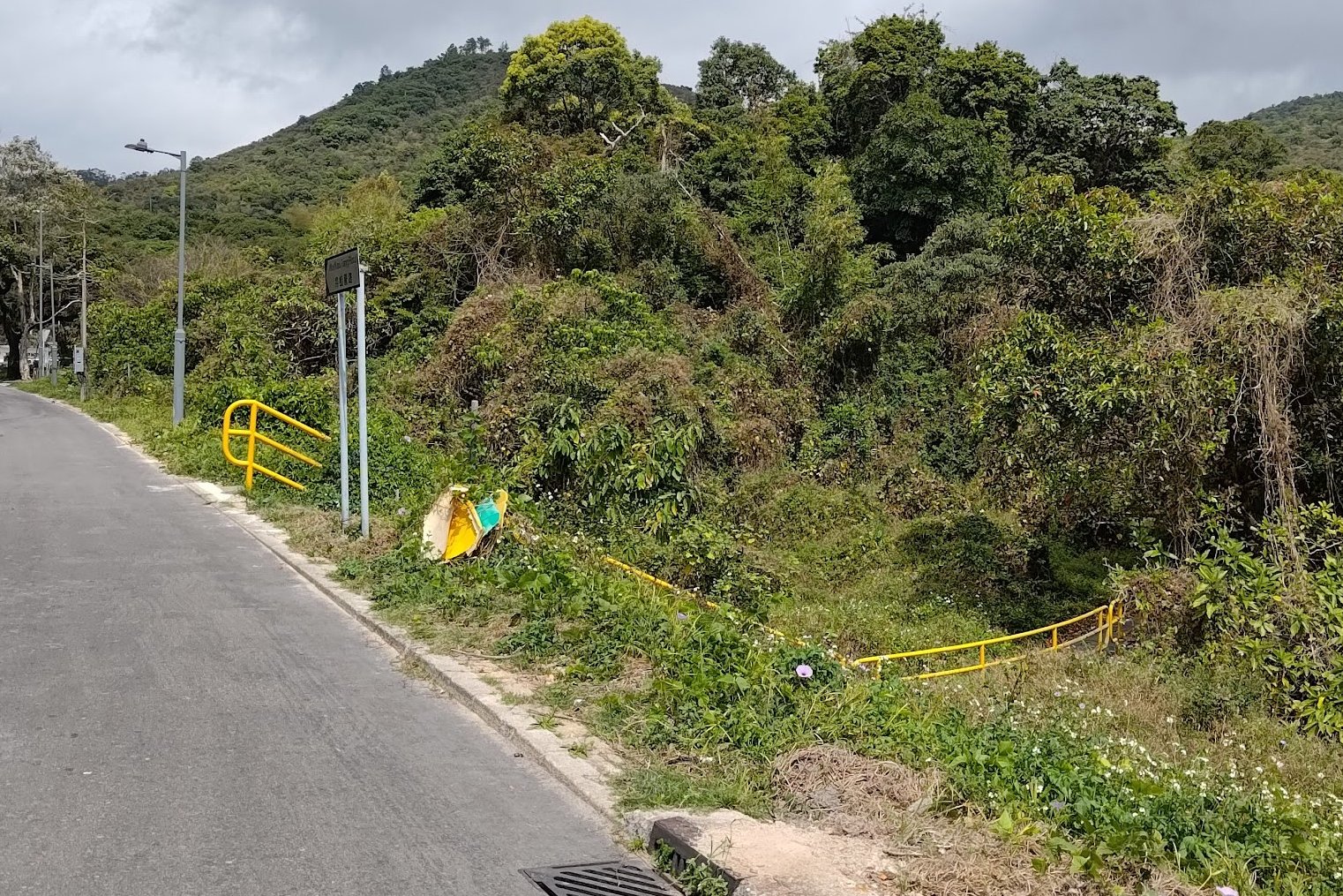
Follow the village road until it intersects with Bride's Pool Road.
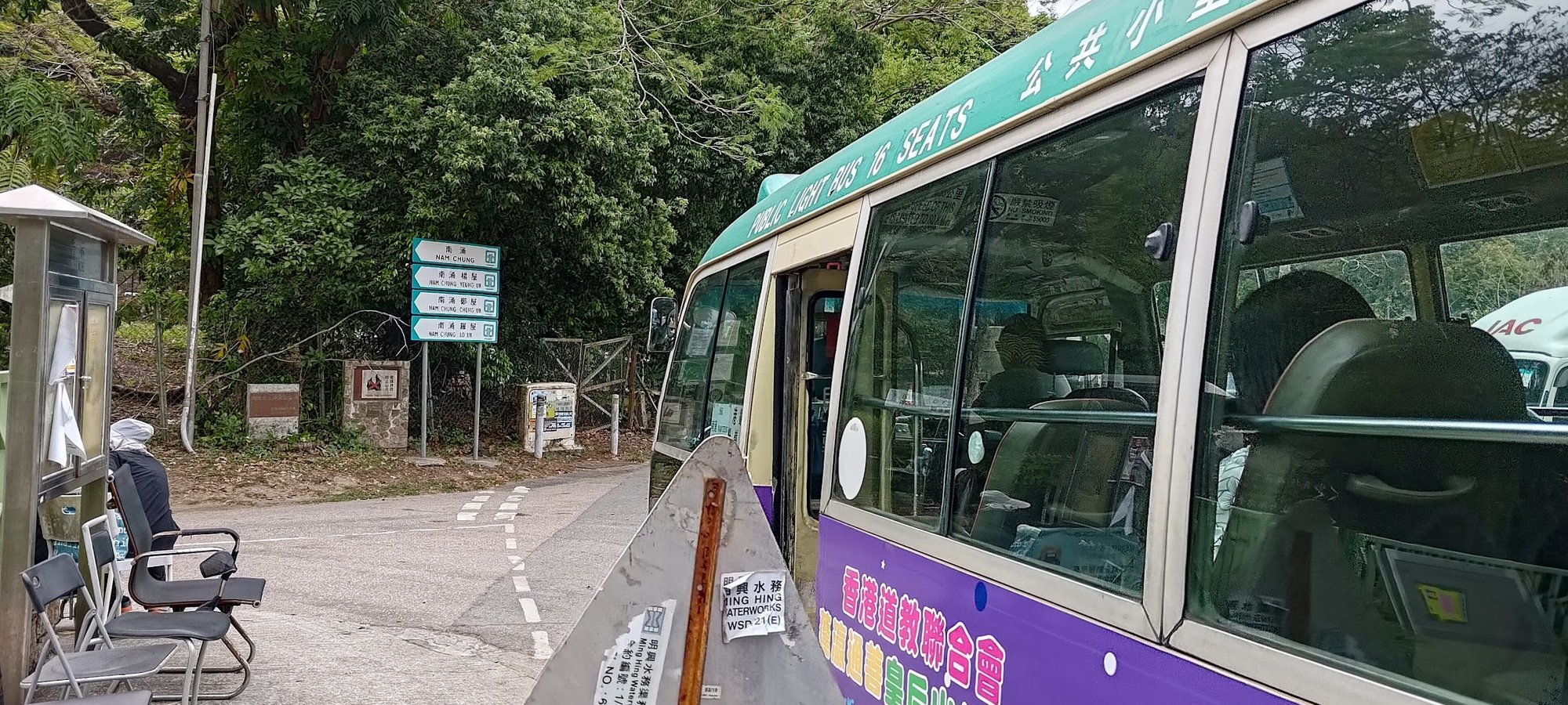
Turn right and walk for 5 minutes until you go past the car park and see the 56K green minibus stop.
*If you're doing this hike on a weekday, you may need to walk about 15-minutes along Bride's Pool Road as it merges into Luk Keng Road. I got the bus just by the public toilet in Nam Chung Village:
Getting Back to the City
Take the 56K green minibus back to Fanling MTR Station (last stop).
The minibus runs every 30 minutes on weekdays and is more frequent on weekends. It's also a bus route that serves the folks living and working in the nearby village, so it's possible they'll get priority over you to board the bus.
From Fanling MTR station, you can take the train home, or grab one of the many buses that run from near the station.

