The 5 Best Easy Hikes in Hong Kong
Contents
- 1. Kai Shan Hike
- 2. Tai Lam Chung Reservoir (Thousand Island) Hike
- 3. Upper Shing Mun Reservoir (Pineapple Dam) Hike
- 4. Cape D’Aguilar
- 5. Dragon’s Back Hike
This list is obviously heavily influenced by my personal preference. I rank a great easy hike by focusing on three main categories:
- How epic and unique the scenery is
- How likely you are to have the trail to yourself
- How easy the hike actually is.
With that being said, these 5 hikes are the ones I believe most people can tackle while still witnessing some of the city’s most incredible sights at the same time! If you've already done these, use the website’s search function and search for other easy hikes you might enjoy.
To search for other easy hikes on the website if you’re using a smartphone, tap on the magnifying glass on the top right and select the “Easy” option on the “Choose Your Hike Difficulty” filter. If you’re on a laptop or tablet, the difficulty filter will be visible at the top of the webpage.
The following hikes are not listed in any particular order.
1. Kai Shan Hike

- District: New Territories
- Duration: 1 hour and 15 minutes
- Distance: 3.6km
- Highest Elevation: 121 meters
- Difficulty: 1/5
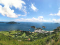
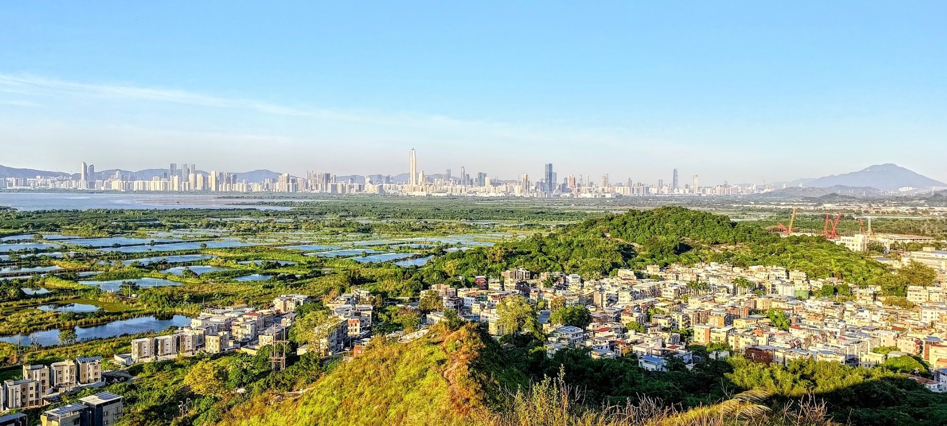
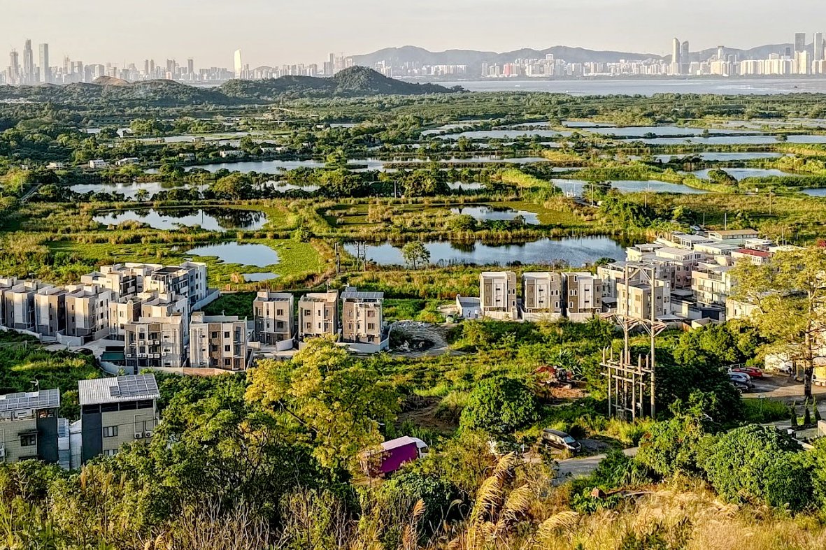
Kai Shan is the shortest hike on the list and is one of the most interesting trails you can do in Hong Kong. Located just beside Tin Shui Wai MTR Station, it takes you up a series of small peaks that are used by local villagers more than curious hikers.
The highlight of the hike comes just after the final ascent, where you’ll have a bird’s eye view of the city’s fish farms, wetlands, villages, and the Shenzhen skyline across the river border that separates Hong Kong and mainland China.
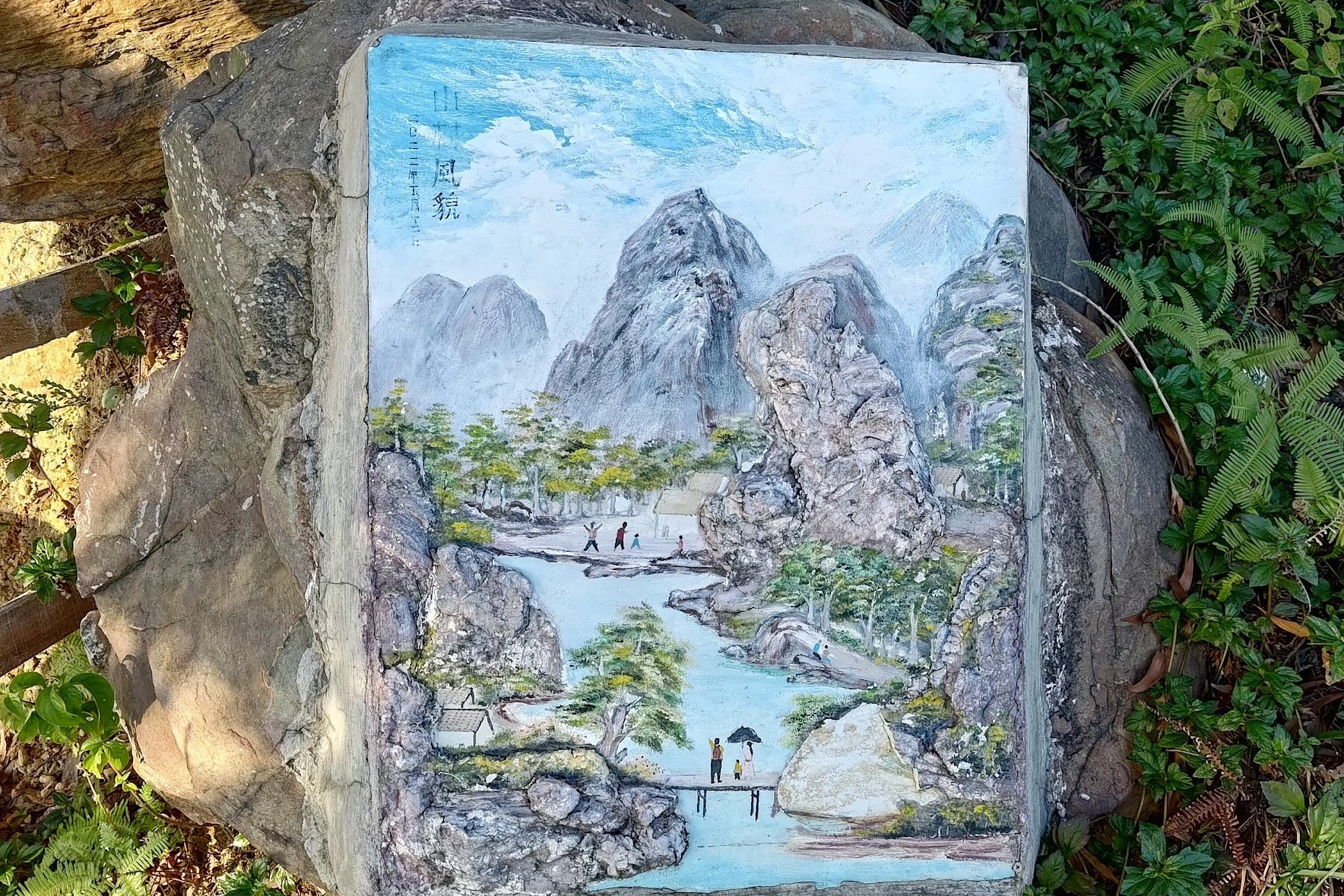
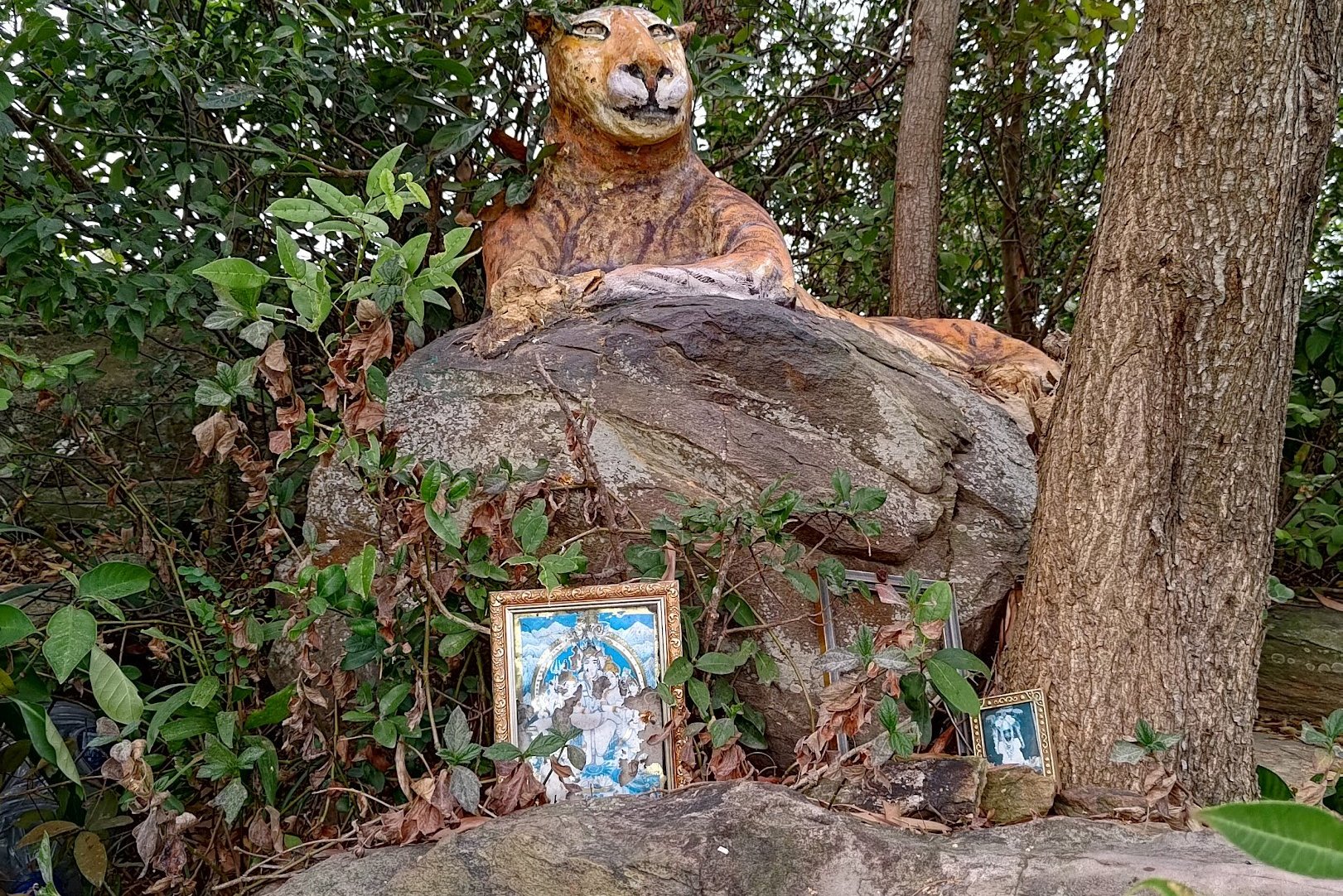
Oh, there are also cute rock paintings and a shrine dedicated to the Hindu god Shiva on the mountain.
*For directions, maps, detailed instructions and more, check out the full Kai Shan hike guide below.

2. Tai Lam Chung Reservoir (Thousand Island) Hike


- District: New Territories
- Duration: 3.5 hours (full route), 2.5 hours (short route)
- Distance: 11.9 km (full route), 8.7km (shorter route)
- Highest Elevation: roughly 200 meters
- Difficulty: 1.5/5
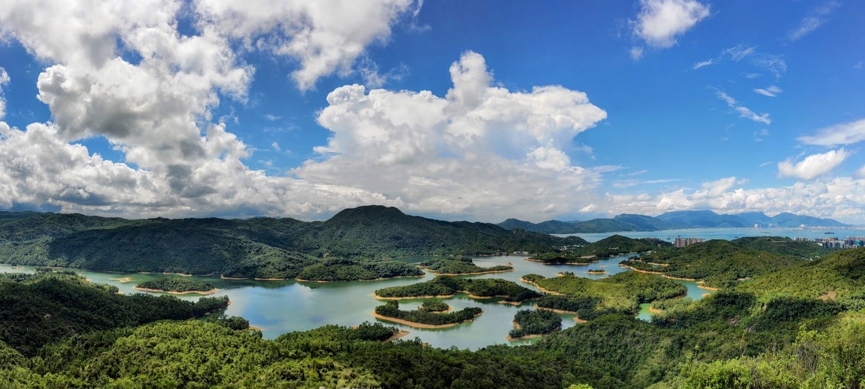
The Tai Lam Chung Reservoir hike has you skirting around the perimeter of Tai Lam Chung Reservoir in Tuen Mun. Much of the hike is on wonderful dirt trails by the water, which makes this a particularly tranquil and peaceful experience. There is perhaps one strenuous uphill section, but it’s not particularly difficult.
The main highlights include the vista of the islands in the reservoir, the red foliage of the maple trees in autumn, and the occasional temple or two along the way. Before the reservoir was built, there was a village where the islands in the reservoir are. Apparently, when the water level is low in the reservoir, you can see some remnants of the village. I have yet to see this, personally.
*For directions, maps, detailed instructions and more, check out the Tai Lam Chung Reservoir hike guide below.

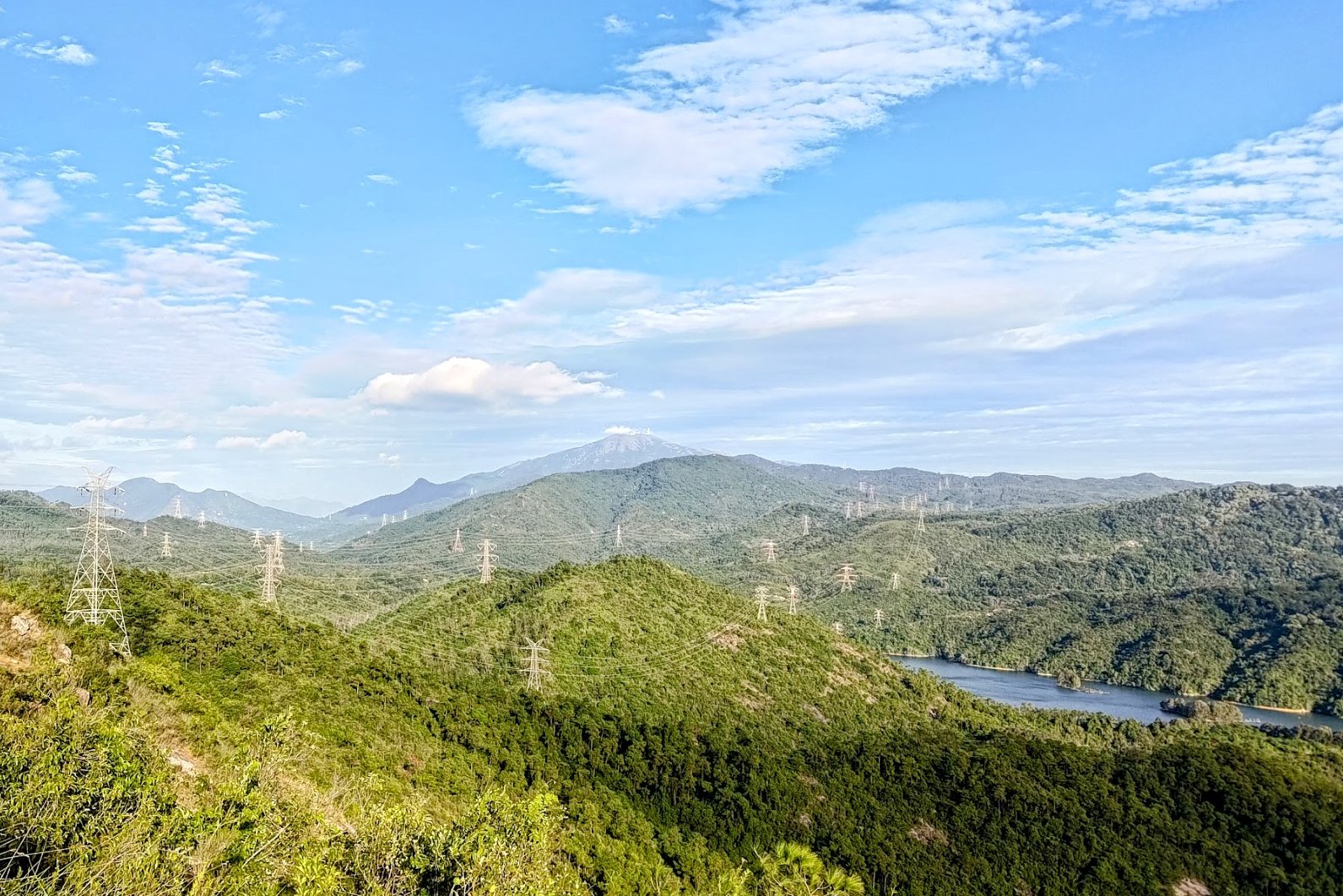
3. Upper Shing Mun Reservoir (Pineapple Dam) Hike
- District: New Territories
- Duration: 2.5 hours (with no breaks)
- Distance: 9km
- Highest Elevation: 250ish meters
- Difficulty: 1.5/5
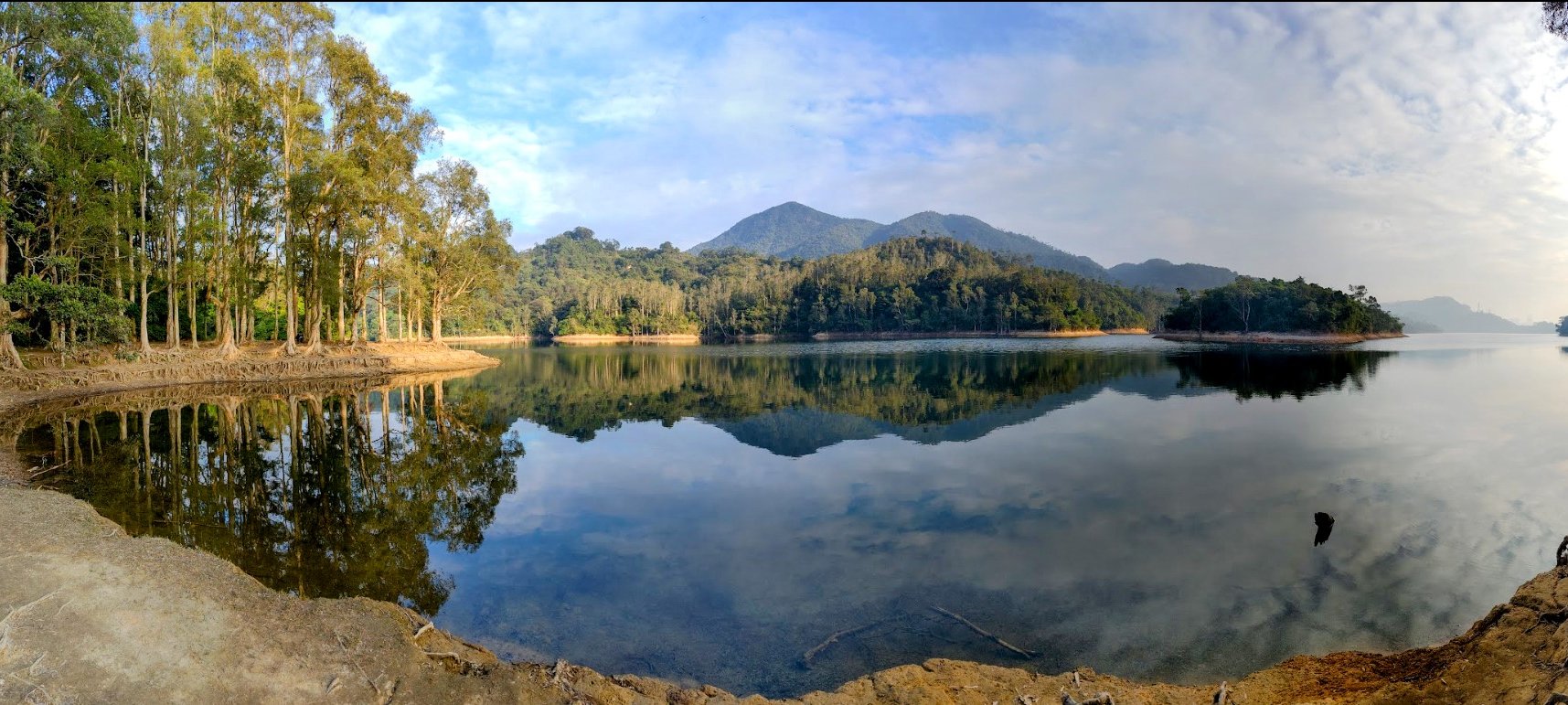
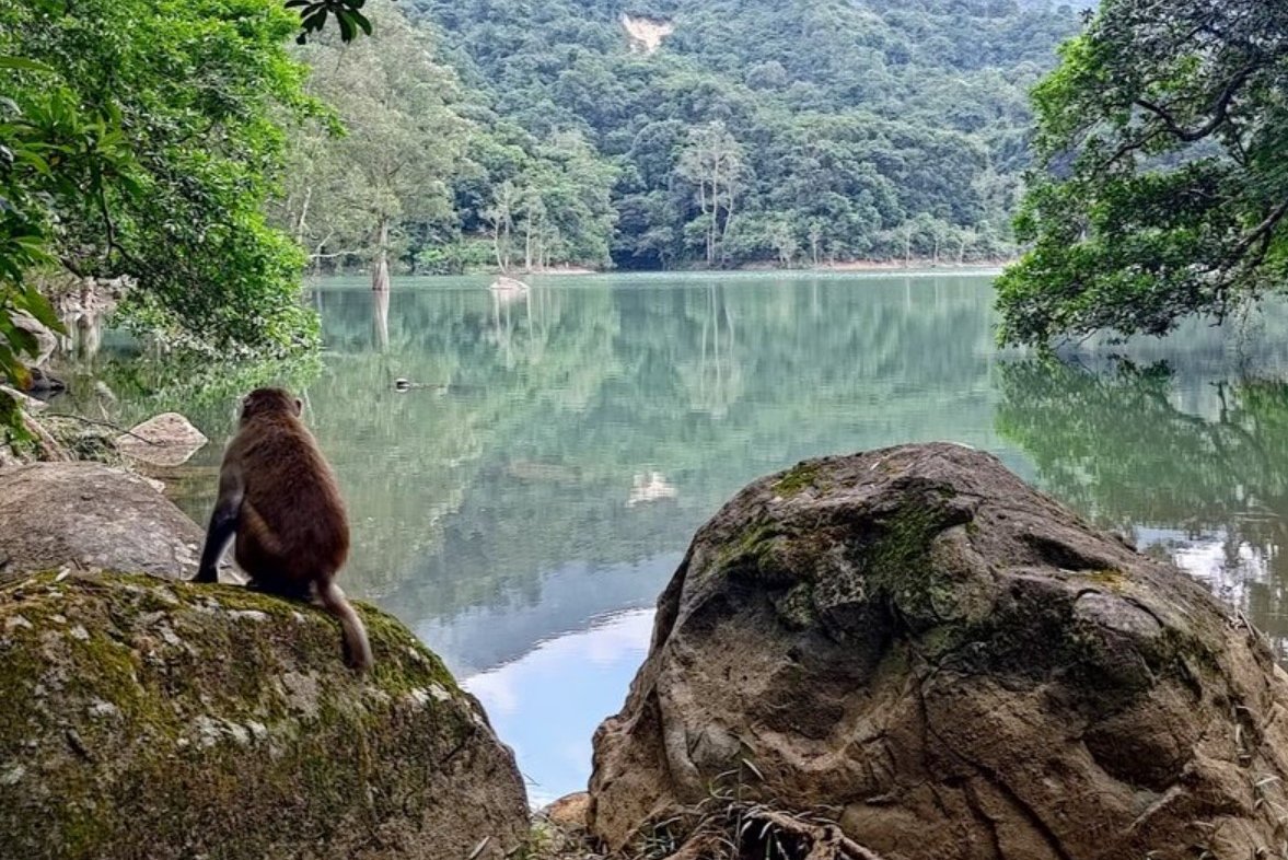
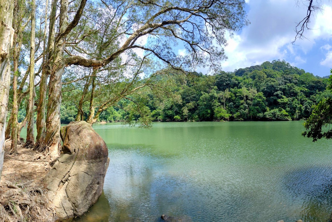
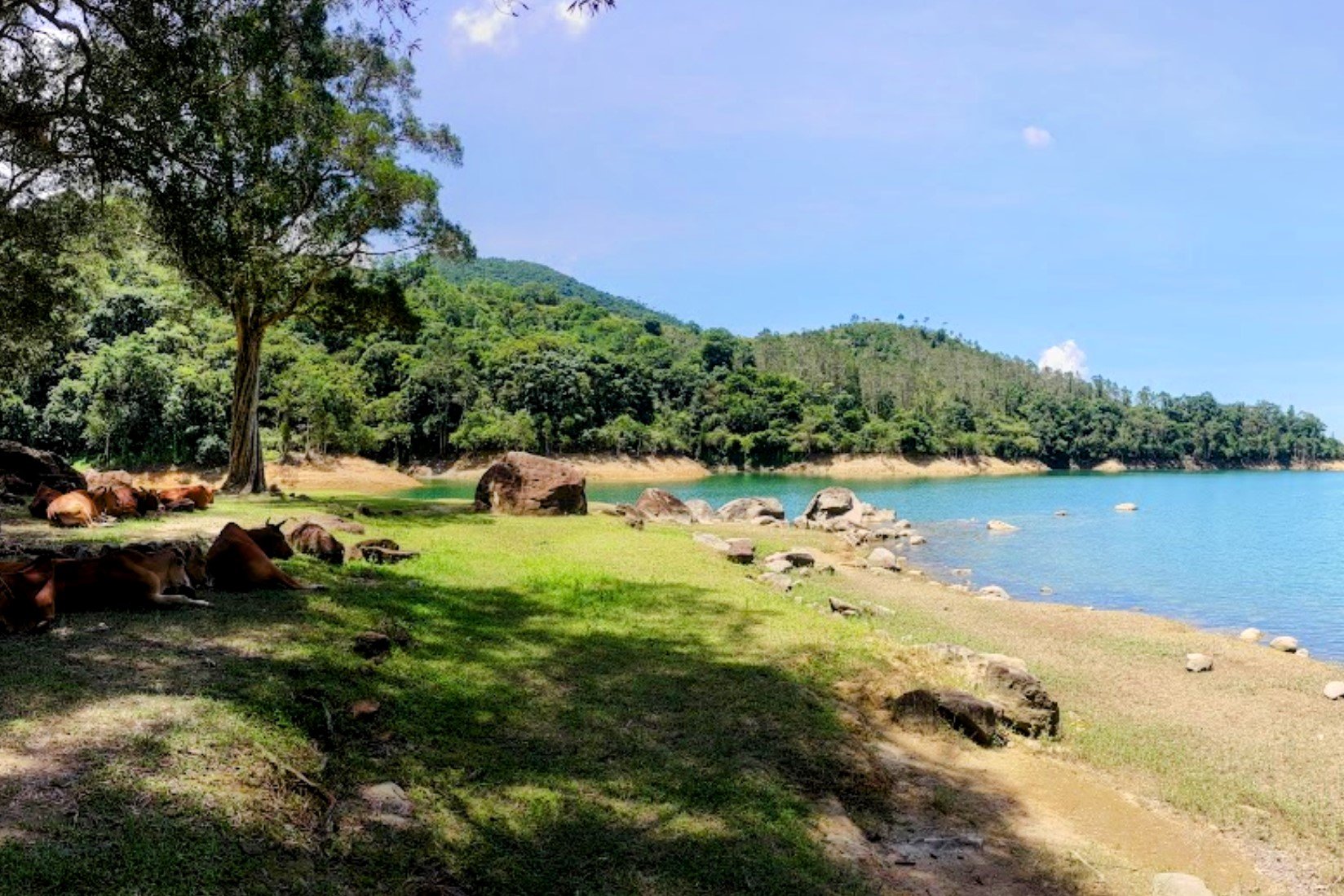
Upper Shing Mun Reservoir is located in Tsuen Wan and is one of the best places to experience a blend of history, wildlife, and stunning scenery. You’re almost guaranteed to see playful macaques, wild cattle, and even wild boars around the reservoir.
The highlights of this hike include the paperbark trees that are situated just by the water, the wonderful mountains that frame the reservoir, and the plethora of little paths that can take you to secret locations. If you look hard enough, you’re guaranteed to find your own little isolated spot where you can soak up some peace and relaxation by the water’s edge.
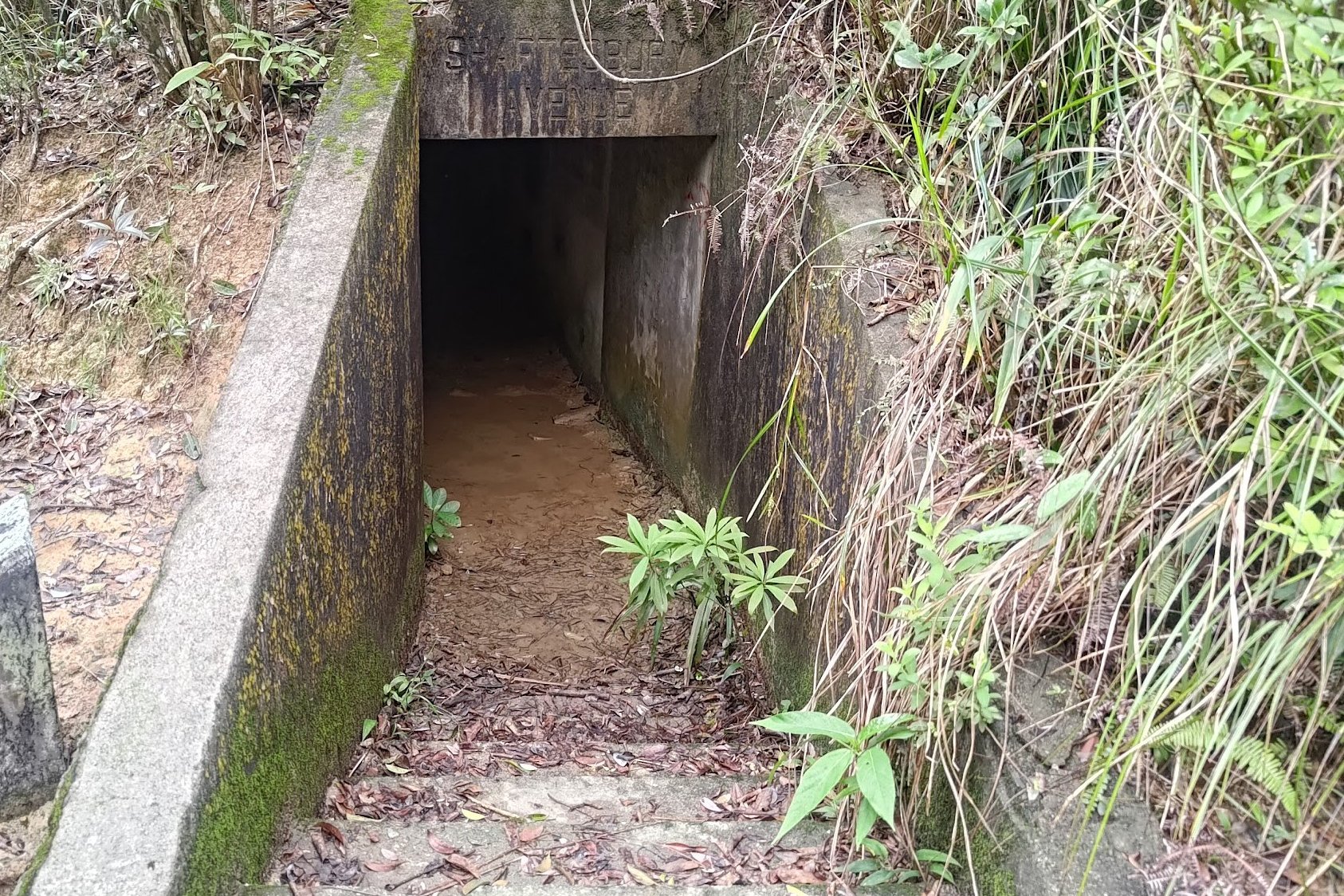
There’s even a short detour to look at old World War 2 tunnels just beside the reservoir!
*For directions, maps, detailed instructions and more, check out the Upper Shing Mun Reservoir hike guide below.

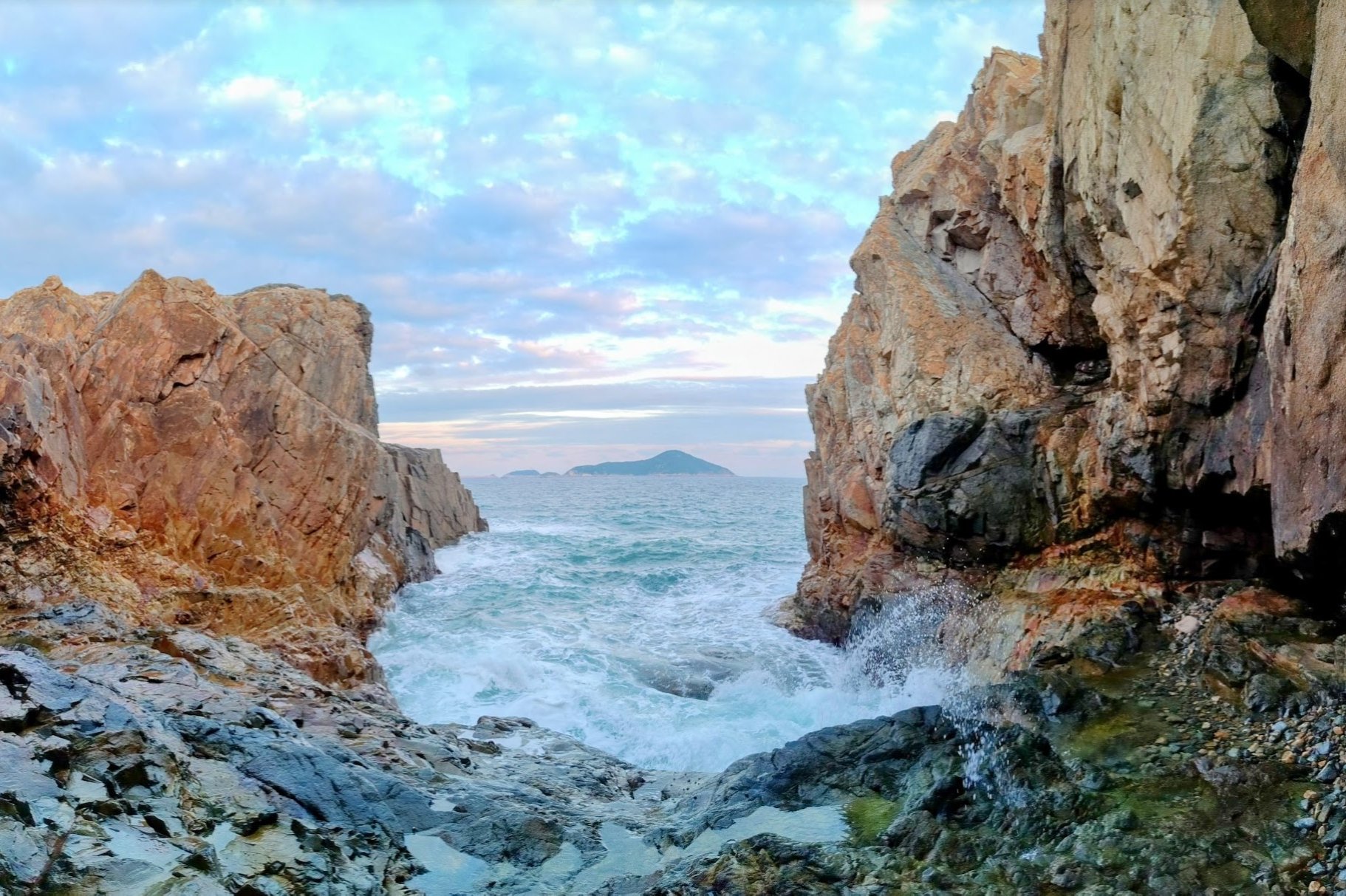
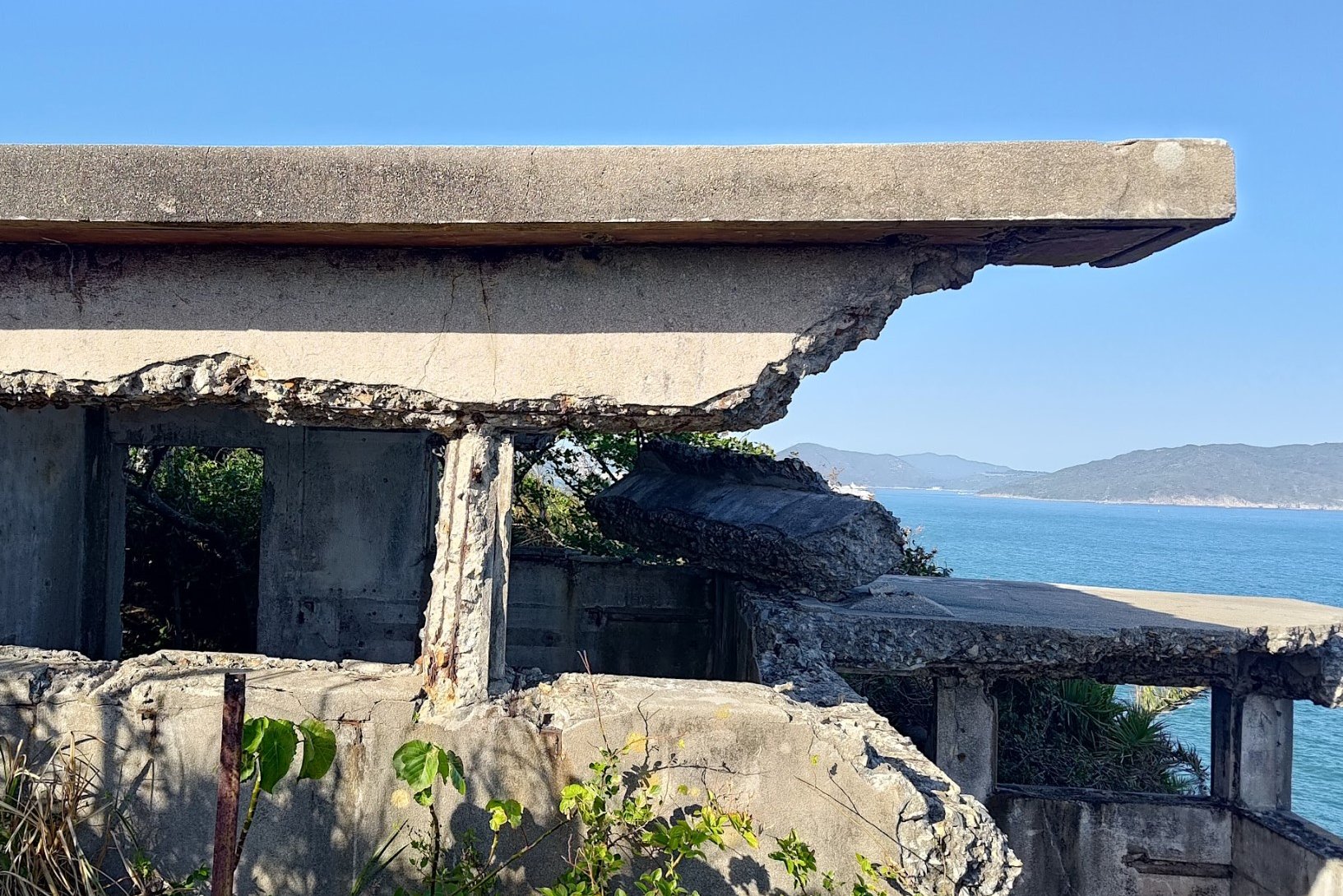
4. Cape D’Aguilar


- District: Hong Kong Island
- Duration: 3 hours (both ways without exploration)
- Distance: 8+km (8km there and back. More with exploration)
- Highest Elevation: 130ish meters
- Difficulty: 1.5/5
Cape D’Aguilar is a there-and-back hike that lets you lap up stunning views of Hong Kong Island’s southern coastline. The entire route follows a concrete road, which makes it super safe and a great option for beginners. Just note, it’s totally unshaded and can get a little roasty on hot summer days.
The highlights of this hike include an old lighthouse, several unique caves, World War Two structures, whale bones, pirate islands and some great coastal cliffs that you can explore.
Cape D’Aguilar is also a totally underrated spot for sunset views!
*For directions, maps, detailed instructions and more, check out the Cape D'Aguilar hike guide below.

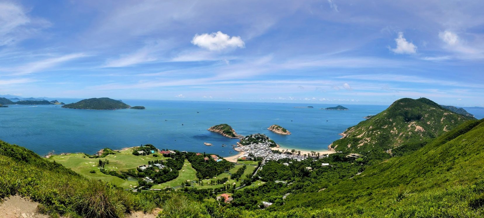
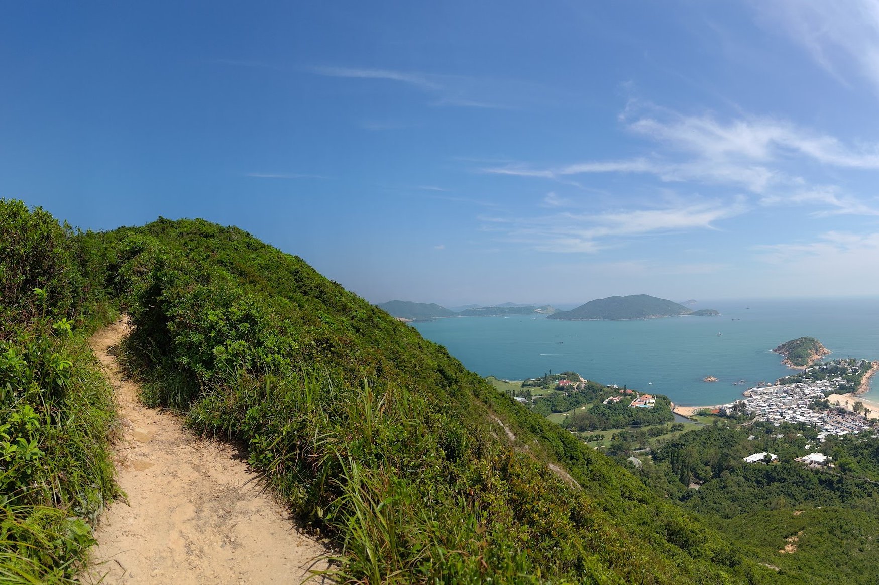
5. Dragon’s Back Hike


- District: Hong Kong Island
- Duration: Just under 2 hours back to To Tei Wan bus stop. Just under 2.5 hours to Big Wave Bay
- Distance: 5.8km back to To Tei Wan bus stop. 7.5km to Big Wave Bay
- Highest Elevation: 284 meters
- Difficulty: 1.5/5
Dragon's Back is arguably Hong Kong’s most famous beginner hike and for good reason. The views from the summit are genuinely incredible, and since the start point of the hike is relatively close to the top, there isn’t too much tough uphill to navigate. With fame, though, also comes crowds. If you hike Dragon’s Back on a weekend, expect it to be crowded, especially on a clear day.
That being said, the highlight of this hike is the view down to Shek O along with the South China Sea that stretches as far as the eye can see. You may also see paragliders sailing through the air right above you as you hike!
There are also two end points to this hike, one being right where you started from (To Tei Wan bus stop), and the other being Big Wave Bay, which takes slightly longer to get to.
There’s a reason this hike was ranked as the world's 8th best hiking trail by CNN in 2022.