10 Best Ridge Hikes in Hong Kong - Easy, Medium and Hard
Contents
- Hong Kong's 10 Best Ridge Hikes
- 1. Dragon's Back - Easy
- 2. Smuggler's Ridge - Medium
- 3. Ma On Shan - Hard
- 4. West Dog's Teeth - Hard
- 5. Kai Kung Leng - Hard
- 6. Tai To Yan - Hard
- 7. Robin's Nest - Hard
- 8. Suicide Cliff - Hard
- 9. Pat Sin Leng (Eight Immortals) - Hard
- 10. Devil's Fist - Ultra Hard
Hong Kong's 10 Best Ridge Hikes
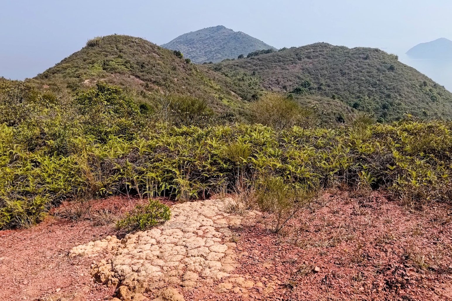
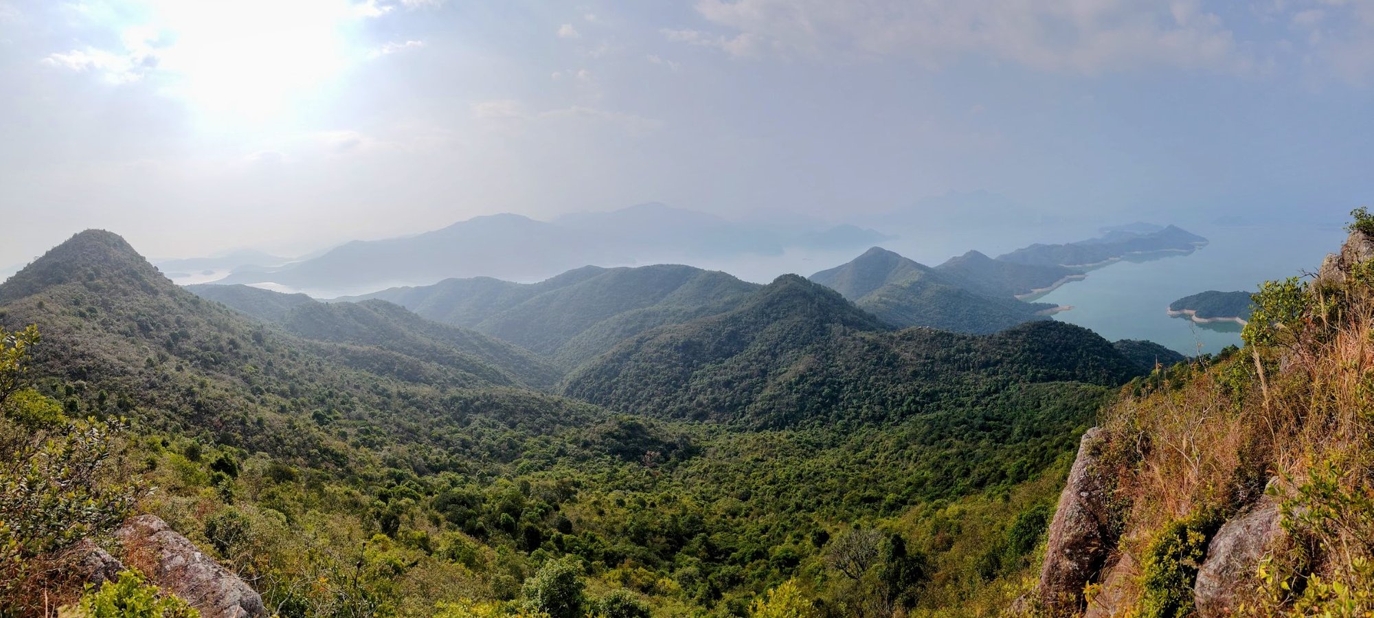
Ridge hikes follow a narrow strip of trail that undulates over several mountain peaks. They often offer dramatic views and can be quite technical, tricky and demanding. However, this list of Hong Kong's best ridge hikes will offer something for beginners, intermediates and advanced hikers!
Here's my list of the 10 best ridge hikes in Hong Kong going from easy to hard:
Easy Ridge Hikes:
Medium Ridge Hikes:
Hard Ridge Hikes:
- Ma On Shan Hike
- West Dog's Teeth Hike
- Kai Kung Leng Hike
- Tai To Yan Hike
- Robin's Nest Hike
- Suicide Cliff Hike
- Pat Sin Leng Hike
Ultra Hard Ridge Hikes:
1. Dragon's Back - Easy


Essential Dragon's Back Hike Details
- District: Hong Kong Island
- Duration: Just under 2 hours back to To Tei Wan bus stop. Just under 2.5 hours to Big Wave Bay
- Distance: 5.8km back to To Tei Wan bus stop. 7.5km to Big Wave Bay
- Highest Elevation: 284 meters
- Difficulty: 1.5/5
- Facilities: Public toilets at the start point. Make sure to bring food and water.
Recognized by CNN in 2022 as the world’s 8th best hiking trail, Dragon’s Back is widely regarded as one of Hong Kong’s most scenic and accessible hikes. Offering spectacular panoramic views of the South China Sea and the lush, rolling hills that surround it, this trail is a must-visit for nature enthusiasts and casual hikers alike.
One of Dragon’s Back’s greatest appeals is its accessibility—hikers of all ages and experience levels can enjoy this stunning route. Over the years, I have encountered young children, seasoned adventurers, and even grandparents relishing the fresh ocean breeze and awe-inspiring vistas. While the trail does include some short, steep sections, it remains a relatively gentle and non-technical hike, making it an excellent choice for those seeking a refreshing escape from the city’s towering skyline. If you ever feel overwhelmed by Hong Kong’s dense urban landscape, the open, expansive views of the South China Sea from Dragon’s Back provide the perfect antidote.
To fully appreciate the tranquility of this stunning trail, consider visiting on a weekday, as weekends tend to attract large crowds.
As an added bonus, the journey concludes in Shek O, one of Hong Kong’s most charming and relaxed seaside neighborhoods. Here, you can unwind on pristine beaches, enjoy a meal at a local outdoor eatery, and admire the quaint, low-rise architecture—a delightful contrast to the city’s high-rise skyline.
Whether you are seeking a peaceful retreat or a scenic adventure, Dragon’s Back offers an unforgettable experience that beautifully showcases Hong Kong’s natural wonders.
Dragon's Back Google Route Map and GPX File
*Click the box icon in the top right of the map below to load the blue route directly into your own Google Maps. You can then see your location relative to the trail in real time!
Dragon's Back Hiking Guide
You can find a full hiking guide below:
2. Smuggler's Ridge - Medium


Essential Smuggler's Ridge Hike Details
- District: New Territories
- Duration: 3.5 hours (longer if you want to explore more)
- Distance: 8.7km (more if you explore deeper into the tunnels)
- Highest Elevation: 350ish meters
- Difficulty: 3.5/5
- Facilities: Toilets and vending machines at the Shek Lei Pui Reservoir bus stop (from Kowloon)
The origins of Smuggler’s Ridge’s intriguing name remain somewhat mysterious, but some sources suggest that during World War II, Guomindang troops may have used this ridge to smuggle munitions into China as part of the resistance against the Japanese occupation. However, this claim is not fully verified, so it's best to take it with a healthy dose of skepticism.
Regardless of its history, the breathtaking views from Smuggler’s Ridge are truly one-of-a-kind. From here, you can fully appreciate Hong Kong’s striking contrast—the lush green mountains of the New Territories on one side, and the dense urban landscape of Kowloon on the other.
Smuggler's Ridge Google Route Map and GPX
World War II Tunnels Hike GPX File
*Click the box icon in the top right of the map below to load the blue route directly into your own Google Maps. You can then see your location relative to the trail in real time!
Smuggler's Ridge Hiking Guide
You can find a full hiking guide below:

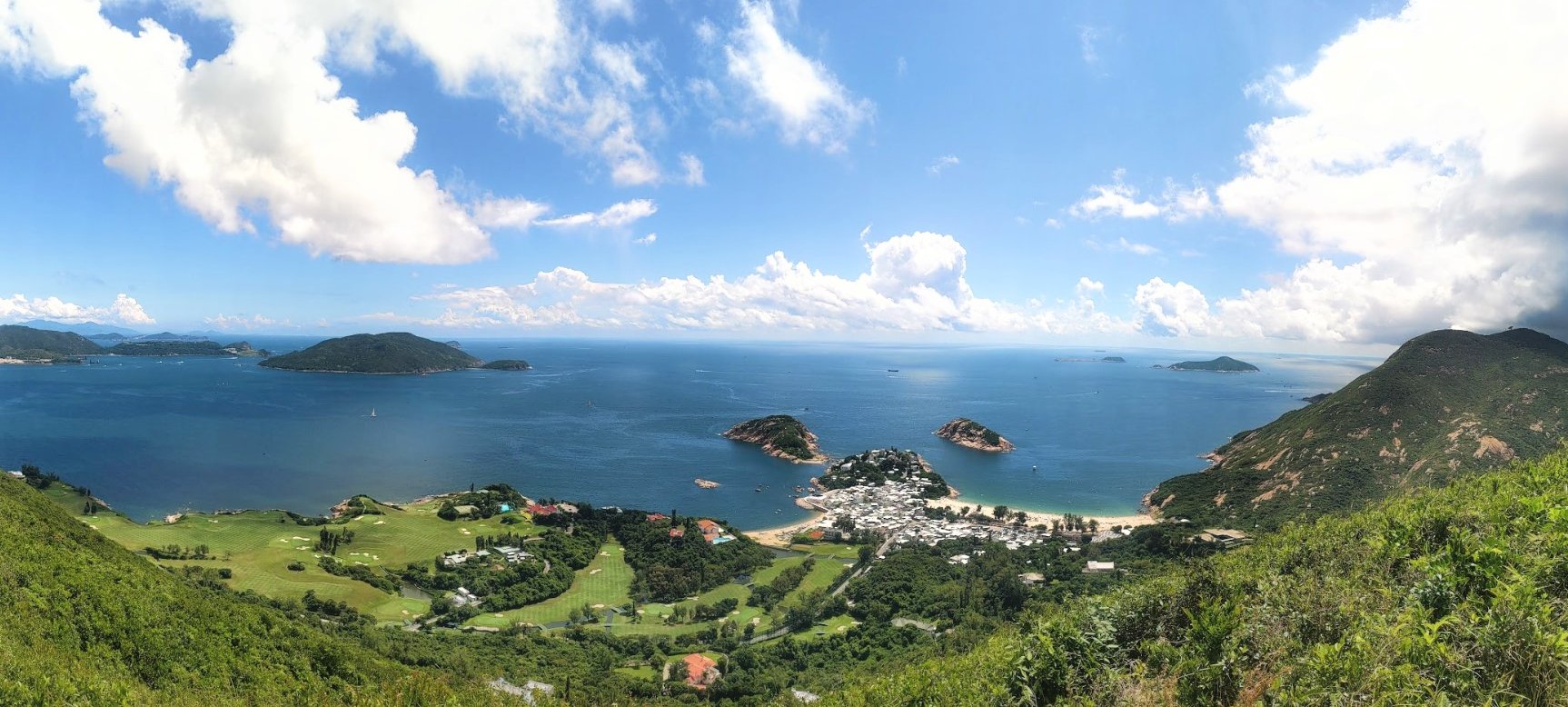
3. Ma On Shan - Hard
Essential Ma On Shan Hike Details
- District: New Territories
- Duration: 4.5-6 hours (depending on how you reach the start point)
- Distance: 11-12 km
- Max Elevation: 702 meters
- Difficulty: 4.5/5
- Facilities: public toilet at BBQ area before the real hike begins
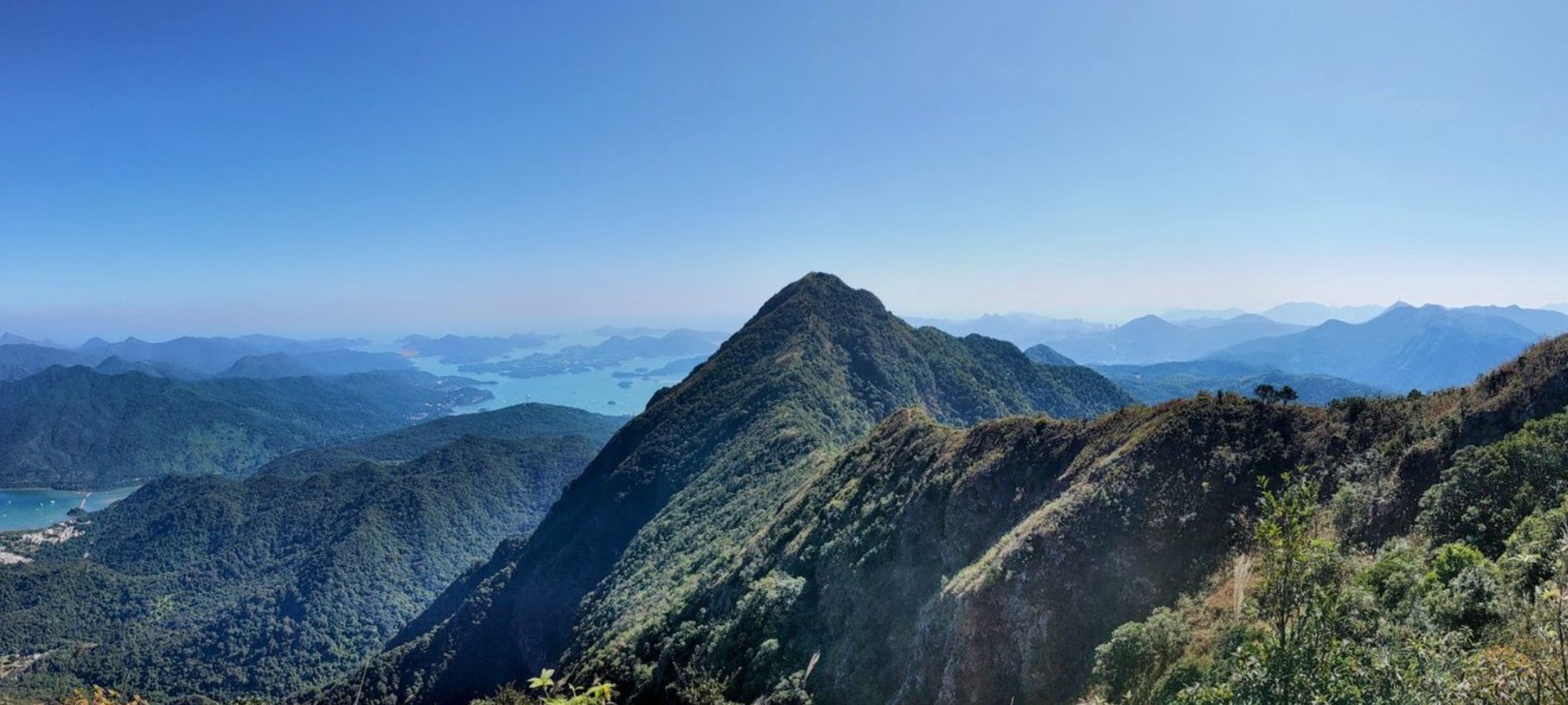
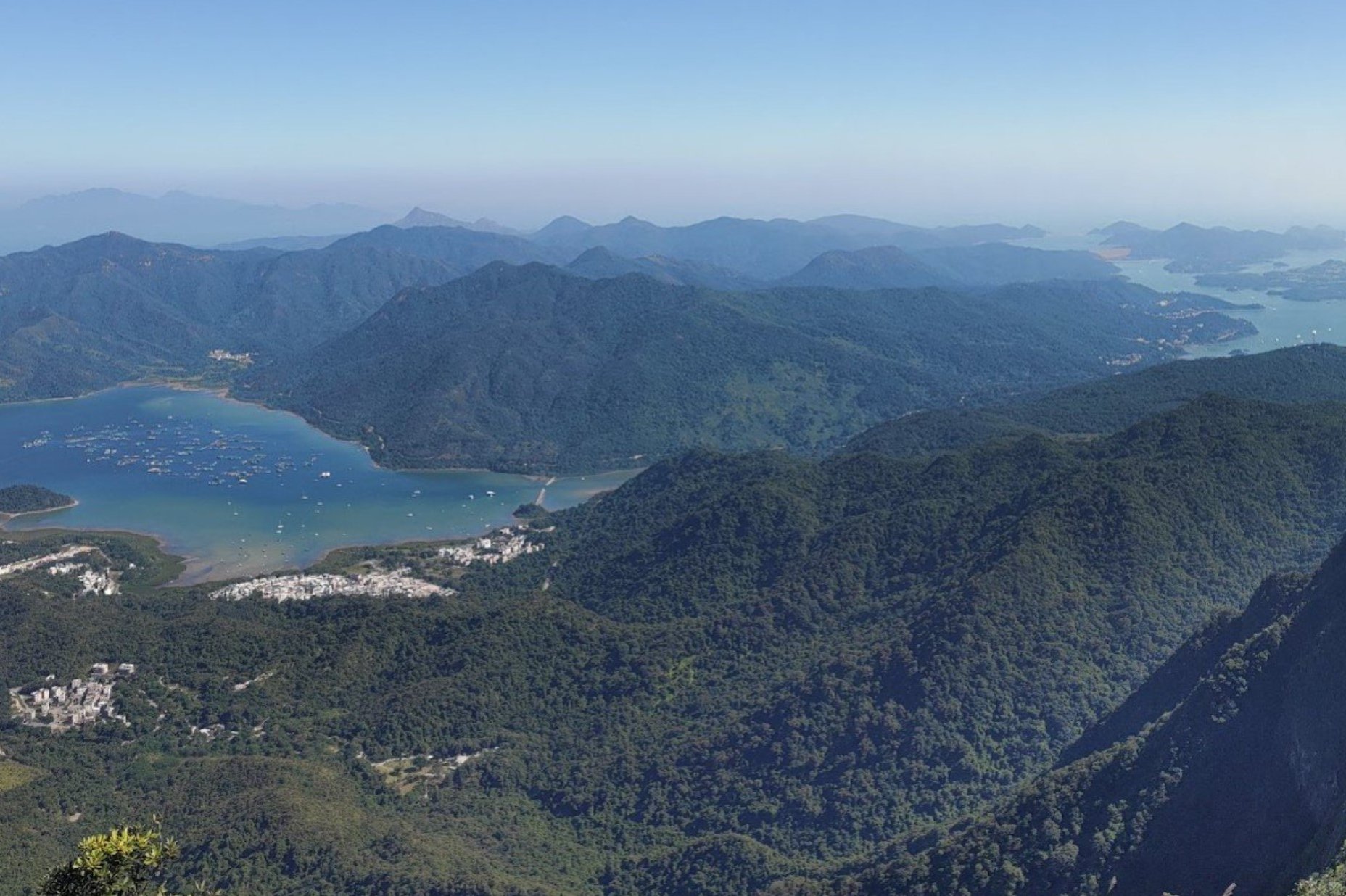
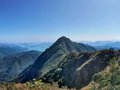
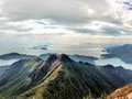
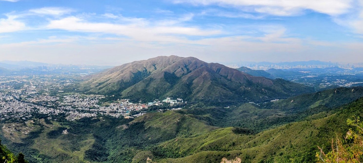
Ma On Shan ( 馬鞍山) , which translates to "Horse Saddle Mountain", is undoubtedly one of the most breathtaking hiking routes in Hong Kong. With sweeping vistas of rolling mountain ranges, sparkling blue waters, and charming villages scattered across the landscape, it’s a dream for nature lovers. Keep an eye out for colorful paragliders soaring through the skies—this area is a popular spot for them!
Though the trail can be demanding, the experience is incredibly rewarding. Be prepared to use your hands for some light scrambling, as the path gets quite steep and rocky in places. In fact, certain sections may not have a clearly defined trail, leaving you to choose your own way forward.
When it comes to hikes that deliver stunning scenery, this one is hard to beat. Every turn reveals a new, postcard-worthy view, making it a paradise for photographers. The journey ends in Sai Kung, where you'll find a wide selection of delicious food and drink—the perfect way to celebrate your adventure.
Ma On Shan Google Route Map and GPX
*Click the box icon in the top right of the map below to load the blue route directly into your own Google Maps. You can then see your location relative to the trail in real time!
Ma On Shan Hiking Guide
You can find a full hiking guide below:
4. West Dog's Teeth - Hard


Essential West Dog's Teeth Hike Details
- District: Lantau
- Duration: 4 hours (at a fast pace with no breaks) expect to take 5 hours or longer at a gentler pace
- Distance: 9 km
- Highest Elevation: 934 meters (if you choose to climb to the top of Lantau Peak) about 150 meters less if you head down to Ngong Ping without climbing to Lantau Peak.
- Difficulty: 5/5
- Facilities: None
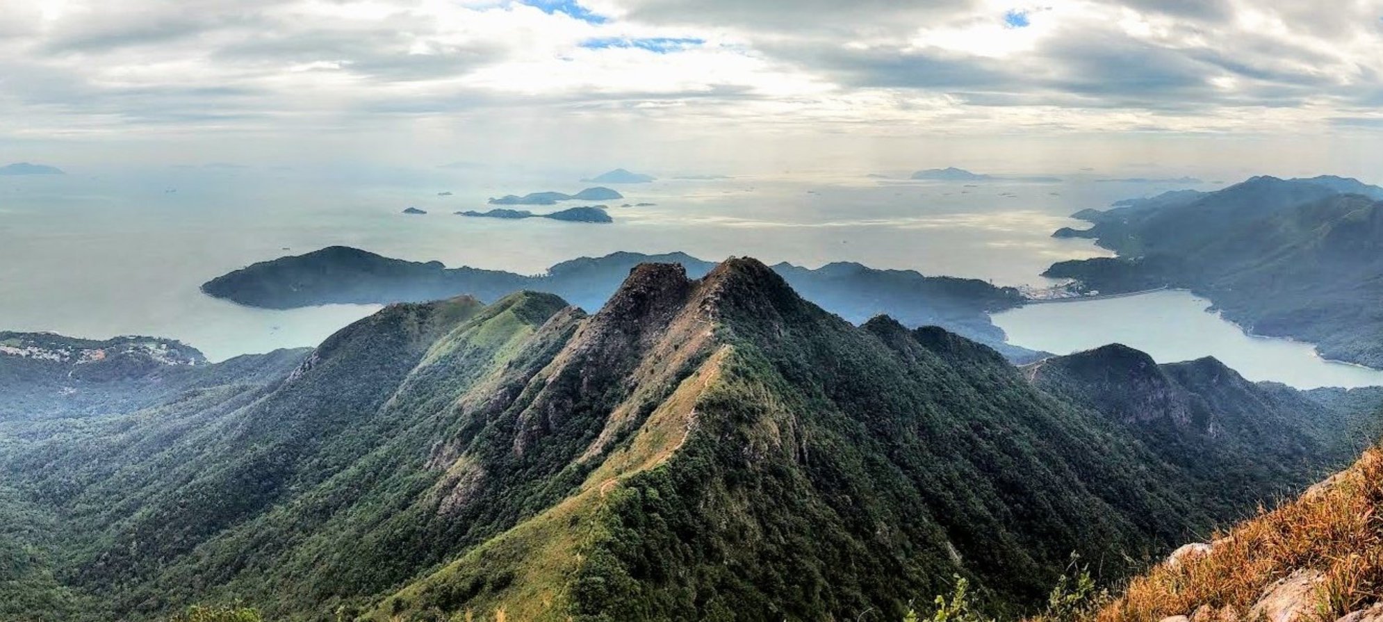
Ask most locals in Hong Kong about the city’s most challenging hike, and chances are West Dog’s Teeth will come up in the conversation. While it's definitely not a trail for beginners, I wouldn't go so far as to label it the hardest hike in Hong Kong — that title, in my opinion, belongs to the Devil’s Fist trail.
Apart from a relatively easy hour-long approach walk, the majority of this hike consists of steep inclines that demand focus and occasional climbing with your hands. If you’re concerned about dirt or rough surfaces, consider bringing gloves.
Even when you're not scaling rocky sections, it’s a good idea to keep your hands free — many parts of the ridge are narrow and require careful navigation, especially on windy days.
Make sure to carry enough water and a snack or two. The hike can take around four hours if you're moving quickly, but it may take significantly longer if you're not used to this level of difficulty. There are no shops or vending spots along the trail, so come prepared.
Once you reach the top of West Dog’s Teeth, you’ll need to continue climbing briefly before choosing whether to descend toward the Ngong Ping Big Buddha or push on to Lantau Peak. From Lantau Peak, there's also an alternative descent to the Big Buddha.
The descent from Lantau Peak is far less demanding than the West Dog’s Teeth ascent, and it finishes at a bus stop that can take you back to the MTR or to the Mui Wo Ferry, depending on your preference.
West Dog's Teeth Google Route Map and GPX
*Click the box icon in the top right of the map below to load the blue route directly into your own Google Maps. You can then see your location relative to the trail in real time!
West Dog's Teeth Hiking Guide
You can find a full hiking guide below:
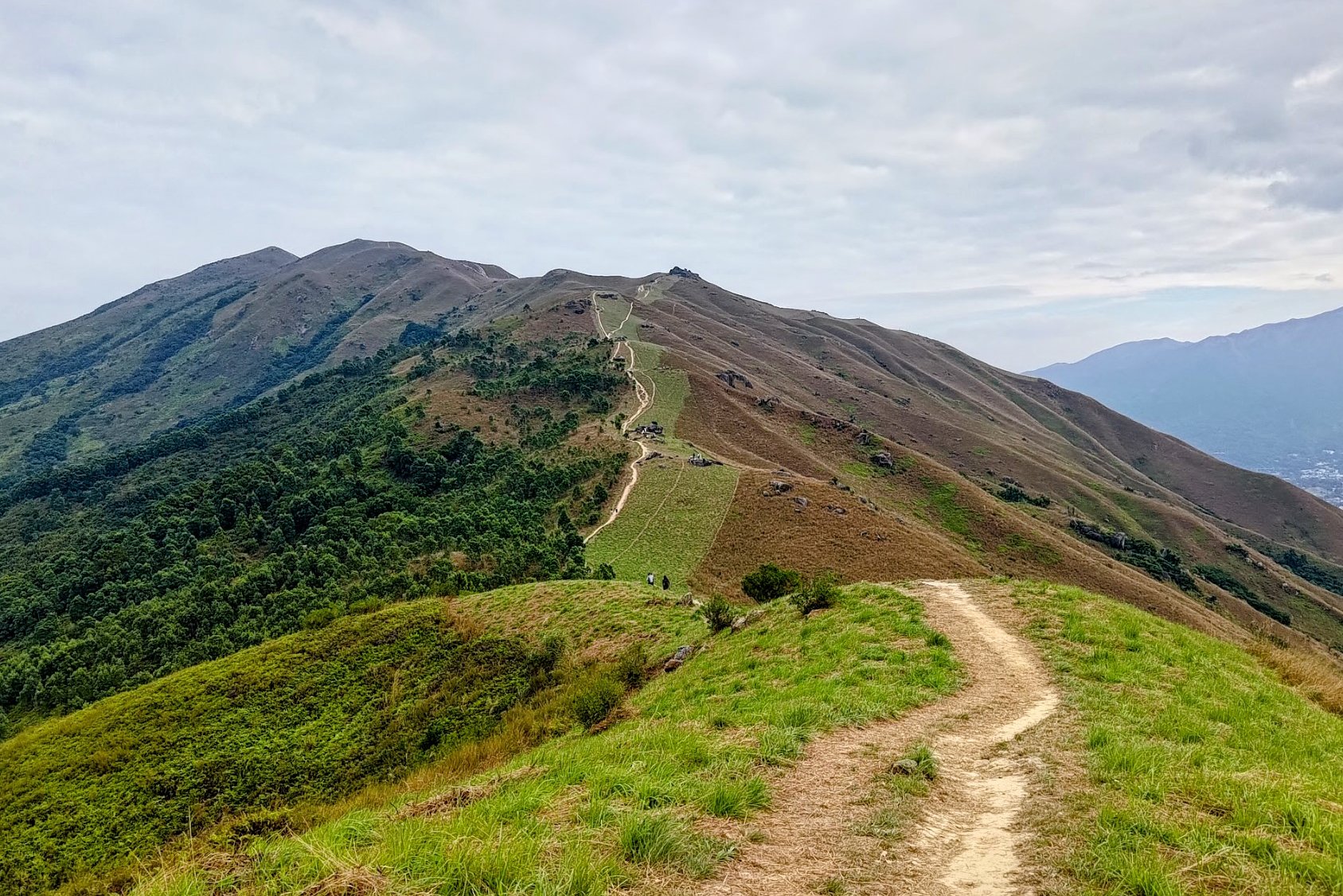
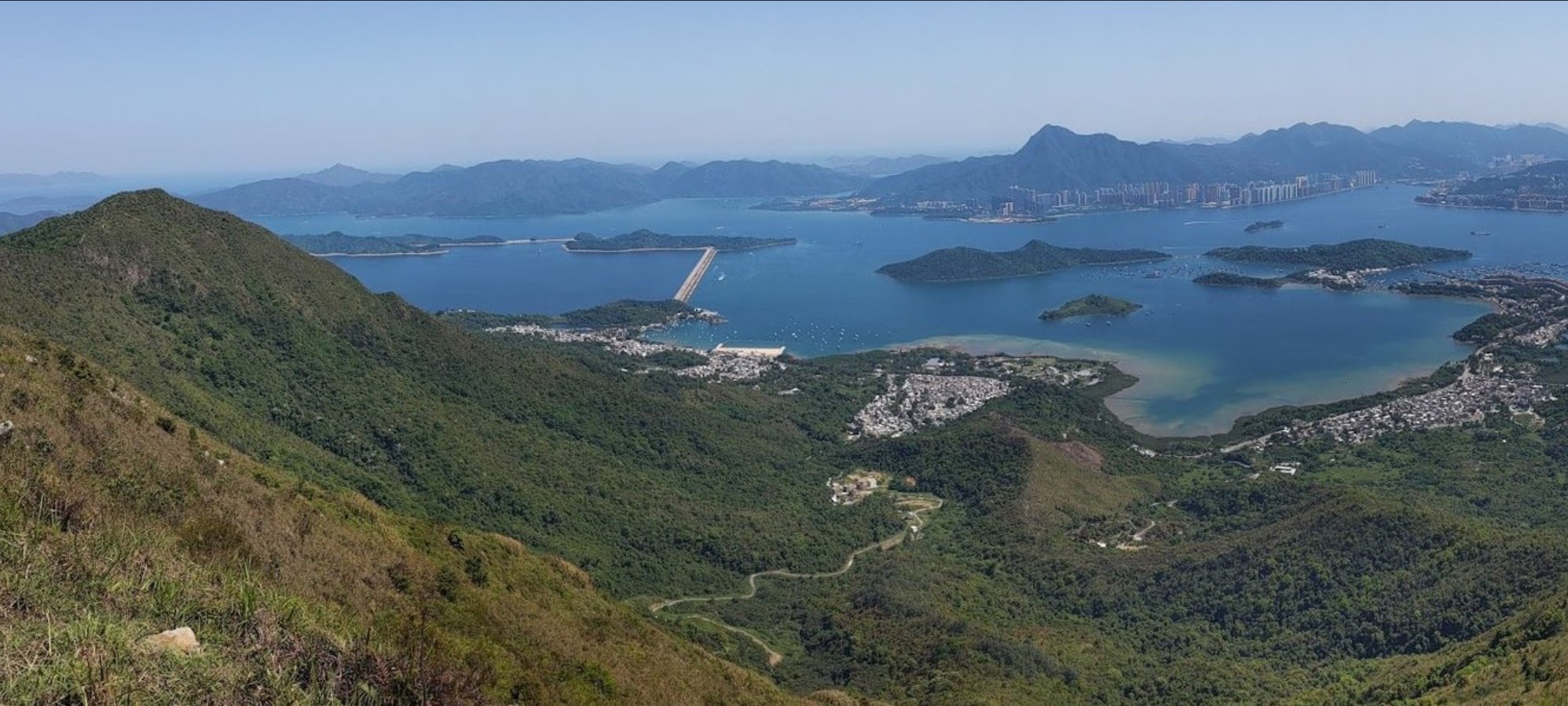
5. Kai Kung Leng - Hard
Essential Kai Kung Leng Hike Details
- District: New Territories
- Duration: 3.5 hours. Expect it to take longer in the summer
- Distance: 7.3km
- Highest Elevation: 585 meters
- Difficulty: 3.5/5
- Facilities: None on the hike, so use the toilet and stock up on food and water at Yuen Long MTR Station
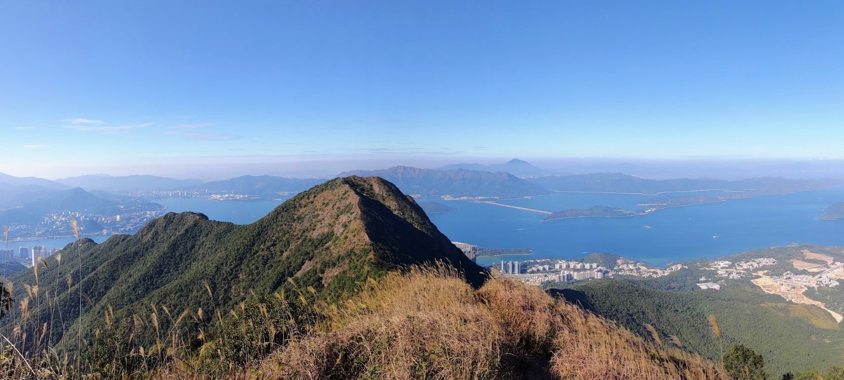
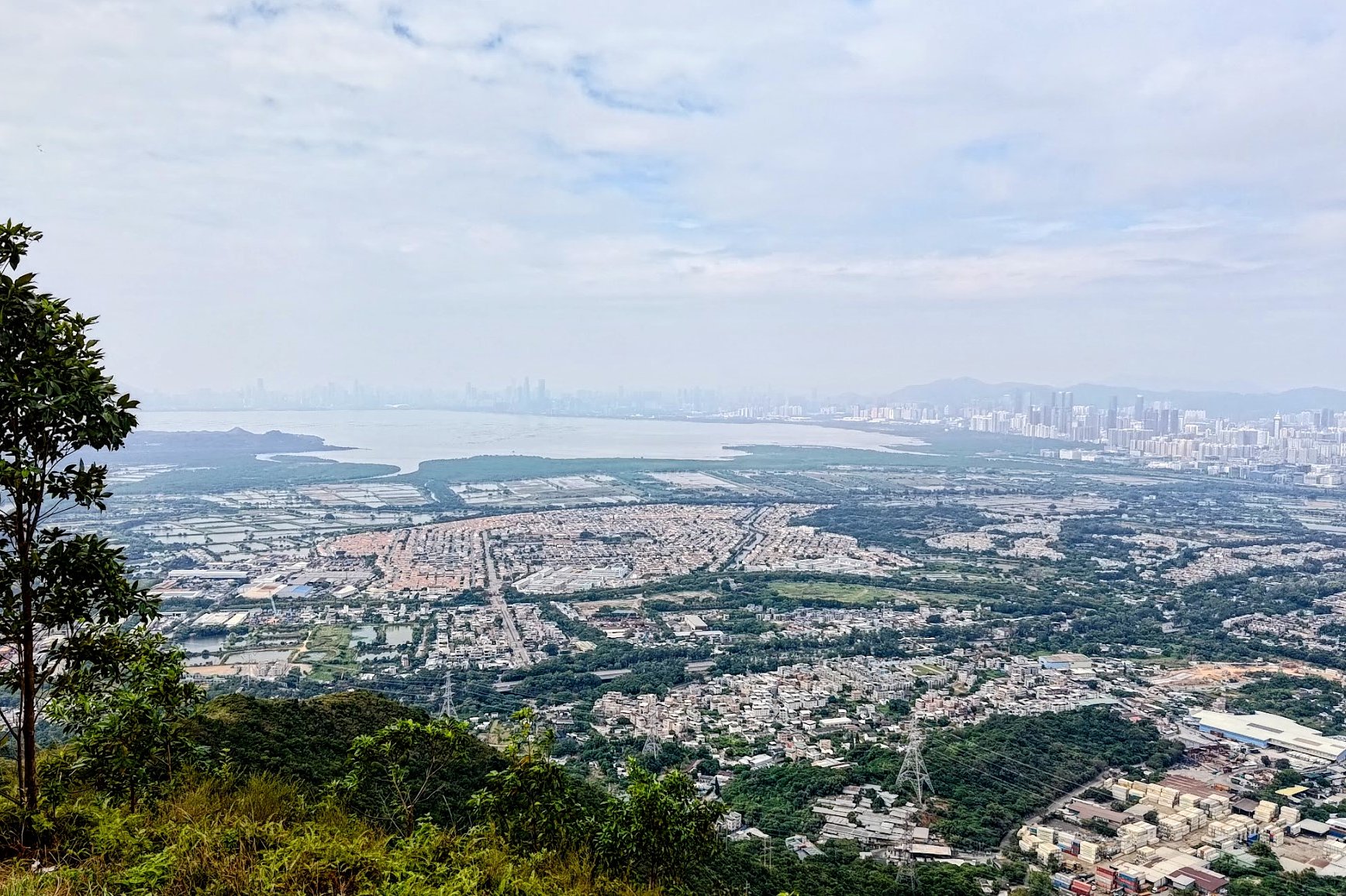
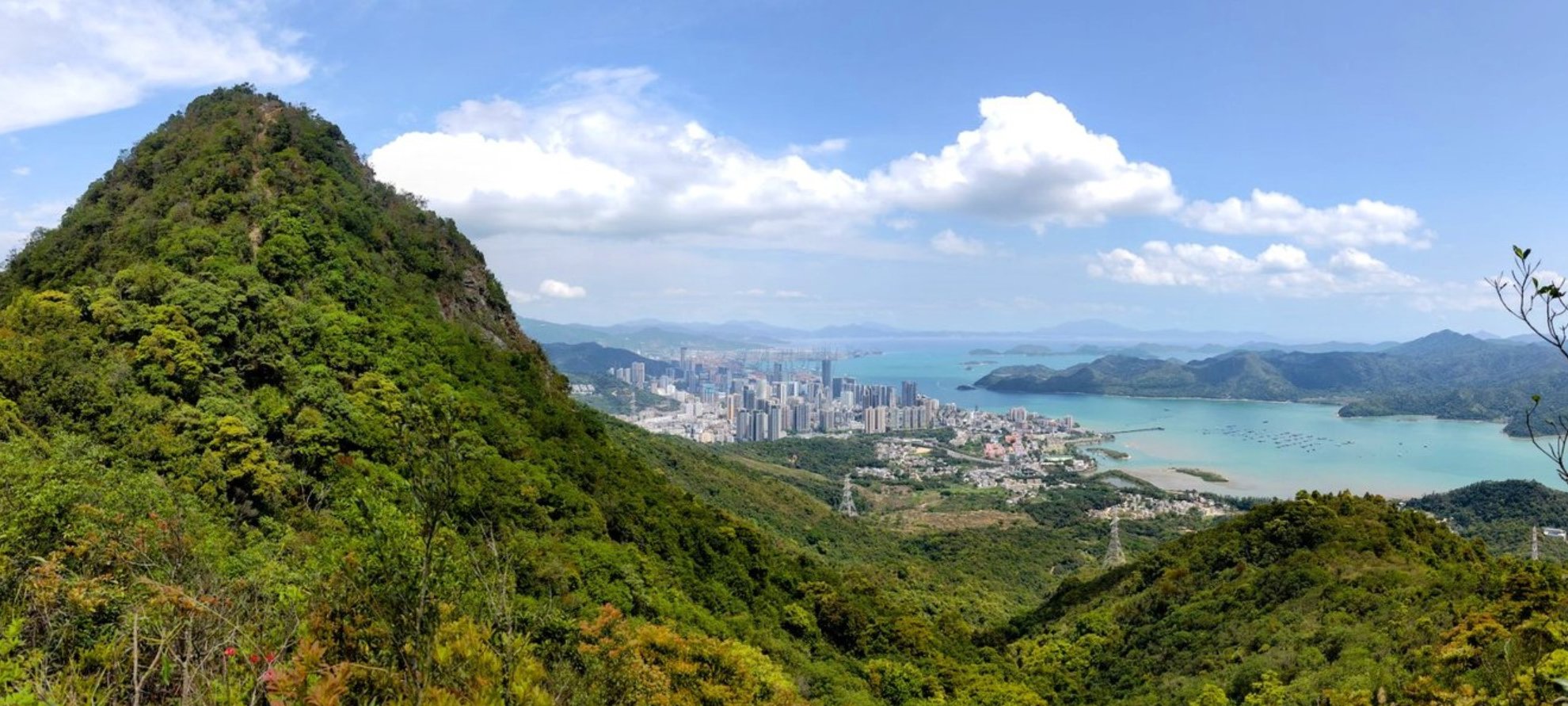
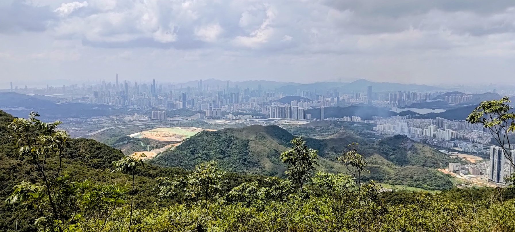
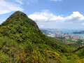
Kai Kung Leng (雞公嶺), also known as Rooster Ridge, offers a quieter alternative to Hong Kong’s more popular hiking routes. Unlike well-trodden coastal paths, this trail gives you vistas of traditional village houses alongside clusters of high-rise buildings near MTR hubs. From the ridge, you can spot areas like Yuen Long, Nam Sang Wai, and Sheung Shui.
The trail also provides a striking view across the border into Shenzhen, China, where a dense skyline of towering buildings starkly contrasts with the rolling green hills of the Hong Kong side.
What sets this hike apart is its distinctive terrain. As you ascend, large open stretches give the illusion of walking across a grassy plain, with soft green turf covering much of the hilltops. Along the way, you'll find scenic rock formations and small groves of trees — great spots for a break or photo op.
Sharing the trail are mountain bikers who also favor the route, so stay alert. If you're a moderately experienced hiker looking for a quieter, more scenic adventure, Kai Kung Leng is a rewarding choice. Just be mindful that the trail offers little to no shade, so it’s best tackled outside the peak summer months.
Kai Kung Leng Google Route Map and GPX
*Click the box icon in the top right of the map below to load the blue route directly into your own Google Maps. You can then see your location relative to the trail in real time!
Kai Kung Leng Hiking Guide
You can find a full hiking guide below:
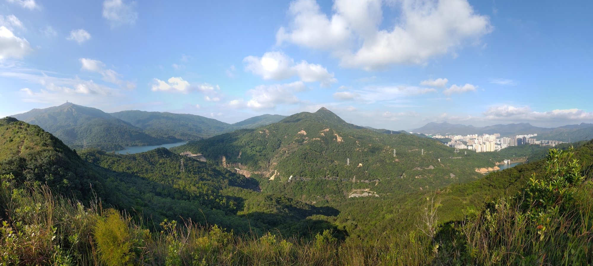
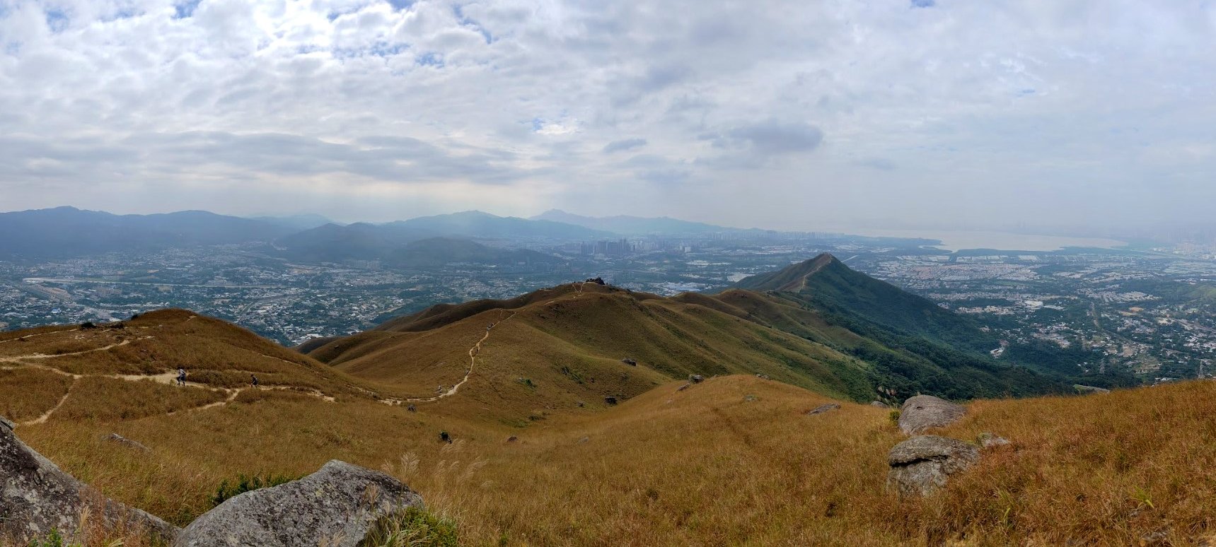
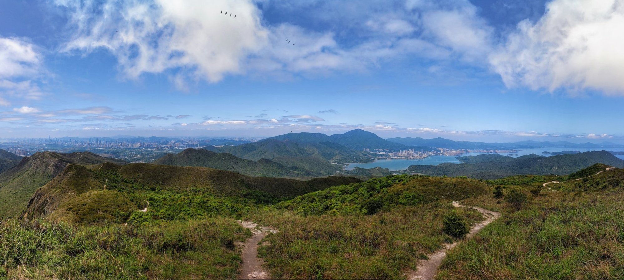
6. Tai To Yan - Hard
Essential Tai To Yan Hike Details
- District: New Territories
- Duration: 3.5 hours
- Distance: 9.5km
- Highest Elevation: 566 meters
- Difficulty: 3.5/5
- Facilities: None. Use the toilet and stock up on water beforehand
Before setting out on this hike during the cooler months, it's important to check for any hill fire risks. The Hong Kong Observatory provides a helpful chart explaining the city's fire danger warning system. You can also visit their website to see if there's an active fire alert today — look for a yellow or red flame icon next to the weather forecast.
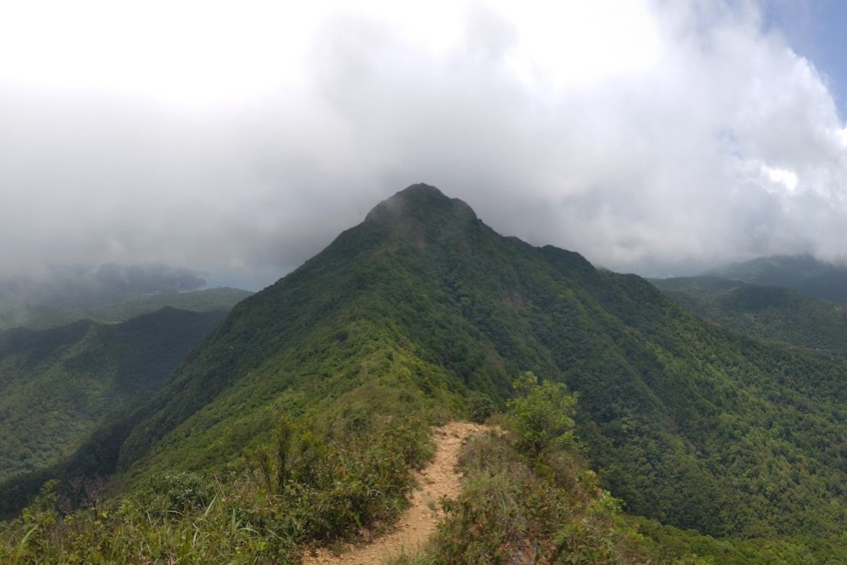
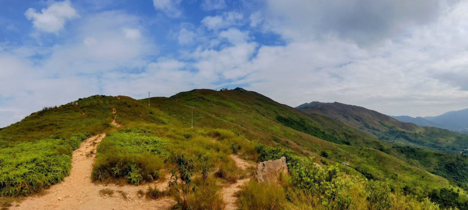
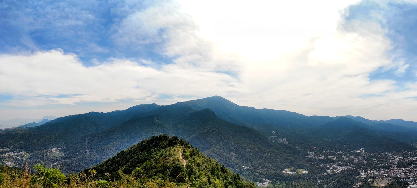
Tai To Yan is a stunning ridge trail that offers a rewarding challenge. While it’s physically demanding, it remains relatively safe compared to some of Hong Kong’s more rugged hikes. Along the way, you'll enjoy sweeping views of Kai Kung Leng — a solitary peak situated across from the trail — all while hiking near the majestic Tai Mo Shan, Hong Kong’s highest mountain.
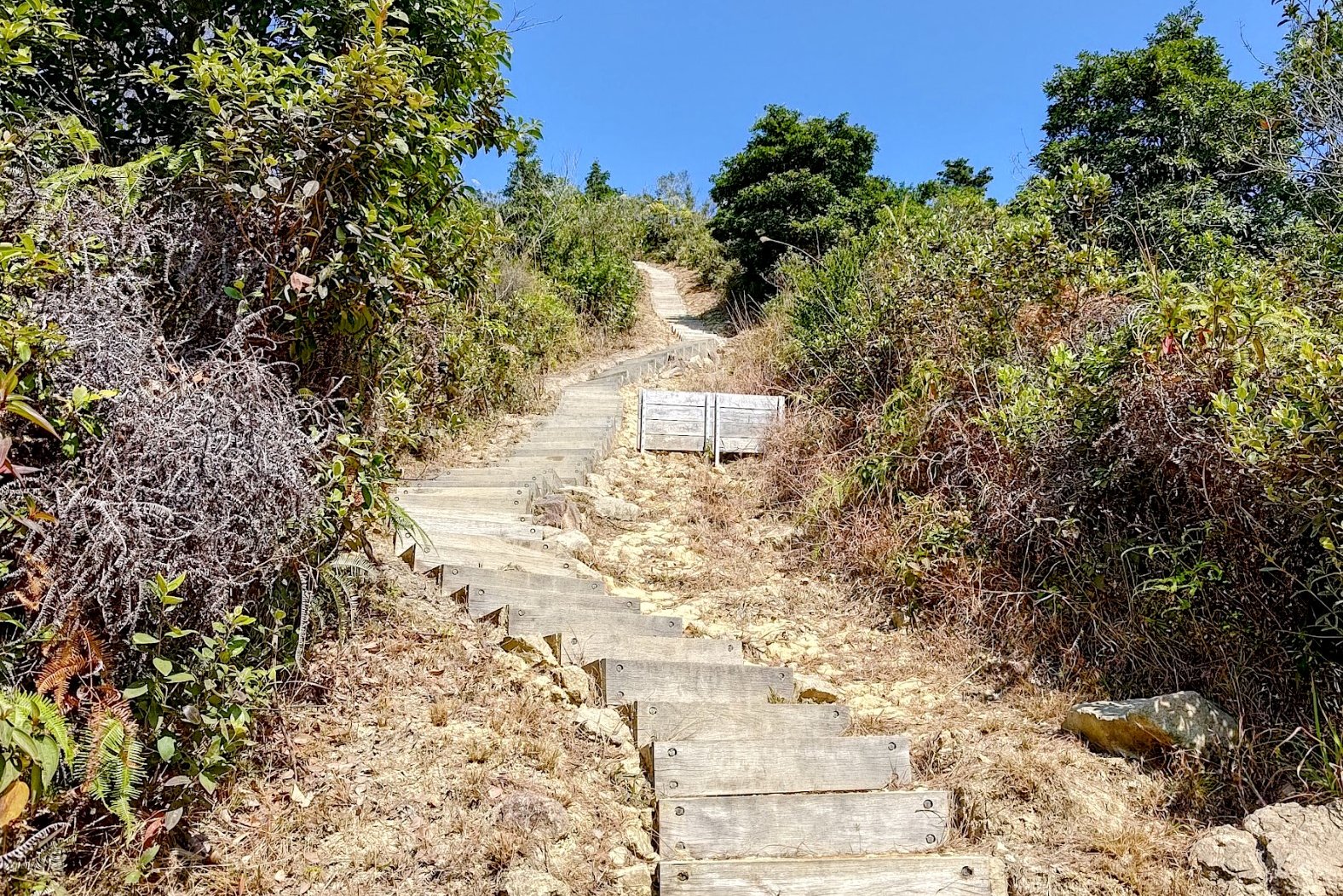
The beginning of the hike is the most strenuous, featuring a steep stair climb that gives your legs a serious workout. However, once you ascend past the treeline, the panoramic scenery makes the effort worthwhile.
The path is well looked after, with handrails installed at more difficult sections to help ensure hiker safety — a feature that sets it apart from more technical ridgelines like West Dog’s Teeth or Ma On Shan.
You also have the option to tackle this route in reverse by starting at Fanling Station (Exit B). Simply follow the hiking guide below in the opposite direction or refer to the trail map for the reversed route.
Tai To Yan Google Route Map and GPX
*Click the box icon in the top right of the map below to load the blue route directly into your own Google Maps. You can then see your location relative to the trail in real time!
Tai To Yan Hiking Guide
You can find a full hiking guide below:

7. Robin's Nest - Hard

Essential Robin's Nest Hike Details
There are two start points to the Robin's Nest hike that converge after about 40-50 minutes of climbing. I recommend the safe route versus the wild route, but outline both ascents in this guide.
- District: New Territories
- Duration: 3.5 - 4 hours for the wild route (not recommended for beginners), 4.5+ hours for the safe route.
- Distance: 8.6km for the wild route, 10km for the safe route
- Highest Elevation: 474 meters
- Difficulty: 4.5/5 for the wild route, 4/5 for the safe route
- Facilities: None, so bring plenty of water and use the toilet beforehand
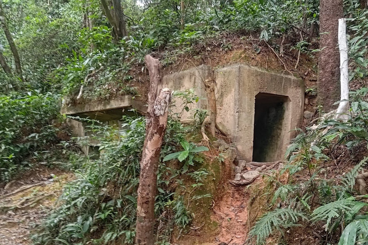
The Robin's Nest (紅花嶺) and Lin Ma Hang Caves (蓮麻坑礦洞) hike offers a truly unique experience, unlike most other trails in Hong Kong. With Robin's Nest Country Park officially established and opened to the public on March 1, 2024, improvements are currently underway to enhance the safety of hiking paths in the area.
The hiking guide below introduces two route options — one more established and secure, and the other more rugged and adventurous. I personally suggest taking the safer trail, not only for peace of mind but also because it passes several fascinating World War II structures along the way. Both paths meet up around 40–50 minutes into the hike, with the main difference being the route you take to reach the ridge.
The views from the top are nothing short of breathtaking. On one side of the ridge, you'll overlook Starling Inlet, a largely coastal area peppered with small villages on the Hong Kong side of the border. On the opposite side, you'll see the dense skyline of Shenzhen, creating a sharp contrast between urban and rural landscapes.
From the ridge, the trail leads to the summit of Robin’s Nest, then descends toward Lin Ma Hang Village. Along the way down, there's an option to take a short detour to the Lin Ma Hang Caves — though note that they're currently off-limits to the public and are expected to reopen in 2025.
Robin's Nest Google Route Map and GPX
Robin's Nest and Lin Ma Hang Caves GPX File Safe Route
*Click the box icon in the top right of the map below to load the blue route directly into your own Google Maps. You can then see your location relative to the trail in real time!
Robin's Nest Hiking Guide
You can find a full hiking guide below:
8. Suicide Cliff - Hard


Essential Suicide Cliff Hike Details
- District: Kowloon
- Duration: Around 4 - 4.5 hours
- Distance: 8.5 km
- Highest Elevation: 602 meters
- Difficulty: 4/5
- Facilities: Dodgy portable toilets on Kowloon Peak. It's best to use the toilet beforehand and don't forget to bring plenty of water along with snacks.
If you're seeking some of the finest city views in Hong Kong, hiking Kowloon Peak and Suicide Cliff is a rewarding endeavor!
The beginning of the trail offers limited viewpoints, making the ascent to Kowloon Peak a bit challenging. However, once you reach the Kowloon Peak summit, the experience transforms dramatically, treating you to breathtaking aerial views of the city.
There’s also a hidden viewpoint that provides a perspective of Sai Kung, allowing you to appreciate the contrast between the densely populated areas of Kowloon and Hong Kong Island and the lush landscapes of the New Territories.
From Kowloon Peak, you'll navigate a series of smaller peaks along the ridgeline before reaching Suicide Cliff, which is one of the premier spots in Hong Kong to witness a spectacular sunset over the bustling city below.
Important: There are several routes to descend from Suicide Cliff. The safest option is a set of stairs just before you reach the Kowloon Peak Television and Radio Transmission Station, requiring a bit of backtracking from the viewpoint.
Suicide Cliff Google Route Map and GPX
Kowloon Peak and Suicide Cliff Hike GPX
*Click the box icon in the top right of the map below to load the blue route directly into your own Google Maps. You can then see your location relative to the trail in real time!
Suicide Cliff Hiking Guide
You can find a full hiking guide below:

9. Pat Sin Leng (Eight Immortals) - Hard


Essential Pat Sin Leng (Eight Immortals) Hike Details
- District: New Territories
- Duration: Between 4 hours and 15 minutes and 5+ hours depending on fitness, hiking speed and rest stops
- Distance: 12.2km - including the walk to Tai Mei Tuk
- Highest Elevation: 639 meters
- Difficulty: 4/5
- Facilities: Toilets available at the start. Make sure to stock up on liquids and food before arriving at the start point
Pat Sin Leng (八仙嶺), also known as the Eight Immortals, is a legendary hiking destination in Hong Kong—and it’s easy to see why!
The initial climb is quite challenging, featuring steep stone steps that elevate you several hundred meters. However, the breathtaking views awaiting you make the effort worthwhile.
Throughout the hike, you'll encounter scenery reminiscent of postcards or National Geographic documentaries, often making it hard to believe you’re still in Hong Kong. From stunning coastal views to rolling green mountains, and even glimpses into neighboring Shenzhen, there’s always something new to admire around each bend.
Whether you're an experienced hiker or simply someone with a good level of fitness, the demanding climbs and long trails might seem intimidating. Yet, with every picturesque vista, you’ll find yourself rejuvenated and eager to discover what lies beyond the next rise.
Pat Sin Leng (Eight Immortals) Google Route Map and GPX
*Click the box icon in the top right of the map below to load the blue route directly into your own Google Maps. You can then see your location relative to the trail in real time!
Pat Sin Leng (Eight Immortals) Hiking Guide
You can find a full hiking guide below:

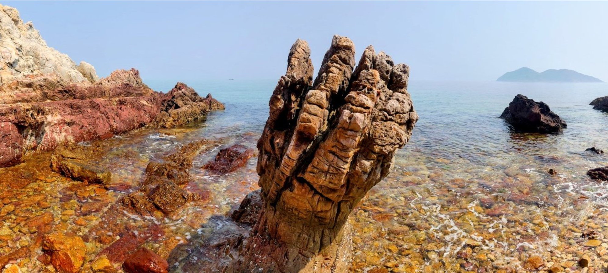
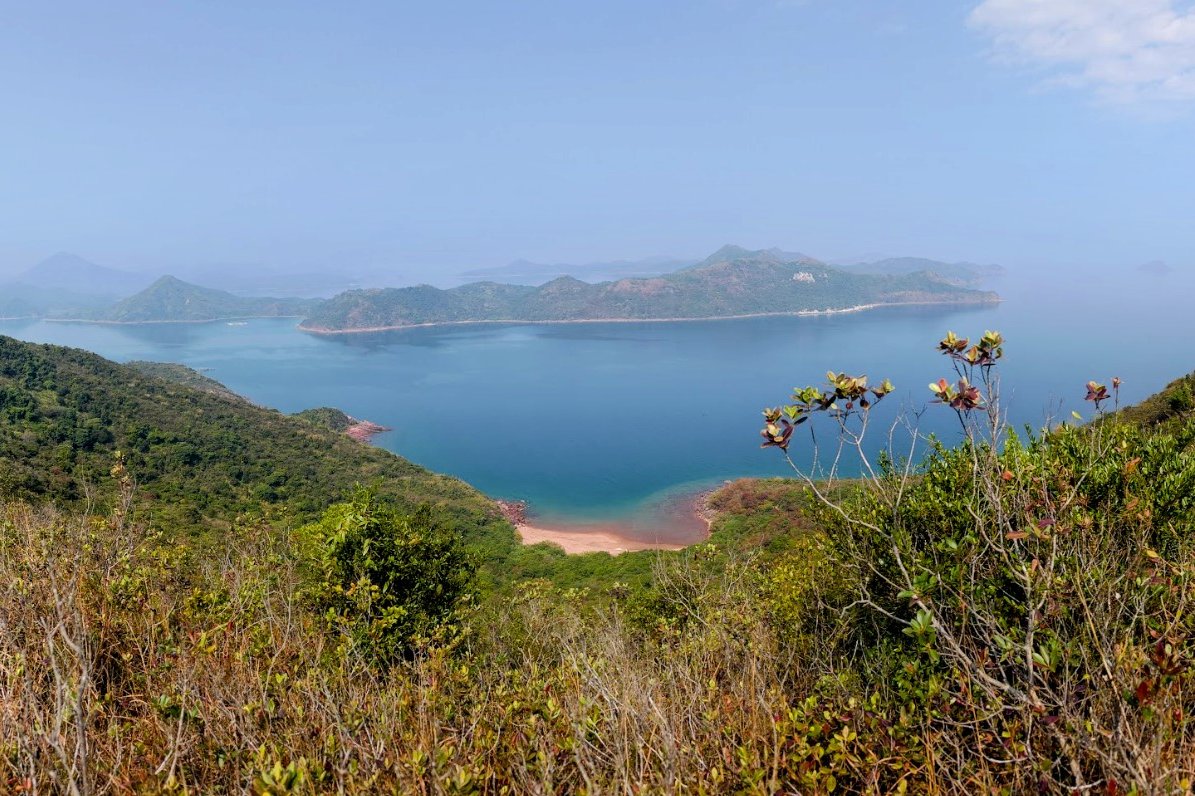
10. Devil's Fist - Ultra Hard
Essential Devil's Fist Hike Details
- District: New Territories
- Duration: 11-12 hours for Devil's Fist and Plover Cove, 6 hours for only Plover Cove
- Distance: 31-32km for Devil's Fist and Plover Cove, 18km for only Plover Cove
- Highest Elevation: 298 meters
- Difficulty: 6/5 for Devil's Fist (that’s not a typo. This hike breaks the scale because it’s so much harder than other 5/5 hikes), 4.5/5 for Plover Cove
- Facilities: None. Bring loads of water (I ran through 5 liters) and bring food as well
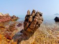
Honestly, I won't be doing this route again. It felt like a grueling slog with minimal payoff, despite the 400-million-year-old Devil's Fist rock. Unless you're a masochist or a hiking completionist, there are far better tough hikes in Hong Kong.
You can also reach the Devil’s Fist by boat, which only added to my frustration. This hike is notorious in Hong Kong for its difficulty, taking 11 to 12 hours to complete. The trail features constant ups and downs, technical sections requiring careful footing, and is quite isolated, limiting the chances of encountering other hikers for assistance. Much of the route is also out of cellphone range.
This Hike Can Essentially Be Split Up into Three Sections
Section 1: Wu Kau Tang Village - Luk Wu Tung
The first section from Wu Kau Tang to Luk Wu Tung is pleasant, with just one significant uphill climb at Tai Tung, where you decide if you want to go to the Devil’s Fist.
Section 2: Devil’s Fist Intersection - Devil’s Fist - Devil’s Fist Intersection
The second section is the toughest, taking you to the Devil's Fist and back from an intersection beyond Luk Wu Tung. Expect to navigate thorny plants, slippery paths, loose rocks, and coastline sections—all for a rock about 2 meters tall. Unfortunately, you’ll have to retrace the same challenging ridge back.
Section 3: Devil’s Fist Intersection - Tai Mei Tuk Village
The final part leads to Tai Mei Tuk. While this section is easier once you’re on the main trail, it still has undulations and tricky inclines with loose rocks. Annoyingly, I was swarmed by clouds of tiny flies for about an hour until I reached the Plover Cove Reservoir Sub Dam.
Precautions
If you decide to tackle this hike, bring plenty of water and food. Inform someone of your plans in case of emergencies. Wear sturdy shoes and long pants to minimize scratches. Avoid hiking in the summer, as much of the route is exposed and can be scorching.
Devil's Fist Google Route Map and GPX
*Click the box icon in the top right of the map below to load the blue route directly into your own Google Maps. You can then see your location relative to the trail in real time!
Devil's Fist Hiking Guide
You can find a full hiking guide below: